

FORECAST:
Sunday (High 80, Low 55): Patchy fog possible in the morning. Mostly sunny.
Monday (High 84, Low 62): Mostly sunny. Warm.
Tuesday (High 83, Low 63): Partly to mostly sunny. An isolated shower or passing thunderstorm is possible.
EXTENDED OUTLOOK:
Wednesday (High 84, Low 64): Partly cloudy with a 30% chance of showers/thunderstorms.
Thursday (High 83, Low 65): Mostly cloudy with a 40% chance of showers/thunderstorms.
Friday (High 80, Low 62): Mostly cloudy with a 40% chance of showers/thunderstorms.
Saturday (High 75, Low 53): Sunny.
PRONÓSTICO:
Domingo (Máxima: 80, Mínima: 55): Posible niebla dispersa por la mañana. Mayormente soleado.
Lunes (Máxima: 84, Mínima: 62): Mayormente soleado. Cálido.
Martes (Máxima: 83, Mínima: 63): Parcialmente a mayormente soleado. Posible chubasco aislado o tormenta eléctrica pasajera.
PERSPECTIVA EXTENDIDA:
Miércoles (Máxima: 84, Mínima: 64): Parcialmente nublado con un 30 % de probabilidad de chubascos/tormentas eléctricas.
Jueves (Máxima: 83, Mínima: 65): Mayormente nublado con un 40 % de probabilidad de chubascos/tormentas eléctricas.
Viernes (Máxima: 80, Mínima: 62): Mayormente nublado con un 40 % de probabilidad de chubascos/tormentas eléctricas.
Sábado (Máxima: 75, Mínima: 53): Soleado.
NOTES:
Of course tomorrow is the 14th anniversary of the April 27, 2011 tornado outbreak. That day was a nightmare to live through, but a lot of people forget we had a pretty bad outbreak on April 15 of that year too. It felt almost like a preview. It affected Central and South Alabama though, so people farther North up this way have good reason not to remember it. There were places in Central/Southern Alabama that sustained damage from both events. And of course, the April 27 event had a morning and an afternoon round. And actually there was a midday round for far North Alabama. I saw the tornado that tracked from about Decatur to Huntsville that day, even though it was behind some trees, during the midday round.
The National Weather Service in Nashville has put together a page of this year’s significant weather events so far. They are also doing Weather101 classes online.
Check out this post on Substack if you want an audio version along with the writing/graphics.
Actually don't because the voiceover did not record. I think the microphone was muted. Happens sometimes. Don't feel like talking another 30 minutes to fix it.
DISCUSSION:
We have fog and mist here at 10:40 PM CDT in Cullman. Technically the most recent observations showing up are from 10:15 PM, but . . . details, details. The temperature is 64 degrees. The dewpoint is also 64 degrees, making the relative humidity 100%. Winds are calm. Barometric pressure is 30.13 inches and steady. Visibility is down to a mile and a half, 1.5 miles.
Overall the day was partly to mostly cloudy with light/variable winds, most often from the South/Southwest. The High in Cullman was 77 with a morning Low of 63.
Visibility is down to 8 miles in Jasper at this hour. They are at 66 degrees, also had a fair amount of fog and mist, though it's clearing up some. They had a High of 79 and Low of 64 today.
Fog/mist and 64 degrees in Haleyville. Visibility is 1.5 mile. High was 77, Low was 63.
The visibility is 10 miles at Huntsville and Nashville. Huntsville saw a High of 80 and Low of 61 today. Nashville saw a High of 77 and Low of 65.


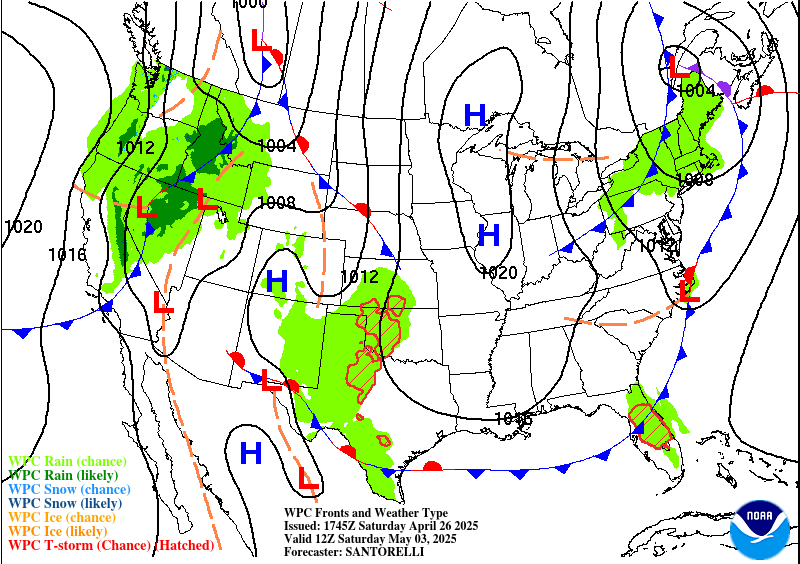
We’ve got some showers out in Missouri, storms moving through Arkansas. Closer to home, we’ve got a stalled front roughly along the Tennessee River. We’ve been dealing with that thing for a while now.
Our wind flow is zonal. Things are not moving along in any sort of hurry.
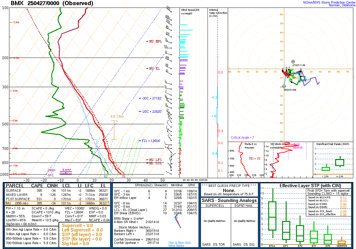
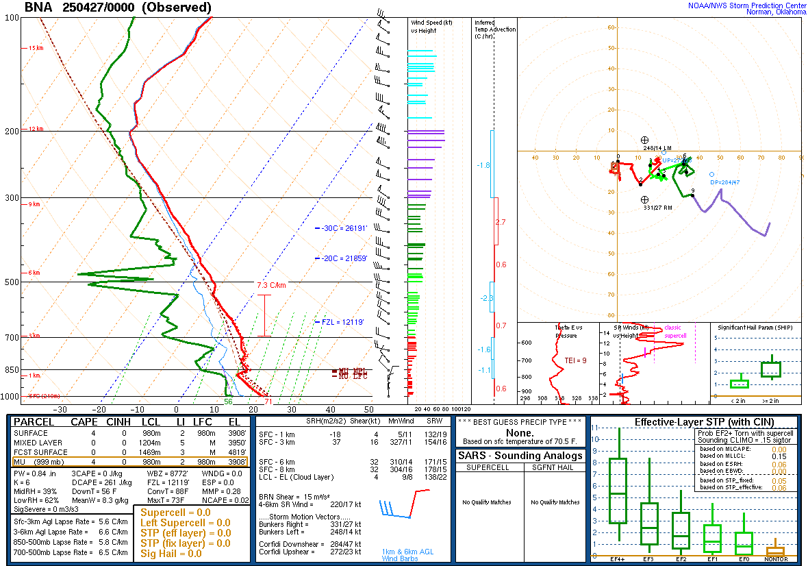
And the radiosonde data from Birmingham and Nashville this evening shows stable air and very weak wind shear even though the air is humid. Certainly not worried about any severe thunderstorms tonight or tomorrow. Even though we’re still in the heart of our usual season, which tends to wind down during the month of May.


Tomorrow it looks like the rain chances will mostly be kept at bay with more high pressure surrounding the region than moisture. Could still have some fog in the morning, but overall a mostly sunny day with a High near 80, Low near 55.


Monday also looks mostly sunny, High should get up to about 83-85 range, Low in about the 62-64 range.


Looks like the front gets moving a little on Tuesday, and will introduce a 20% chance of rain, just isolated showers possible, maybe some thunder wherever they happen. Partly to mostly sunny skies, Highs in the lower 80’s, Lows in the lower 60’s.


Then Wednesday as moisture spreads toward the area ahead of a front in the Midwest, rain chance is more like 30% which is still widely scattered showers/maybe a few thunderstorms. High should be in lower 80’s again, Low in lower 60’s.
Similar temperatures Thursday, rain chance of 40%.
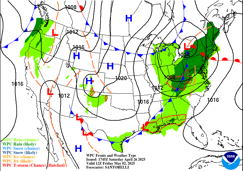
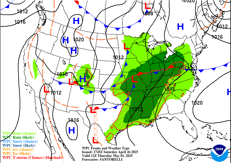
Then on Friday that cold front moves through our region. Looks like similar rain chances to Thursday, High near 80, Low in lower 60’s.
Then behind all that, next Saturday looks sunny with a High in the mid-70’s, Low in the mid-50’s.


As far as severe weather chances across the country, looks like some potential for severe thunderstorms tomorrow, mainly up in Nebraska into the Dakotas. Then on Monday, a fairly widespread severe weather outbreak is possible, potential for large hail, tornadoes, and damaging winds, especially up in places like Iowa, Minnesota, Wisconsin, but really a fairly widespread risk that includes places like Kansas City, back through Wichita, Oklahoma City, all the way back into Texas.
Then on Tuesday the severe weather risk shifts more to the Mid-South and Ohio Valley.
Wednesday it looks like it will stay confined to mainly Northeastern parts of Texas.
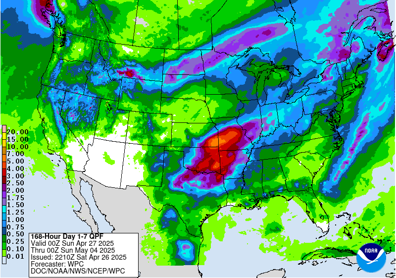
Most of us will see rainfall totals up to around a quarter of an inch during this forecast period.


No comments:
Post a Comment