


I'd stay sheltered in these areas out of a respect for the history of this storm.
From Alisha Michael “Center Star tonight. A tree fell on our house” pic.twitter.com/gWAJtUNI7p
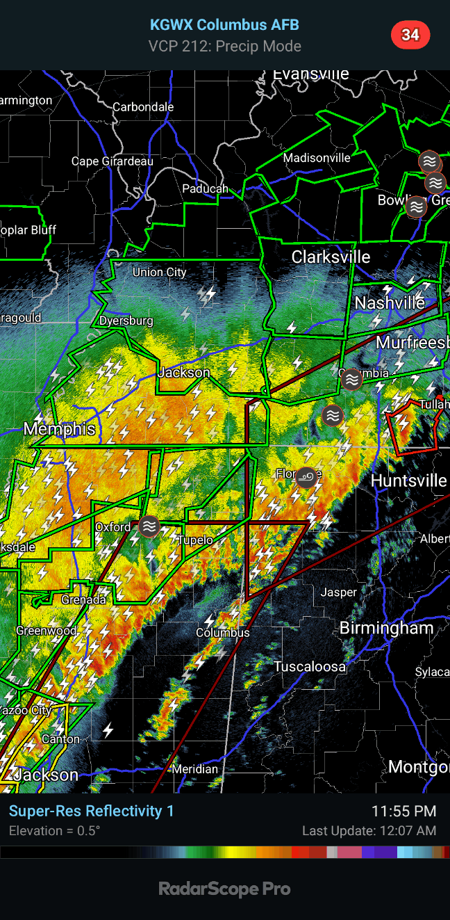
— James Spann (@spann) April 6, 2025
971
WWUS54 KHUN 060454
SVSHUN
Severe Weather Statement
National Weather Service Huntsville AL
1154 PM CDT Sat Apr 5 2025
ALC089-TNC103-127-060530-
/O.CON.KHUN.TO.W.0028.000000T0000Z-250406T0530Z/
Madison AL-Moore TN-Lincoln TN-
1154 PM CDT Sat Apr 5 2025
...A TORNADO WARNING REMAINS IN EFFECT UNTIL 1230 AM CDT FOR NORTH
CENTRAL MADISON...MOORE AND LINCOLN COUNTIES...
At 1154 PM CDT, a severe thunderstorm capable of producing a tornado
was located near Fayetteville, moving northeast at 45 mph.
HAZARD...Tornado.
SOURCE...Radar indicated rotation.
IMPACT...Flying debris will be dangerous to those caught without
shelter. Mobile homes will be damaged or destroyed. Damage
to roofs, windows, and vehicles will occur. Tree damage is
likely.
This dangerous storm will be near...
Fayetteville around 1200 AM CDT.
Lynchburg and Tims Ford Lake around 1220 AM CDT.
Other locations impacted by this tornadic thunderstorm include
Mulberry, Chestnut Ridge, Howell, Belleville, Elora, Hurdlow,
Belleview, Lois, Mimosa, and Booneville.
PRECAUTIONARY/PREPAREDNESS ACTIONS...
TAKE COVER NOW! Move to a basement or an interior room on the lowest
floor of a sturdy building. Avoid windows. If you are outdoors, in a
mobile home, or in a vehicle, move to the closest substantial shelter
and protect yourself from flying debris.
Heavy rainfall may hide this tornado. Do not wait to see or hear the
tornado. TAKE COVER NOW!
&&
LAT...LON 3541 8625 3539 8628 3538 8625 3534 8627
3532 8624 3522 8632 3521 8630 3515 8633
3498 8631 3493 8669 3526 8680 3525 8675
3533 8660 3537 8657 3532 8642 3535 8641
3536 8633 3541 8629
TIME...MOT...LOC 0454Z 245DEG 37KT 3510 8668
TORNADO...RADAR INDICATED
MAX HAIL SIZE...<.75 IN
$$
AMP


No comments:
Post a Comment