FORECAST:
Tuesday (High 57, Low 38): Sunny. Cool and breezy.
Wednesday (High 67, Low 32): Sunny. Cold in the morning with widespread frost possible - or even a freeze for a few places.
Thursday (High 71, Low 44): Partly to mostly sunny, clouds gradually increasing during the evening. Scattered showers and thunderstorms are possible at night.
EXTENDED OUTLOOK:
Friday (High 63, Low 46): Mostly sunny.
Saturday (High 64, Low 40): Sunny.
Sunday (High 72, Low 38): Sunny.
Monday (High 80, Low 47): Mostly sunny.
PRONÓSTICO:
Martes (Máxima: 57, Mínima: 38): Soleado. Fresco y ventilado.
Miércoles (Máxima: 67, Mínima: 32): Soleado. Frío por la mañana con posibilidad de heladas generalizadas, o incluso la congelación en algunas zonas.
Jueves (Máxima: 71, Mínima: 44): Parcialmente a mayormente soleado, con aumento gradual de la nubosidad temprano en la noche. Posibles chubascos durante la noche.
PERSPECTIVA EXTENDIDA:
Viernes (Máxima: 63, Mínima: 46): Mayormente soleado.
Sábado (Máxima: 64, Mínima: 40): Soleado.
Domingo (Máxima: 72, Mínima: 38): Soleado.
Lunes (Máxima: 80, Mínima: 47): Mayormente soleado.
So far, six tornado tracks have been found in North Alabama from the Saturday night/Sunday morning event. Three of them occurred in that general vicinity of Tuscumbia and Sheffield, though in real time, we were thinking more Florence/Muscle Shoals.
We are under a Freeze Watch for Wednesday morning.
The National Weather Service in Morristown (TN) has a good page about storm anxiety. This caught my attention because of an occasional reader I have who has an inordinate level of fear related to storms with a lot of lightning. But look, storms are scary for everybody sometimes. And being reminded of the facts can help ease a lot of that unease. There are times when being nervous about (severe) storms is a very rational and natural response.
For that matter, John Gordon, who recently retired from the National Weather Service in Louisville (KY), admitted on the most recent episode of Weatherbrains that he was worried about his house having a close call with an E/F-3 tornado the other night. He was on the air with WHAS 11, and I really want to give them a shout-out and thank them for hiring him as part of their team.
DISCUSSION:
At 8 PM, skies are fair in Cullman. The temperature is 42.8 degrees, which I'm going to round up and say 43. Dewpoint is the same, relative humidity is 100%. Winds are calm, though they were variable through the day, and it was fairly breezy. It was an overcast day overall with periods of light passing showers. So this system continues to be stubborn and slow-moving. There were times during the day that winds were trying to establish out of the Northwest, but they were generally all over the place. But North/Northwest was as far as we could establish a consistent direction today. The pressure now is 29.91 inches and rising again. Visibility is down to 9 miles at the moment. Our High was 54, and the Low so far is 43 for the day. Temperatures have been going backwards since Midnight last night/this morning.
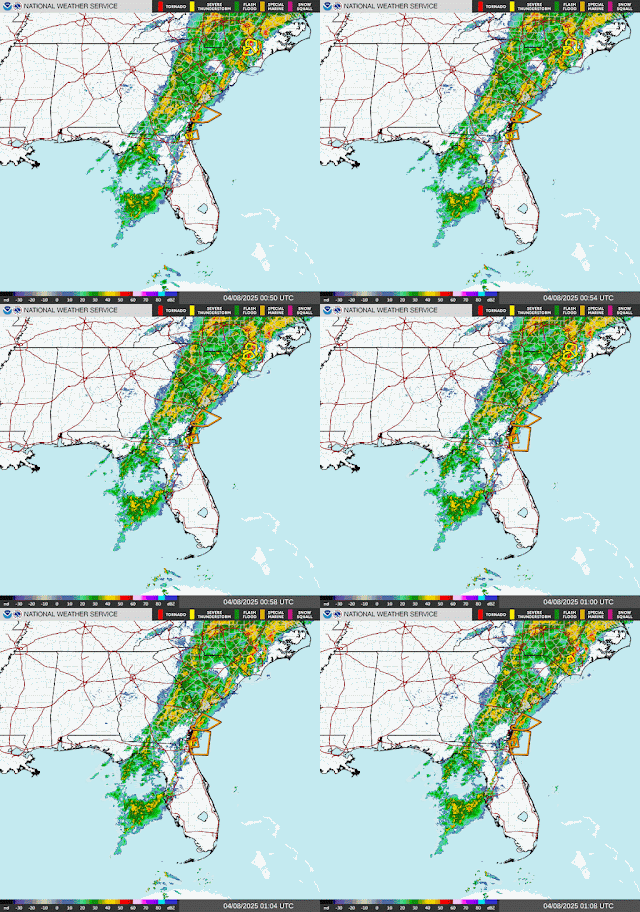
That cold front is finally moving through Eastern Georgia tonight and the Carolinas. Clear skies and cool weather are on the way the next couple days, and then even in the long-term, our pattern looks calmer for a while. I'd say we've earned it after the past week.
High pressure will be moving in near Memphis tomorrow, and we'll be sunny, still breezy at times, winds shifted to the North, look for a High near 57, Low tonight/in the morning near 38.
Winds should settle down by Wednesday, and we'll stay sunny, look for a High in about the 66-68 range and a morning Low only about 30-32. That's why we have a freeze watch in effect for all of North Alabama and a potential for widespread frost.
As to why Tennessee counties are not under a similar advisory, I'm not sure. Different local forecast offices have different standards about why they issue certain products and when.
And actually I did find the reason. It was a technicality, as I suspected. Will excerpt from NWS Nashville's forecast discussion in boldface here:
.KEY MESSAGES...
Updated at 648 PM CDT Mon Apr 7 2025
- River flooding will be the main concern for the next several
days.
- While we don`t do frost/freeze headlines until May 1,
temperatures will be sufficient for a frosty conditions Tuesday
and Wednesday mornings.
- Showers and a few thunderstorms Wednesday night - Friday, no
severe weather expected.
&&
<snip - before including another excerpt from AFD NWS Nashville>
Lows tonight will be chilly as
the cold air starts to settle in. We will see lows in the low to
mid 30s, we do not due frost/freeze products until May 1. If you
got an early start on the growing season you may want to cover up
or bring in your plants. Canadian high pressure will drift south
over the region on Tuesday. This will bring mostly sunny skies but
it will remain cool with highs only making it into the low to mid
50s.
So it is against the local office's policy to issue advisories about frost or freezes this time of year. Obviously similar issues are possible in Tennessee anyway. But for anybody who's confused by the Alabama counties being included and Tennessee counties not, now you know why. I guess it's kind of like a McDonald's I used to work at that didn't have a dollar menu. A lot of people got confused when they came in there and couldn't get certain burgers for a dollar and had to pay full price. But that's the reality of the world. Different workplaces have different standards. Sometimes it makes weather maps look kind of funny.
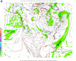
On Thursday we actually have another cold front coming at us.
We'll look at it on a standard weather map instead of raw model output so you can actually see the cold front clearly. The only difference is that the raw GFS model data above was for 1 PM Thursday, and this regular weather map directly above is valid for 7 AM Thursday. But the general idea is the same.
Most of the day should stay dry. We could see an isolated shower somewhere during the daylight hours, but the risk is very low, about 20% or less. Skies should start out mostly sunny and then clouds increase gradually toward evening. Look for a High of about 70 or so, a Low in the mid-40's.
And at night, the rain chances will climb more into the 40-50% range overnight. We might have enough instability for a little thunder.
Friday will be mostly sunny with a High in the lower 60's, Low in the mid-to-upper 40's.
High pressure moves back in strongly on Saturday, and we'll be sunny with a High in the lower 60's, a Low near 40.
Another sunny day Sunday as the High temperature rebounds to about 70 or so, the Low in the upper 30's.
And we'll stay sunny next Monday even as the High rebounds to about 80 degrees, the Low to the upper 40's. Our winds aloft will be picking up from the Southwest, bringing us some Gulf moisture.
After that, the next even low chance of rain looks to come Thursday of next week. Tuesday through Thursday, Highs should be near 80 with Lows in the 50's.
Rainfall totals over the next seven days should range from about one-tenth to a quarter-inch. And that works out great since we just got through with some flooding.
Since the weather is looking so much quieter, I'm planning on taking some time off this blog, as I have a lot on my plate in everyday life. If you would like to help support these weather blogging efforts, above are the links to drop a dollar or two in my bucket. Hasta luego, hope you enjoy the nicer weather.
What we've just come through was some rough stuff. The National Weather Service in Memphis will finally be able to start their storm surveys safely tomorrow, and I'd like to close this post with their public statement in the meantime:
Over the past week, the Mid-South has been impacted by an unprecedented stretch of severe weather and historic rainfall. This prolonged event has led to multiple devastating tornadoes, damaging winds, destructive hail, and widespread, ongoing flooding across much of the region.
We are just beginning to analyze the scale and scope of the impacts. The nature of this event makes it difficult to put into context immediately. In the coming weeks, we’ll be working closely with our emergency management partners to survey the impacts and help frame what this means for our communities and how it fits into historical perspective.


No comments:
Post a Comment