

FORECAST:
Tuesday (High 76, Low 44): Sunny. Breezy.
Wednesday (High 68, Low 45): Mostly sunny. Breezy.
Thursday (High 72, Low 41): Sunny. Mild.
EXTENDED OUTLOOK:
Friday (High 77, Low 48): Mostly sunny.
Saturday (High 73, Low 55): Partly cloudy with a 30% chance of showers/thunderstorms.
Sunday (High 78, Low 61): Thunderstorms likely - some possibly severe.
Monday (High 67, Low 53): Mostly sunny.
PRONÓSTICO:
Martes (Máxima 76, Mínima 44): Soleado. Ventilado.
Miércoles (Máxima 68, Mínima 45): Mayormente soleado. Ventilado.
Jueves (Máxima 72, Mínima 41): Soleado. Templado.
PRONÓSTICO EXTENDIDO:
Viernes (Máxima 77, Mínima 48): Mayormente soleado.
Sábado (Máxima 73, Mínima 55): Parcialmente nublado con un 30 % de probabilidad de lluvias/tormentas eléctricas.
Domingo (Máxima 78, Mínima 61): Probabilidad de tormentas eléctricas, algunas posiblemente severas.
Lunes (Máxima 67, Mínima 53): Mayormente soleado.
NOTES:
The next SKYWARN class is this Thursday evening in Rainsville at Northeast Alabama Community College. Anyone near there who wants to learn more about severe weather and/or public safety is strongly encouraged and welcomed to attend this free class.
The National Weather Service in Birmingham has put together an excellent summary page of the March 15, 2025 tornado outbreak. And so has the Nashville office.
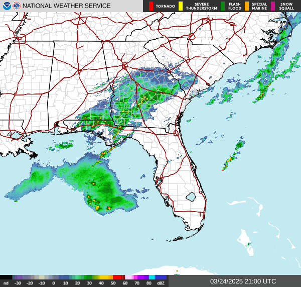
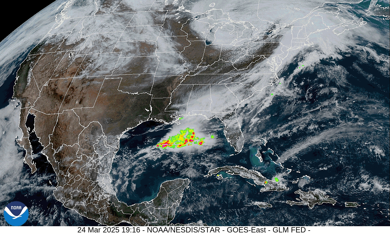
And here are the preliminary storm reports from last night.
The National Weather Service in Nashville is starting their Weather101 classes for this year tomorrow morning. These classes are free, online, and fun. The first one is about hurricanes and tropical storms.
With another severe weather potential looming this weekend, it is a good time to go over your severe weather safety plan, while the weather is still nice. If you need to buy anything, like a weather radio, batteries for the radio you already have, or something like a safety helmet, now would be the time, not when the weather is already turning threatening again.
Not to be all doom and gloom with such a nice week ahead, I'll share something purely for fun: David Blaine has been making the rounds on talk shows lately to promote a show he did on National Geographic, that is releasing now. And when he went on Kelly Clarkson's talk show the other day, she was so astonished by his card magic that they had to bleep out some of her reactions. It was a lot of fun to see. I love her show anyway, when I can catch the abbreviated YouTube version (I can't get a TV antenna to work at my place), and I've always loved his magic. And magic in general . . . some of my kinfolks recently got to see Mac King's show in Vegas, sounded really great. The Cullman library has one of his books, for any kids (or adults actually) that want to learn some simple tricks. I was told that Mac was way sillier in person than on any of his TV/YouTube spots and also friendlier than one would ever expect. Anyway, if you get nervous about the weather and want something purely fun to take your mind off it, check out Kelly Clarkson tripping out over David Blaine's sleight of hand with a pack of regular cards. Plus I love the way he defies the fears that most people wouldn't go anywhere near, sort of like Houdini. I don't know that I'd kiss a cobra myself, but it's really something to see. Takes a special kinda' guy to pull that off and not get bit, if nothing else. It's not for everybody, but some meteorologists these days say that if storms worry you, it can be good to take a few days off from keeping up with it. So I thought I'd throw in something random for fun at the end of these notes where I'm talking about severe weather we've had lately and may have again this coming Sunday. Plus just taking a walk outside while the weather is great this week might be better for the soul than any TV or YouTube show.
DISCUSSION:


So the cold front has moved to our East/Southeast, and we have High pressure moving back into the region from just West of Memphis this evening. The air behind this front is not going to be all that cold, just seasonable.


Here are this morning's upper-air soundings from Birmingham and Nashville. Some National Weather Service offices across the country have suspended their balloon launches, but fortunately our local ones are still launching at 7 AM and 7 PM every day (12Z and 00Z, Universal Time). This helps out human forecasters and also the supercomputers (forecast models) that predict the future states of the atmosphere for the next several days, to have more of this radiosonde data to give an accurate diagnosis of every level of the atmosphere. You can see cooler, stable air has replaced the atmosphere we had yesterday evening. Lifted Indices (LI) are a positive value, which should be the case when the atmosphere is stable, air cools as it rises . . . for just one example.
Since some people these days seem to think budget cuts are more important than keeping essential services like these weather balloon launches in place, I'm trying to remember to show them on a regular basis. If we need to make a change in these launches, we need more across the country (and around the world), not less. Unless we're hoping to make poorer forecasts. Do you know anybody who really wants that? They're probably out there . . . but I think most people just don't understand how valuable some of these services performed by National Weather Service personnel really are.


We've got a secondary front going to move through the region tomorrow evening, so conditions are going to stay breezy the next couple days.
Tomorrow looks sunny with a High of about 76, a Low near 45. Plenty of sunshine Wednesday too with a High of about 68, Low near 45 again.
Clear skies continue on Thursday with High pressure in place in the region, High of 70 or so, Low about 40 or so.


Friday will stay mostly sunny around here even as the High pressure shifts off into the Atlantic. We'll see a High in the upper 70's and Low near 50, perhaps only upper 40's for many of us.


Saturday clouds will increase some, and we'll have about a 30-40% chance of showers/thunderstorms. High temperature should be in the lower 70's, the Low in the mid-50's.

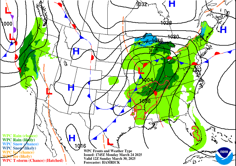
A storm system will bring a threat of severe thunderstorms to Missouri, Arkansas, Eastern Kansas, and Eastern Oklahoma.


The upper-level trough takes on a negative tilt via the GFS with the surface Low passing through Southern Missouri. This would favor severe thunderstorms in our region on Sunday.


The ECMWF shows things moving a little slower maybe, shows the Low pressure center a little further to the West, but still, fairly favorable severe weather look for our region.


It's tough to speculate on details of a severe weather event a full 6 days out, but let's look at a few clues. The GFS is showing enough of a combination of unstable air and wind shear to be concerned about between about 4-7 PM Sunday evening, which tends to be the prime time of the day for thunderstorms to become severe anyway.

Taking a forecast sounding from near Huntsville at 4 PM shows very strong instability (over 3,000 j/kg of CAPE and Lifted Index of -8 degrees) combined with sufficient wind shear to produce rotating storms - about 40 knots of bulk shear between 0-6 km, Storm Relative Helicity of about 200 m^2/s^2 at 3 kilometers, more like 100 units at the lowest 1 km. Long, curved hodograph in the upper-right-hand corner. Temperature getting up to about 80 degrees with a dewpoint of 65. Composite indices are not overwhelming but enough to pay attention to, Supercell Composite of 9-10, Significant Tornado Parameter of 1-2.
This would support a threat for severe thunderstorms capable of large (perhaps very large, like last night) hail, damaging winds, and at least a few isolated tornadoes in the region.

Glancing at the ECMWF, it shows similar dewpoint-temperatures around here Sunday evening.
So it looks likely that we'll have more than enough unstable air this time, and wind shear that's more on the marginal/moderate end of the spectrum. But this has the potential to be an organized severe weather event Sunday evening.

The entire Tennessee Valley region is already included in a Basic 15% risk for severe weather Sunday/Sunday night. (Technically the outlook is valid from 7 AM Sunday to 7 AM Monday, or 12Z Sunday to 00Z Monday.) And as you can see, this threat stretches back through the Mid-South, parts of the Midwest, and into the Ohio Valley as well. These severe thunderstorms could get organized, and impacts could be significant for someone within this broad area. Over the next several days we'll get a better idea of what to expect locally, but confidence is good that we'll have some threat for severe weather. It could be a lower-end event like last night, a higher-end event like about a week before that, or (more likely) somewhere in the middle. We are almost into the month of April, which tends to be the core of our severe weather season. Some recent years, we've been lucky, but typically we do see several threats for severe weather in the months of March, April, and May. Things usually start to wind down through the month of May, but sometimes we can't let our guard down until June gets here and a Summer pattern starts. And this may be one of those years where things stay pretty active. We just have to take these storm systems one at a time and evaluate as they come.
So the basic forecast for Sunday is that thunderstorms are likely, some possibly severe, with a High temperature in the upper 70's and a Low near 60.


The cold front is past us on Monday. Look for mostly sunny skies, a High in the upper 60's and a Low in the lower 50's.

Expecting about an inch of average rainfall totals for this forecast period.
This blog doesn't write itself, so if you'd like to support these efforts, above are a couple of links where someone could drop a dollar in the bucket.


No comments:
Post a Comment