FORECAST:
Sunday (High 32, Low 30): Partly cloudy and breezy with isolated light snow showers possible. Accumulations, if any, are expected to stay between a dusting and one inch.
Monday (High 27, Low 10): Sunny. Bitterly cold.
Tuesday (High 30, Low 11): Partly to mostly cloudy with scattered snow showers possible. Light accumulations are possible.
EXTENDED OUTLOOK:
Wednesday (High 33, Low 10): Sunny.
Thursday (High 40, Low 16): Sunny.
Friday (High 42, Low 20): Mostly sunny.
Saturday (High 49, Low 23): Sunny.
PRONÓSTICO:
Domingo (Máxima 32, Mínima 30): Parcialmente nublado y ventoso con posibles nevadas aisladas. Se esperan acumulaciones, si las hay, entre una fina capa de polvo y una pulgada.
Lunes (Máxima 27, Mínima 10): Soleado. Mucho frío.
Martes (Máxima 30, Mínima 11): Parcialmente a mayormente nublado con posibles nevadas dispersas. Es posible que haya acumulaciones ligeras.
PERSPECTIVA EXTENDIDA:
Miércoles (Máxima 33, Mínima 10): Soleado.
Jueves (Máxima 40, Mínima 16): Soleado.
Viernes (Máxima 42, Mínima 20): Mayormente soleado.
Sábado (Máxima 49, Mínima 23): Soleado.
We are under a Wind Chill Advisory, or since the National Weather Service has apparently resigned itself to catering to our cultural science illiteracy, a "Cold Weather Advisory." We're staying below freezing through Wednesday or Thursday, and we aren't used to that around here. Here are some safety guidelines for this kind of weather.
Today we lost one of the best meteorologists who ever lived, Dr. Charles Doswell, or "Chuck" to his friends. If you read through even a third of the science he made freely available on his personal website, you'd learn some things you might miss just getting your required credits in school. He was one of a kind and one of the most brutally honest people I've ever crossed paths with. James Spann posted today that he'd learned more about severe weather from this man than from anyone else. He was one of the early storm chasers, and he was a responsible one, something that has become a real novelty in later years. It is devastating news for the world of weather. I guess the silver lining sometimes is that such people lived at all, that we got to enjoy them while they were here and learn from them. I didn't wear it on my sleeve, especially since he was known to be cantankerous at times, but I absolutely loved this man. And his taciturn nature was a lot of the reason why. He was a very decent, thoughtful person if people took the time to look beyond his tough exterior.
DISCUSSION:
It was an overcast, breezy day in the Tennessee Valley, with some fog this morning too. Even as I'm writing this at 10 PM, visibility in Cullman is reduced back down to 7 miles. Winds are from the North at 12 mph. Our High today was 57 with a morning Low of 45. Jasper had a High of 63 and Low of 45. Oh wow, and the visibility in Haleyville is down to 1.5 miles at this hour thanks to heavy fog, also some light rain. The High there was 54, and the current temperature of 40 is the Low for the day so far. Temperatures can go backwards in the Winter time sometimes.
Huntsville had a High of 55, and now they are down to 42 degrees, colder than they've been all day. Nashville got up to 51 degrees today, and they are down at 36 degrees now.
This cold front is bringing us some seriously cold air that will make the next few days hazardous around here. People, pets, and plants could suffer frostbite or hypothermia (yes, could even freeze to death) if left out in this kind of cold. Pipes can burst if precautions are not taken (like wrapping them, or if indoors, make sure your heat can circulate to them and leave faucets dripping). And people need to remember to practice heat safety, like allowing at least three feet around space heaters, not using generators or grills indoors. Or if you have an old fashioned fireplace, that's great, but remember to open the flue to allow the carbon monoxide gas to flow up and out the chimney. I know of a popular singer whose parents died because they left it closed one night, just forgot to pay attention. We are not used to this kind of cold around here, and we need to mind our p's and q's about it.
Tomorrow begins the deep freeze around here (and actually across many other parts of the country, but we're going to focus on our own back yard here), and between tonight and about midday tomorrow, we do have some chance for isolated snow showers. Most of us will probably only see a dusting at most, and most of that will be on grassy surfaces. But especially up around Huntsville and points East/Northeast in those higher elevations, amounts up to a half-inch or even one inch will be possible tomorrow. So this could cause some slick spots on roads. The temperature tomorrow will hover around freezing, and it will be breezy.
Then Monday we see sunny skies but a morning Low of about 10-11 degrees, an afternoon High of only about 27-28 degrees. Winds should be light from the North, but wind chill values will be in the single digits, actually may dip into the negative numbers in the morning. So again, please be careful with this, don't take any chances with older folks in your family or any pets who might be more susceptible to the cold. Check on them, make sure they have a way to stay warm, free advice.
The forecast for Tuesday continues to be a challenging one. The GFS is very much in favor of the significant snow staying farther South, not only affecting South Alabama and into the Florida Panhandle, but also places like Louisiana, where they are under a rare Winter Storm Watch. They see snow down there even less than we do.
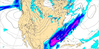
The ECMWF has brought the Northward extent of the precipitation (which would be snow) up into our neck of the woods on this latest run, where earlier, it was on board with the GFS in keeping it over about the Southern half of Alabama. This is an anomalous setup, and as Forecaster Sizemore from NWS Birmingham noted a day or two ago, it just looks strange for all the snow to be focused so far South. To a human forecaster, it looks strange. So as to whether North Alabama sees much or any snow from this system, still a close call. This European model graphic is valid at 9 PM Tuesday.
Then the Canadian GEM has backed off on the northward extent of the snow, when for a while, it was the model really advertising us getting some up this way, and if I remember right, even showing it extending up across the Tennessee state line. And now it is much more conservative, like the GFS and ECMWF have been on many runs the past few days.
In light of the latest ECMWF data and just my personal observations and thinking about past events, going to bump the chance of snow up to 40% for Tuesday. High should be about 30 or so, Low near 10 or so again. And some accumulation is possible. It is not looking as concerning as our event last Friday, but with temperatures like this in place, ground already had time to freeze, anything that falls is going to stick. And if we do get anything up here, it should be snow.
That Gulf Low that'll bring the snow (to some folks, not necessarily us, but we're not out of the woods on it either) Tuesday will be moving well up into the Atlantic on Wednesday, leaving us with high pressure and dry conditions here. Once again we will start the day about 10 degrees or so, maybe lower teens, and only warm up to about the mid-30's. Which is actually warmer than we've been. Now if you're up in Huntsville, the Shoals, or certainly up into Tennessee, you're likely staying below freezing Wednesday too. Another thing to consider is that if we have even a minor snowpack in some areas, that will keep temperatures lower than mid-30's on Wednesday. And that has to be taken into account. It's a possibility.
Then Thursday looks mostly sunny with Highs getting back up to about 40 or so, the Low in the upper teens.
There has been some rogue model guidance at times suggesting we could have another winter weather threat Friday, but that appears to be gone on the latest runs. And I'm going to focus on what is more probable. We don't need to borrow extra issues right now. This weather is rough enough as it is. Unless you really like the cold and snow. I just mean it's a headache for people in general, like if they can't really go outside much and some roads may be affected.
As of right now, it looks like Friday will be mostly sunny with a High near 40, Low near 20.
And then Saturday should be sunny with high pressure really centered over the Southeast region, High climbing up near 50, Low in the lower 20's.
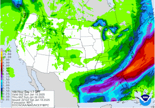
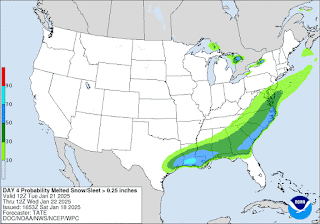
This will be a close call for North Alabama. Especially in counties like Cullman, Marshall, Dekalb, and Jackson, I'd keep an eye on it, and really any bordering counties to the ones I just mentioned. It is a close call even for Central Alabama. Very unusual, but South Alabama stands to get the best snow from this. And in Southern Mississippi and into Louisiana, they'll likely see more accumulation from this winter storm. Georgia, the Carolinas, up into Virginia may also see significant accumulations.
Around here, it is dicey how much we see, and many of us may see no snow at all Tuesday.
This probabilistic graphic from the Weather Service in Birmingham is as good as anything I've seen. I don't really have the tools to draw my own graphics, so I pick the best ones from government sources. The probabilities are lowest in North/Northwest Alabama and of course as you get up across the Tennessee state line, Southern Tennessee.
But we all need to keep an eye on it and make sensible plans. Far North Alabama into Tennessee will likely stay below freezing through Thursday. Farther down this way, places like Cullman, Jasper, Double Springs, may break a little above freezing Wednesday. It is still more of a subfreezing stretch than we are used to around here.


No comments:
Post a Comment