Columbus Day (High 70, Low 52): Mostly sunny. Cool and breezy.
Tuesday (High 66, Low 44): Mostly sunny and breezy. Cold in the morning, still cool in the afternoon.
Wednesday (High 60, Low 37): Sunny. Cold with frost possible in the morning.
Thursday (High 65, Low 35): Sunny.
Friday (High 70, Low 39): Sunny.
Saturday (High 74, Low 42): Sunny.
Sunday (High 77, Low 46): Mostly sunny.
We had a sunny, breezy day in Cullman with a High of 82 and a Low of 57.
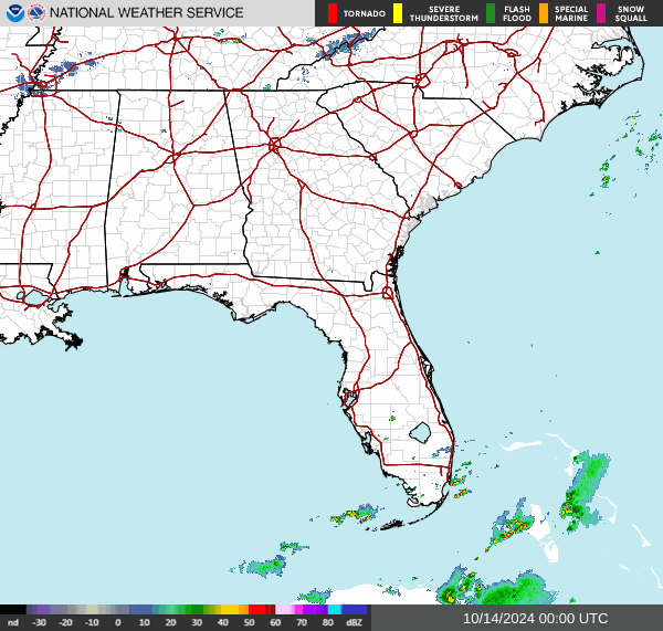
There have been a few isolated showers with this front up in Tennessee, mostly Northeast parts of the state. For the most part, this is a dry cold front for our region.
And high pressure is going to dominate our weather all week.
Tomorrow we'll have a mostly sunny day, breezy again, but wind out of the North again behind this cold front. They tended to be from the Southwest today, the winds of . . . whatever. If you have the holiday off, hope you enjoy it. If you're out there cooking chicken nuggets or sacking other people's TV dinners, you have my respect, because you're earning it, y'know? Anyway, we'll have a high near 70, the morning Low about 50 or so, probably about 52.
It still looks breezy on Tuesday, as it takes a while for the seriously colder, drier air to fully move in here associated with that strong high pressure system working its way further to the Southeast and in our direction behind this front. The pressure gradient, differences in air pressure between the contrasting air masses, is what causes the winds to kick up. Anyway, excuse my impromptu half-baked science lesson there. Google it if you like. In between looking at bikini pictures and reading self-righteous social media posts. Which I don't recommend you do necessarily, just trying to stay in touch with reality. So Tuesday it'll be mostly sunny and breezy again, or maybe I'm just talking to move the wind around, but it looks like we'll have a High of about . . . hmmmmmm . . . the models keep waffling this way and that in their temperature guidance. Yesterday I think they were showing exactly 65/45 for us, but definitely not today. So my best guesstimate at getting it exactly right is 66 degrees for the High and 44 degrees for the Low on Tuesday. Double digits can be fun.
And then Wednesday morning will be seriously cold compared to what we've had since like February. The Low should get down to about 37 degrees, and we have to consider the potential for frost with that. But overall we'll have a sunny, calm day, with a High near 60. Not expecting the breeziness anymore, which is because I'm going to stop talking by then . . . no, actually, it has more to do with the pressure gradient, or lack of same. Like I said, you can "google" this stuff, but it's so much more fun to listen to me yap on and on about it, right? The thing is I get sidetracked from any serious science lessons. So you're probably better off to . . . hmmmm . . . well,
this'll get you started.
Or you could go to the library and check out a book on weather, that's a thing.
Where was I . . . funny to be talking about the winds dying down by Wednesday. But I was already past that, to Thursday. Another sunny day where we'll definitely have to watch for frost in the morning. Model trends are showing it even more likely that we'll have a Low in the mid-30's. And I don't think the High will get past the mid-60's.
By the way, this is awesome weather if you've been putting anything off to get done during the daylight hours. I'd get to it this week.
My sister always said I had a firm grasp of the obvious.
Wait a minute, I don't even have a sister, do I?
Friends don't let friends drink and post weather blogs.
Nah, only sobriety could produce this kind of grammar and punctuation.
So that brings us to Friday. I usually don't clown around this much publicly anymore, as in, online publicly. I'm going to lose all dozen or so real followers I have here. Ah well, not a moment too soon.
I shoulda' quit this crap as soon as I left a college campus. I heard a preacher-man say that in a sermon today, "crap". Some people consider that swearing now. A girl in my extended family walloped me for saying it one night, and I didn't know what I was getting walloped for until she called attention to my language. Anyway, if I get struck by lightning for posting that word here tonight, with our tiny rain chances, while I'm indoors . . . then I'll know it was a mistake.
Lest anybody should misinterpret that, please understand that I consider our rain chances tonight to be less than 20%, probably less than 10% except in Northeast Alabama up into Tennessee, mainly Eastern Tennessee. But the chance isn't zero. So if you find an obituary about me dying from a lightning strike . . . don't say "crap" on a Sunday night. Not worth the risk. But . . . we're not there yet.
Friday looks sunny with a High near 70 and a Low near 40.
Then Saturday I predict there will be another football game, which means nobody cares about the weather. So we'll just skip over Saturday maybe . . .
Nah, loyal readers deserve to know: Saturday also looks sunny with a High in the lower 70's, Low in the lower 40's.
And I'll talk about the elephant in the room for next Sunday: Yes, the GFS does show a tropical cyclone approaching Haiti and the Dominican Republic. If you don't see that here, and see it somewhere else, the average reader will probably think I'm clueless or negligent. But this is why I decided to do a blog tonight instead of taking the break I was planning on. Because I scrolled around enough to see some hype developing over this.
The ECMWF does not currently agree with this scenario, and it tends to do better at this time range and better with hurricanes and tropical storms. So there's that.
Beyond that, the truth is that there's really little to no skill in forecasting specifics of a tropical cyclone (or a potential one) seven or more days in advance.
So allow me to share some words of wisdom from some folks who know more about tropical cyclones than I do, and more than most my readers do.
The National Weather Service office in Tampa said this exactly right, even better than Jim Cantore, who posted that people needed to keep an eye on it but not get paranoid over it.
Now if you're in Puerto Rico or the Leeward Islands, then absolutely, I could see where you'd already be watching this with vigilance, to be on the safe side. We've just had two major hurricanes hit Florida, and the first of them devastated other states well inland. We've had a very rough season. It's very understandable to be shaken up by that. Sort of like if you had a fire in your kitchen, you might be eating more sandwiches than cooking a whole lot on the stove for a while . . . that'd be a natural human tendency, to be nervous about whatever rocked your world lately, or the world of somebody you know.


This system may develop into a tropical depression (or storm) by this next weekend. It's sensible for people in the Leeward Islands, Puerto Rico, or Haiti/Dominican Republic to already have some concern. (Again, not panic, but concern, is reasonable.) But if you're in Florida or along the Gulf Coast, please relax. We don't even know if this thing is going to develop or not, much less where it is going if it does fire up. If it were to develop into something and aim somewhere at the Gulf Coast, people would have plenty of time to get ready. This thing has been monitored off the West Coast of Africa. For the next couple days, it is over unfavorable waters. It's only over the next 3-7 days that we'll have to start watching to see if it strengthens as it moves West/Northwest toward the Leeward Islands. For now it is still moving more West/Southwest. And it just needs to be watched, like any other tropical system this time of year, in this unusually severe hurricane season.
I think I'm going to stay out of the arguments over who's actually helping the survivors properly. Partly because I was not hit by either of these hurricanes and would only be going on secondhand information, even if I respect the people giving that information. I don't mind sticking my neck out sometimes if I know what I'm talking about, but with this, I'm not confident enough that I do. So I'm leaving the arguments to others and just throwing out the information people can choose from if they want to contribute to the relief efforts.
I've actually heard some people say that local churches, especially in Northern Georgia up into North Carolina, have sometimes helped more than any of the big organizations. But the only thing I'd know to tell you about that is to ask your local church where you actually live about relief efforts. They might have connections up that way. And you could probably figure that out on your own, but remember now, in any group, sometimes there's one person in the back of the room that needs to be reminded of the obvious. On some of my down days, I'm that slow guy in the back of the room myself. If you know any of the families affected directly, then that's the best scenario for knowing how to help. To be bluntly honest, I almost never donate to any charities, for storm relief or anything else. My nose is not running money these days, and the most I'm likely to do is send a few dollars to one person or family that I see having a rough time, if I feel like they deserve some help, especially if they do not appear to be getting it elsewhere. That's what I do. I'm an odd duck. Some of you may have much bigger hearts and/or wallets than mine, and I just thought I'd organize things for your handy reference. Since I found it confusing to sort out just from social media posts. These are the best sources I know to help folks out. If you know something better, you can always leave me a comment, send a social media note, or
e-mail me. I'd love to include any relief resources that I can feel reasonably confident are doing the right things to help and not pocketing any of the funds.

If we get any rain tonight beyond what we already have, it'll probably be in Northeast Alabama or Eastern parts of Tennessee. And it probably will be very little.
And I know nobody really cares about my Spanish forecasts, so not bothering with it tonight.


No comments:
Post a Comment