FORECAST:
Thursday (High 73, Low 64): Rainy and windy. An isolated tornado or instance of flash flooding is possible.
Friday (High 76, Low 65): Showers likely, gusty winds at times. An isolated tornado or instance of flash flooding is still possible.
Saturday (High 78, Low 64): Partly to mostly cloudy. Numerous showers are still possible, off and on.
EXTENDED OUTLOOK:
Sunday (High 80, Low 63): Partly cloudy with a 40% chance of showers/thunderstorms.
Monday (High 81, Low 62): Partly cloudy with a 30% chance of showers/thunderstorms.
Tuesday (High 83, Low 61): Mostly sunny with a 20% chance of a shower or thunderstorm.
Wednesday (High 85, Low 63): Mostly sunny.
BEACH FORECAST:
Thursday (High 85, Low 76): Windy and rainy. Tropical storm conditions likely, especially in the morning - heavy rain, high winds, and isolated tornadoes possible along with dangerous rip currents.
Friday (High 84, Low 76): Mostly sunny. An isolated lingering shower or thunderstorm is possible.
Saturday (High 85, Low 74): Sunny.
Sunday through Wednesday (Highs in mid-80's, Lows in lower 70's): Mostly sunny with a 20% chance of an isolated shower or thunderstorm.
PRONÓSTICO:
Jueves (Máxima de 73, Mínima de 64): Lluvioso y ventoso. Es posible que se produzca un tornado aislado o una inundación repentina.
Viernes (Máxima de 76, Mínima de 65): Probables lluvias, ráfagas de viento ocasionales. Aún es posible que se produzca un tornado aislado o una inundación repentina.
Sábado (Máxima de 78, Mínima de 64): Parcialmente a mayormente nublado. Aún es posible que se produzcan numerosas lluvias, de forma intermitente.
PERSPECTIVA EXTENDIDA:
Domingo (Máxima de 80, Mínima de 63): Parcialmente nublado con un 40 % de probabilidad de lluvias o tormentas eléctricas.
Lunes (Máxima de 81, Mínima de 62): Parcialmente nublado con un 30 % de probabilidad de lluvias o tormentas eléctricas.
Martes (Máxima de 83, Mínima de 61): Mayormente soleado con un 20 % de probabilidad de lluvias o tormentas eléctricas.
Miércoles (Máxima de 85, Mínima de 63): Mayormente soleado.
PRONÓSTICO DE LA PLAYA:
Jueves (Máxima de 85, Mínima de 76): Ventoso y lluvioso. Es probable que haya condiciones de tormenta tropical, especialmente por la mañana: lluvias intensas, vientos fuertes y tornados aislados, además de corrientes de resaca peligrosas.
Viernes (Máxima de 84, Mínima de 76): Mayormente soleado. Es posible que haya una lluvia o tormenta eléctrica aislada.
Sábado (Máxima de 85, Mínima de 74): Soleado.
De Domingo a Miércoles (Máxima de 85, Mínima de 70): Mayormente soleado con un 20 % de probabilidad de una lluvia o tormenta eléctrica aislada.
NOTES:
All this rain will help our drought conditions.
The National Weather Service in Birmingham is holding SKYWARN classes, most of them online, toward the end of September through October. As always, these are free, and anyone with an interest in learning more about severe weather/public safety is strongly encouraged to enjoy one.
At 1 PM skies are mostly sunny in Cullman. The temperature is 84 degrees. The dewpoint is 61 degrees, making the relative humidity 45%. Winds are calm, though earlier this morning, they have been variable and gusted up to as much as 15 or 17 miles per hour. Like I say, direction has been variable, but usually from the South and East. The barometric pressure is 30.03 inches and falling.
Skies are partly cloudy in Jasper with a temperature of 88 degrees. They're usually a little warmer. The dewpoint is 63. Relative humidity is 43%. Winds are variable at 7 miles per hour, with higher gusts up to 16 mph. The pressure is 29.99 inches and falling.
It is mostly cloudy and 85 degrees in Haleyville. The dewpoint is 63. Which makes their relative humidity 48%. Winds are from the Southeast at 8 mph. The pressure is 30.04 inches/1015.8 millibars and falling. As usual, kudos to the Haleyville station for providing their pressure in millibars. I don't feel like calculating and converting it every time. And hey, they're the home of the 911 system. They do a great job taking care of folks there during bad weather and as far as I know, other things. There's something about Winston County that's just unique anyway. Anybody who would secede from the Confederacy and declare themselves The Free State of Winston just has my total respect. And here I am, talking about a county like it has a personality. But you know, people do live in the county. And they did back then too . . .
By the time I'm getting this rounded up here, already finished posting the latest tropical updates separately, we are actually getting close to 2 PM. So this Huntsville observation is actually from 1:53. But skies are mostly cloudy in the Rocket City with a temperature of 88. The dewpoint is 52, making for a relative humidity of 29%. Winds are Southeast at 12 mph. The pressure is 30.01 inches/1015.4 millibars and falling.
Then finally the Music City, Nashville is partly cloudy and 88 degrees. The dewpoint is 56, making the relative humidity 34%. Winds are from the East at 7 mph. The pressure is 30.03 inches/1016.2 millibars and falling.


Tomorrow we'll be in a good position to get the tropical rain bands from the remnants of this hurricane. Overall it's just going to be a rainy and windy day. We could see some tree damage just from regular gradient winds, here and there. But as with any tropical system that has moved inland, we do have a risk of isolated tornadoes, maybe a few instances of localized flash flooding. So please be mindful of that. High should be about 73 degrees, Low of about 63-64 tonight/in the morning. By the way, we'll see a few showers moving in tonight, not really expecting anything severe with a lack of unstable air to fuel any of those low-topped supercells (like we may see tomorrow), but the wind will be picking overnight as well.


Then on Friday, looks like another rainy, windy day. And IMHO people in Tennessee will need to watch those spiral bands for an isolated spinup tornado more than the Alabama side on Friday as the center of the TC remnants move further to the North. Around here, expecting a High in the mid-to-upper-70's, about 76, a Low in the mid-60's, about 64-66 range. Maybe I should have just said 65 then.


Saturday is now looking like a little more rain hanging around. A ridge will block the remnants from moving too far North and keep them meandering around our region. I think we can drop the concern for any severe weather, but will forecast a rain chance of 50% for Saturday based on this latest guidance. Yesterday I was predicting 40%, more scattered. Still doesn't look like tomorrow or Friday where it could rain all day for some of us. High in the upper 70's Saturday, Low in the lower 60's.


Then for Sunday, expecting a High near 80, Low in the lower 60's, and about a 40% chance of scattered showers and thunderstorms.


Then Monday we'll trim the rain chance back to 30%, High near 80 or so, Low of 60 or so.


And the model guidance has kind of gotten messy in the extended, but I still think it's safe to reduce the rain chance to 20% by Tuesday. High in lower 80's, Low of 60 or so.


And by Wednesday, the chance of rain is probably down to 10% or less, so going to drop it and forecast mostly sunny skies again, High in lower-to-mid-80's, Low in lower 60's.

We do have a couple of weak tropical disturbances out there in the Atlantic between Tropical Depression 7 and Hurricane Francine.


Tropical Depression Seven has formed West of the Cabo Verde Islands, way out in the Atlantic. Current forecast keeps it at tropical storm strength and on a track that would not make it a threat to our local weather, even in the long-term.


The eyewall of Hurricane Francine is about to hit the Louisiana coast as we are at 3 PM now. Maximum sustained winds are 90 mph. So the National Hurricane Center did an incredible job with this forecast.

And I'm just going to geek out a little by admiring this thing on radar.

Locally we will have to watch the threat for isolated tornadoes tomorrow and tomorrow night, in North Alabama and Southern Middle Tennessee. Actually the threat is a little greater as you get into Central and South Alabama, down into the Florida Panhandle. But anywhere in these spiral rain bands, let's respect the threat of a possible tornado.
If you get a Tornado Warning, remember the rules in a site-built house:
* Stay away from windows.
* Get to the lowest floor.
* Get into a smaller room like a bathroom, closet, or hallway.
* Make that room as near the center of the building as you can, some walls between you and outside.
Everybody has Wireless Emergency Alerts on a cell phone, but the best way to get the warnings is a NOAA Weather Radio with battery backup or a phone service like Weathercall.
Nobody needs to stay in a mobile home if a tornado is coming, and I hope nobody gets caught driving that way either. If I was caught without any shelter, I'd lie in an unflooded culvert or ditch or even flat on the ground, covering my head and neck. Would not stay in a mobile home. But try to plan ahead. Tomorrow is a good day to stay with a friend or family member who has a sturdy house or is closer to some kind of storm shelter. Even the winds gusting throughout the day could make things uneasy for some people in mobile homes, especially if there are trees around. The tornado threat is low, but it is there. And these tropical tornadoes happen so quickly. The damage is usually on the lower end too, but it's still dangerous if people do not have shelter. And IMHO no mobile home offers shelter from even the weakest tornado. I really would rather somebody lie flat on the ground than stay in one, with a tornado coming.

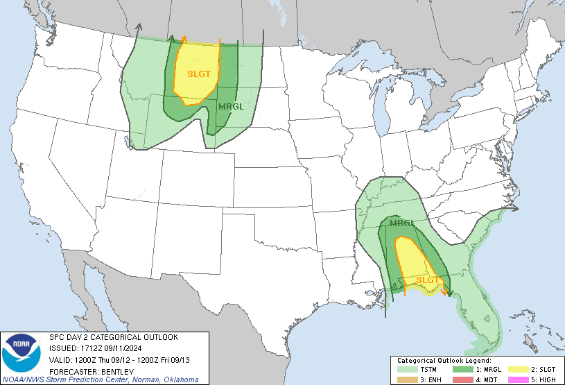
On Friday the Storm Prediction Center currently thinks the threat for any tornado spinups will shift into Northeast Alabama and much of Georgia. If I was drawing this map, I would include at least part of Tennessee in this outlook, but that's just my personal opinion.

The National Weather Service in Nashville is using the Thursday outlook from SPC while giving their forecast. If this turns out to be right, only the Southern Counties of Middle Tennessee will have a tornado risk, while places closer to Nashville will only have general showers and maybe some gusty winds from this. If you live in Nashville or thereabouts, I'd still keep an eye on radar trends and any forecast updates, because a situation like this with the remnants of a hurricane often gets messy. All it would take is one tropical rain band moving a little farther North than expected, and somebody could see a tornado up that way. It's nothing to be overly concerned with, but I'd just keep an eye on it, to be on the safe side. These outlook areas are always meant to be basic guidelines. Sometimes they get it exactly right, but the SPC expects people to understand that these are only basic guidelines and that there's always a margin for error. And you always have to be ready for a surprise. Inland tropical cyclones are often a forecast challenge.

Having said all that, the overall threat for tornadoes is low, and so is the risk for flash flooding with this system, at least around here. The big concern for flooding is down in Louisiana and Southern Mississippi. Northwest Alabama and about the Southern half of the state have the best chance of any flooding issues around here, but really none of us are completely immune from the threat, even as you get up into Tennessee.
Never cross water that covers the road. You can't tell how deep it is. Especially if you're in a vehicle, don't even think about it. It puts your life at serious risk and also puts the rescue workers at risk who are going to have to try to save you. Water rescues are tough for everyone involved, and a lot more people die from driving into flood waters than get killed or seriously injured from tornadoes every year. People just don't think before they drive into it. So as the NWS says: "Turn around. Don't drown."

It's looking like rainfall totals of 4-5 inches are going to be common with this system over the next few days. So even if the threat for flooded roads is relatively low, still worth respecting, same as the tornado threat.
And by the way, there ARE no Haitian (or any other kind of) immigrants kidnapping and eating people's cats or dogs up in Ohio. THAT IS FAKE NEWS.
God bless America?
No comments:
Post a Comment