

FORECAST:
Sunday (High 74, Low 60): Overcast with periods of fog. Numerous rounds of light rain showers are possible.
Monday (High 79, Low 60): Patchy fog possible in the morning, otherwise partly to mostly sunny. An isolated shower is still possible, mainly in the morning hours.
Tuesday (High 81, Low 59): Mostly sunny. Some fog possible in the morning.
EXTENDED OUTLOOK:
Wednesday (High 82, Low 59): Sunny.
Thursday (High 83, Low 56): Mostly sunny.
Friday (High 82, Low 58): Mostly sunny.
Saturday (High 79, Low 61): Increasing clouds with a 20% chance of showers.
PRONÓSTICO:
Domingo (Máxima 74, Mínima 60): Nublado con períodos de niebla. Son posibles numerosas rondas de lluvias ligeras.
Lunes (Máxima 79, Mínima 60): Niebla dispersa posible por la mañana, por lo demás parcialmente o mayormente soleado. Todavía es posible algún chaparrón aislado, principalmente por la mañana.
Martes (Máxima 81, Mínima 59): Mayormente soleado. Es posible que haya algo de niebla por la mañana.
PERSPECTIVA EXTENDIDA:
Miércoles (Máxima 82, Mínima 59): Soleado.
Jueves (Máxima 83, Mínima 56): Mayormente soleado.
Viernes (Máxima 82, Mínima 58): Mayormente soleado.
Sábado (Máxima 79, Mínima 61): Nubosidad creciente con un 20 % de probabilidad de lluvias.
NOTES:
SKYWARN classes are being held through October. November is when we typically see another uptick in severe thunderstorms around here, instead of the tropical stuff.
The impacts from Hurricane Helene have been devastating. We were spared anything serious locally. Here is a reference for some relief efforts in Western parts of North Carolina. Here is a look at what FEMA is up to. There is no quick fix for any of this, but I can tell you from past experience, victims of major storms like this appreciate any help they can get. Think back to our tornado outbreak in April 2011 if you lived here back then.
The Tennessee Bureau of Investigation has set up a hotline to find missing persons from the floods that also affected Northeast Tennessee. That is 1-800-TBI-FIND. Or if you have a hard time translating keypad letters, it's 1-800-824-3463. That should underline just how serious the devastation has been. There are still people unaccounted for. Latest confirmed death toll I saw was 64 people, spanning several states. This is going to take a while to sort out.
Adding this at 11:31 PM because I just ran across it on social media: Here is an excellent one-stop page from FEMA on how to help with relief from Hurricane Helene. It is very detailed for all the states that were affected.

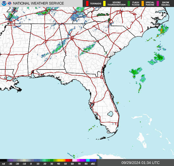


It was an overcast, breezy day in the Tennessee Valley with periods of light rain. The High in Cullman was 68 with a Low of 61. The High in Jasper was 72 with a Low of 63. Haleyville had a High of 67 and Low of 60 today.
Then peeking around the rest of the region, Huntsville had a High of 68 and Low of 63. Noticed they had a bit of fog with some of the rain, especially this afternoon. Lots of places did really, this was just that sort of a day. Nashville even right now at 9:19 PM has enough fog to restrict the visibility down to 3 miles. They had a High of 67 and a Low of 62.
That remnant low that used to be Hurricane Helene is now parked up in Kentucky, and man, has it ever done a number on a lot of people. That stuff in East Tennessee into Western parts of North Carolina, the flooding, is looking even more devastating than what the full hurricane impacts were in the Big Bend of Florida and Southern Georgia. But it is sad stuff for anyone who got a major blow from this storm. And there has been significant loss of life from it, not just property damage. I'm confident in saying that the damage in North Carolina is of historic proportions, and some towns were destroyed by flood waters.


And over the past three days, those spiral rain bands on the Eastern side of the tropical cyclone produced isolated tornadoes and low-topped supercell thunderstorms that produced damaging straight-line wind events. We were on the West side of that and did not have any such problems. We did have a few trees come down the other day from just the gradient winds and some saturated soil, remember seeing at least one case in Jackson County where a tree was blocking both lanes of a road. I think they got that cleared up pretty soon, and at least I heard of no injuries around here from downed trees.
The really awful stuff happened in our neighboring states, especially North Carolina.
Having said that, let's move on to discussing the local forecast.


Well, I misspoke the other day, when I was second-guessing the GFS and trying to rush the rain on out of here. This system has turned out to be stubborn, and the standard American forecast model had a pretty good handle on it. I think I was mainly just tired from trying to keep up with that hurricane, but I definitely made a mistake there. Even low-impact forecasts deserve better than that flippant attitude.
So tomorrow is not looking as blustery, lighter winds, but it's going to be a lot likely today, just an overcast day with numerous rounds of light rain possible, probably some fog again too, a High in about the 73-75 range and a Low of about 59-60.


Skies should be partly to mostly sunny on Monday, but there is enough residual moisture in the region that I'll keep a minimal 20% chance for isolated showers in there. The High should be about 78-80, the Low near 60. And we could definitely see some patchy fog in the morning.


But by Tuesday, it is definitely out of here. We'll be mostly sunny with a High of 80 or so, Low near 60 again. And again it's the time of year for fog in the morning. And this setup certainly is conducive to that. This'll be the first day of October.


Then we actually get a reinforcing cold front, a dry one, for Wednesday.


Which deserves to be seen on a classic weather map. Just doesn't show up that well to the untrained eye on raw GFS model data.
For Wednesday we'll see a High in the lower 80's and Low near 60, sunny skies.


Then on Thursday, we start to feel that drier air behind the front. We'll start the day in only the upper 50's before warming to the lower 80's again.
By the way, another mistake I made in the last forecast was being too dismissive of the tropical trouble that the GFS shows may be brewing in the Gulf of Mexico late this coming week. I overstated the case, because I get tired of seeing people act like the sky is falling when the GFS shows a Gulf hurricane about 7-10 days in advance. That's just silly. But the basic idea is on the table from the ECMWF too. And there is an area being watched in the Caribbean as it moves toward the Gulf of Mexico. We'll get to that soon.
The balance point is to pay attention to those trends but to realize that a lot of factors are at play. There are even parts of the Gulf that have cooler waters now because of the upwelling from this hurricane we just had. So the exact track and intensity of any tropical storm or hurricane that did make it into the Gulf of Mexico would really be a wild card. Nobody can pinpoint that this far in advance. We all just have to watch the trends and digest the data one day at a time. And this time of year, especially in a year like this with record-warm ocean temperatures, if you live along the coast, it is always a good idea to keep a check on these things. Nobody needs to go into any sort of a panic over every single slight possibility of a hurricane, but if something gets organized and is coming at you, or near you, of course it makes sense to take precautions. And for a hurricane like Helene, that meant evacuating, for people along and just East of the eyewall. That was an unusually significant hurricane. A lot of them, you can shelter in place for.


Notice the GFS has really shifted the timing and placement of this potential tropical cyclone for Friday. And that's why I was downplaying it a couple days ago. The basic idea is right, but trying to get a really specific forecast out of this would be wrong, for the tropical potential. Anyway we'll have a mostly sunny day around here with a High in the lower 80's and a Low of 60 or so. Taking into account some moisture from the Gulf starting to spread up this way, regardless of exactly where any tropical cyclone is located.


Then on Saturday, the GFS is pretty aggressive with bringing a hurricane (or tropical storm) up toward the Gulf Coast. If this were to verify, the track would be similar to Hurricane Francine. But I wouldn't trust this, not in the specifics. I would only trust the basic idea that a tropical storm or hurricane in the Gulf late this coming week is a good possibility. Where it goes, how strong it gets, we just don't know yet. And I'd be careful about anybody who claims to, check out their agenda. If they start rambling about how their political opponents are controlling the weather, you're on your own with that. I know Donald Trump is at the Alabama-Georgia game, and even as high and mighty as that dude can be, he'll tell you, he doesn't control the weather. I guess it could be caused by some Haitian migrant secretly working for HAARP, a top-secret organization where voodoo sacrifices of dogs, cats, and geese are regularly used to steer global and synoptic weather patterns. And maybe Kamala Harris is secretly the cult leader that masterminds all this. And her lackluster interview with Oprah was just a cover job to keep people from realizing how they control the hurricanes . . . they, the elite. It has nothing to do with global warming, and by the way, Greta Thunberg is in on the conspiracy and chows down on domesticated animals too. I think some of these people might also be into cannibalism, and don't be too sure Trump Almighty isn't in on that part himself. After all, he is a man of wealth and taste. And he's probably seen that Jeffrey Dahmer show on Netflix by now, even with his busy schedule. I think he's still pissed at Mike Pence, and maybe he's planning to throw him at the mercy of a bunch of hungry Haitian migrants once he's back in office. It beats waterboarding for revenge. Oooooga chacha . . . praise the Lord and pass the barbecue . . . and fried green tomaters.
I have to laugh at these things once in a while. People online can be breathtakingly literal these days, so if there should be any doubt in someone's mind, the above was plain old sarcasm. None of these people are controlling the weather, and I doubt they're even killing and eating their own geese, much less anybody's pets. If you do believe such things, you might should go tell a doctor about it. Or at least publish a good essay or YouTube video to enlighten the rest of us as to what's actually going on behind the curtain. Make sure to mention it if you see a pink elephant at any point while gathering your thoughts. Or reptilian humanoids . . . I always like to know about those too. (If they give you the anal probe, definitely tell a doctor. I'm just trying to help some folks out here.) You gotta' watch out for so many boogeymen these days, I tell ya', what's this tired old world comin' to . . . ?
I do have a cat named Salem who found it most amusing, who says he'd like to see anybody try to eat him. Not even RFK, coming from the prestigious and powerful Kennedy family, could croak his way over into such a feat. For Salem is a badass lil dude, even Kid Rock would have to acknowledge, if their paths should cross at some point after the Alabama game. And he is more American than Kid Rock, not that I'd ever disrespect someone patriotic enough to shoot up a case of Bud Lite instead of drinking it and making frog noises, like a real American Badass from the old school would.
The other cat around here, Stormy, simply rolls her eyes at my foolishness and . . . yow . . . time for another band-aid.
Roll turkey.
Though Stormy is an Auburn fan and sends her blessings to Tommy Tuberville. She wishes to inform Bocephus that even if all his rowdy friends have settled down, she never will. And she sends a nice, nourishing slurpy to the ear of the former President, not because she likes him in particular, but because she has gotten her sadistic impulses out of her system by biting me, and thus can feel natural compassion again for someone who got physically wounded by some random whacked-out coward toting a gun around. This is only the luck of the draw, though. Nobody is safe from her bites unless she has gotten it out of her system for the evening. I offered myself to be bitten so the rest of you could be the target of her sweeter side, more inclined toward slurpies. If anybody tried to kidnap and eat her, I assure you, she'd end up eating them instead. And the death of that would-be cat assassin would be grisly even by 4Chan standards. She holds any Caucasian catnappers in particular contempt, since they've tried to blame it on the Haitians lately. Salem is a black cat, so he calls Caucasian cat-haters "honkies." Why that little racist bastard . . .
.webp)
Moving right along . . .
The ECMWF shows that hurricane or tropical storm displaced well to the Southwest of where the GFS would have it. So again, I don't want to totally write off the idea, but there is not enough confidence in the guidance to say that any part of the Gulf Coast will be dealing with a hurricane by this next weekend. The experts are keeping an eye on the trends, I can assure you.
Our local weather Saturday depends a lot on what happens in the tropics. For now I'll introduce a 20% chance of rain, even though the ECMWF may have it right, without the Gulf moisture the GFS is showing. High near 80, Low near 60.
If you want to tinker around with model output yourself and try to figure out what this disturbance in the Caribbean is going to do, a good source is Weather Nerds.
But I'm going to play this straight down the middle.

We have an elongated area of low pressure a few hundred miles West/Southwest of the Cabo Verde Islands that is really disorganized for now, and has a low chance of becoming a tropical depression over the next couple days, but a high chance within the next week. It is moving to the West/Northwest.
And we have two active tropical cyclones in the Atlantic.


Tropical Storm Joyce is going to slowly move northward and then fizzle out over open waters.


Hurricane Isaac is going to track to the Northeast over unfavorable waters, weaken to a tropical storm over the next week.
Neither one of them will bother us locally at all.


But we do have to watch this system down in the Caribbean. Both global models, the GFS and ECMWF, do make it look like this will be in the Gulf of Mexico some time late in the week or by next weekend. Once it is there, there are a lot of factors that will help determine how much it strengthens and where it ends up. It is worth watching.
This isn't even a clearly-defined area of low pressure in the Caribbean Sea yet, but by about mid-week, it may be a tropical depression. And depending on several things, it could strengthen more as it moves into the Gulf of Mexico. So people along the Gulf Coast do need to pay attention to this, just to be on the safe side. Any tropical storm or hurricane can be dangerous if people are not prepared. It doesn't take a really bad one like we just got through dealing with to our East/Southeast.
And man, things have been so rough for so many people. The impacts in East Tennessee into North Carolina have been absolutely devastating.

Fortunately, our rainfall totals around here, even in Tennessee, are expected to be light for the next week, only up to about a tenth or a quarter of an inch. However, we have to watch that tropical system in case it does head for the Gulf Coast. Notice the rainfall forecasts from the WPC are much higher down that way.
This hurricane produced some of the worst weather damage I think I've ever seen, at least the stuff in North Carolina, around those mountains. And it will take a while to sort it out. Those poor people. Next few days, I'm sure some relief efforts will be set up. And if I'm blogging, I'll try to sort out the ones I think are the most trustworthy. The flooding sort of stole the show, and there is still serious damage down in Florida and up through Georgia. This was one hurricane that lived up to all the worst that was expected, and overperformed once it was inland.


No comments:
Post a Comment