

FORECAST:
Sunday (High 90, Low 61): Sunny. Cool in the morning, seasonably hot in the afternoon.
Monday (High 93, Low 63): Sunny. Cool in the morning, hot in the afternoon.
Tuesday (High 96, Low 65): Mostly sunny. Hot.
EXTENDED OUTLOOK:
Wednesday (High 99, Low 70): Mostly sunny and hot.
Thursday (High 98, Low 72): Mostly sunny and hot.
Friday (High 96, Low 73): Partly to mostly sunny with a 20% chance of a shower or thunderstorm.
Saturday (High 93, Low 72): Partly cloudy with a 30% chance of showers/thunderstorms.
BEACH FORECAST:
Sunday (High 88, Low 79): Partly cloudy. Scattered showers and thunderstorms are possible.
Monday (High 90, Low 78): Partly cloudy. Widely scattered showers and thunderstorms are possible.
Tuesday (High 90, Low 78): Partly cloudy. Scattered showers and thunderstorms are possible.
Rest of Week (Highs ~90, Lows ~80): Partly cloudy with a 40% chance of scattered showers and thunderstorms each day.
PRONÓSTICO:
Domingo (Máxima de 90, Mínima de 61): Soleado. Fresco por la mañana, caluroso por la tarde, según la estación.
Lunes (Máxima de 93, Mínima de 63): Soleado. Fresco por la mañana, caluroso por la tarde.
Martes (Máxima de 96, Mínima de 65): Mayormente soleado. Caluroso.
PRONÓSTICO EXTENDIDO:
Miércoles (Máxima de 99, Mínima de 70): Mayormente soleado y caluroso.
Jueves (Máxima de 98, Mínima de 72): Mayormente soleado y caluroso.
Viernes (Máxima de 96, Mínima de 73): Parcialmente a mayormente soleado con un 20 % de probabilidad de lluvias o tormentas eléctricas.
Sábado (Máxima de 93, Mínima de 72): Parcialmente nublado con un 30 % de probabilidad de lluvias o tormentas eléctricas.
PRONÓSTICO DE LA PLAYA:
Domingo (Máxima de 88, Mínima de 79): Parcialmente nublado. Es posible que haya lluvias dispersas y tormentas eléctricas.
Lunes (Máxima de 90, Mínima de 78): Parcialmente nublado. Es posible que haya lluvias dispersas y tormentas eléctricas.
Martes (Máxima de 90, Mínima de 78): Parcialmente nublado. Es posible que haya lluvias dispersas y tormentas eléctricas.
Resto de la Semana (Máxima de ~90, Mínima de ~80): Parcialmente nublado con un 40 % de probabilidad de lluvias dispersas y tormentas eléctricas cada día.
NOTES:
Yesterday was the anniversary of Hurricane Katrina.
And today was the anniversary of Hurricane Andrew.
It was a sunny day in Cullman with light winds. The High was 88 after a morning Low of 59. Jasper had a High of 93 and Low of 55. Haleyville had a High of 91 and Low of 57.
Decatur saw a High of 90 and Low of 62. Huntsville had a High of 90 and Low of 63.
Scottsboro appears to have had a High of 102 and a Low of 61. Naturally I question this observation and am going to see if I can double-check it.
Wow, it appears to be technically correct. Went to a totally different site for getting NWS observations around the region, and it was the same. All I can say is that the Municipal Airport up that way must get a lot of good direct sunlight.
Fort Payne had a High of 88 and a Low of 57.
Then looking over on the other side of the local map, to Muscle Shoals, they had a High of 92 today, morning Low of 61. Tupelo saw a High of 93, Low of 66 there across the Mississippi border. Then looking up into the Volunteer State, or don't they call it the greenest state in the land of the free . . . where they kill bears when they're only three . . . Memphis saw a High of 93 and Low of 75 degrees. Nashville had a High of 93 and Low of 66, so drier air in place there this morning. Most of these places have had a cool morning, don't know if you noticed or anything. Memphis, the home of Elvis (or maybe Sam Phillips) was the outlier today. Winchester had a High of 88 and Low of 61. And Chattanooga had a High of 90, Low of 63.


The ridge of high pressure will assert itself over our region tomorrow making for another sunny day, High in the lower 90's, about 90-93 range. We'll start the morning down around 60 or so degrees again, not as many upper 50's as this morning.


The heat bubble turns up the thermostat a little more for Monday, and it'll be more common to see lower 90's around region, maybe some mid-90's, morning Low edging toward the mid-60's but mostly staying in lower 60's for most of us.


Skies stay mostly sunny on Tuesday with a High in the mid-90's, maybe upper 90's for a few places. Low should be in mid-60's.


The heat may reach its peak on Wednesday, where we're in the upper 90's in the afternoon, a few places might break 100 degrees. Strangely I noticed Scottsboro already did that today, unless that report got jargled up somehow. So I bet their station will really be cooking by Wednesday there at the airport. Something tells me Jasper's observation out there at Bevill Field I think it is, will also be remarkable midweek. Expecting a Low near 70.


Then Thursday looks like another scorcher with a High up close to 100 degrees, and that's not the heat index, that's the actual temperature in the afternoon, morning Low temperature of about 70 or so.


Doesn't look like much relief even as clouds increase some on Friday, High still in the mid-to-upper-90's, Low in lower 70's. Chance of rain 20% at best.


And I'm a little skeptical of the model data for next Saturday, showing a 20-30% rain chance and increase in clouds, High back in the lower 90's so soon and the Low near 70 or so.
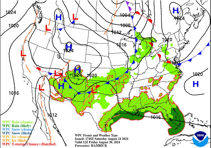

But if we get away from raw model data and look at more standard weather maps, it's obvious to everybody (who didn't sleep through science class) that we've got a cold front coming in here in the extended, Days 6-7. Given the time of year, about to get into the Fall season (technically . . . it usually takes a while for it to really feel like it), and how well the models have done so far this season . . . this is probably right. I'll give it the benefit of the doubt.


While our tropics are quiet in the Atlantic and expected to remain that way this coming week, out in the Pacific, we do have Hurricane Gilma, a major hurricane, which is expected to weaken to a remnant Low pressure system later in the coming week, about Wednesday. Before it has a chance to hit any land.


Then Tropical Storm Hone is expected to graze the Big Island of Hawaii tonight and tomorrow, maximum sustained winds of 51 knots, main threat being heavy rains/flash flooding issues but also some high winds possible. It is not expected to reach hurricane strength. And it's going to start moving a little more Southeast, so away from land, after tomorrow. The swells and rip currents could still affect all the islands of Hawaii, so dangerous conditions to try to surf in. Usually there's one or two idiots who do it anyway, but I dunno, maybe folks in Hawaii have better sense, with the nice climate and distance from the lunacy of so much of the rest of the country. My last couple years of high school, there was this guy from Hawaii whose name escapes me now, but he was just the coolest guy, like when everybody else was a total jerk, I was still glad to see him in class or walking down the hall. I'll put it this way, there's a good reason, when David Copperfield used to still tour and come through Alabama, he made people disappear and sent them to Hawaii. Nobody ever asked to just go to Mobile.

We'll see little to no rain for most of this forecast period, and then we'll see what we get, probably fairly isolated, light amounts Friday and Saturday. One silver lining for this week's heat is that the humidity doesn't look all that bad. If we get hot enough for a Heat Advisory, local NWS offices are saying it'll be from the air temperature alone, if it gets up to about 105 degrees. Some days, at least early in the week, the Heat Index may even be a degree or two below the air temperature through much of the day, because humidity levels will be relatively low. Any way you slice it though, it looks like a hot week with little hope of seeing any rain until next weekend.


No comments:
Post a Comment