

FORECAST:
Sunday (High 87, Low 61): Sunny. Low humidity levels.
Monday (High 90, Low 64): Mostly sunny. Seasonably hot.
Tuesday (High 92, Low 67): Partly to mostly sunny. An isolated shower or thunderstorm is possible.
EXTENDED OUTLOOK:
Wednesday (High 91, Low 70): Partly cloudy with a 40% chance of thunderstorms.
Thursday (High 92, Low 71): Partly cloudy with a 30% chance of showers/thunderstorms.
Friday (High 91, Low 71): Partly cloudy with a 40% chance of thunderstorms.
Saturday (High 92, Low 72): Partly cloudy with a 30% chance of showers/thunderstorms.
BEACH FORECAST:
Sunday (High 92, Low 80): Mostly sunny. An isolated shower or thunderstorm is possible.
Monday (High 92, Low 80): Mostly sunny. An isolated shower or thunderstorm is possible.
Tuesday (High 93, Low 82): Partly cloudy. Widely scattered showers and thunderstorms are possible.
Rest of Week (Highs in lower 90's, Lows in lower 80's): Partly cloudy with a 30% chance of widely scattered showers and thunderstorms.
PRONÓSTICO:
Domingo (Máxima 87, Mínima 61): Soleado. Bajos niveles de humedad.
Lunes (Máxima 90, Mínima 64): Mayormente soleado. Estacionalmente caliente.
Martes (Máxima 92, Mínima 67): Parcialmente a mayormente soleado. Es posible que se produzcan lluvias o tormentas aisladas.
PERSPECTIVA EXTENDIDA:
Miércoles (Máxima 91, Mínima 70): Parcialmente nublado con un 40 % de probabilidad de tormentas eléctricas.
Jueves (Máxima 92, Mínima 71): Parcialmente nublado con un 30% de probabilidad de lluvias/tormentas eléctricas.
Viernes (Máxima 91, Mínima 71): Parcialmente nublado con un 40 % de probabilidad de tormentas eléctricas.
Sábado (Máxima 92, Mínima 72): Parcialmente nublado con un 30% de probabilidad de lluvias/tormentas eléctricas.
PREVISIÓN DE LA PLAYA:
Domingo (Máxima 92, Mínima 80): Mayormente soleado. Es posible que se produzcan chubascos o tormentas aisladas.
Lunes (Máxima 92, Mínima 80): Mayormente soleado. Es posible que se produzcan chubascos o tormentas aisladas.
Martes (Máxima 93, Mínima 82): Parcialmente nublado. Es posible que se produzcan lluvias y tormentas eléctricas muy dispersas.
Resto de la Semana (Máximas en los 90 grados inferiores, Mínimas en los 80 grados inferiores): Parcialmente nublado con un 30 % de probabilidad de lluvias y tormentas eléctricas ampliamente dispersas.
NOTES:
Our drought conditions have improved a lot lately.
Next Saturday will be the 55th anniversary of Hurricane Camille.


At 4:30 AM skies are fair in Cullman with a temperature of 70 degrees. The dewpoint is 66 degrees, making the relative humidity 88%. Winds are from the North at 6 miles per hour. The pressure is 30.08 inches and steady.
It is fair and 72 in Jasper, fair and 69 in Haleyville, fair and 72 in Huntsville, and fair and 67 degrees in Nashville.
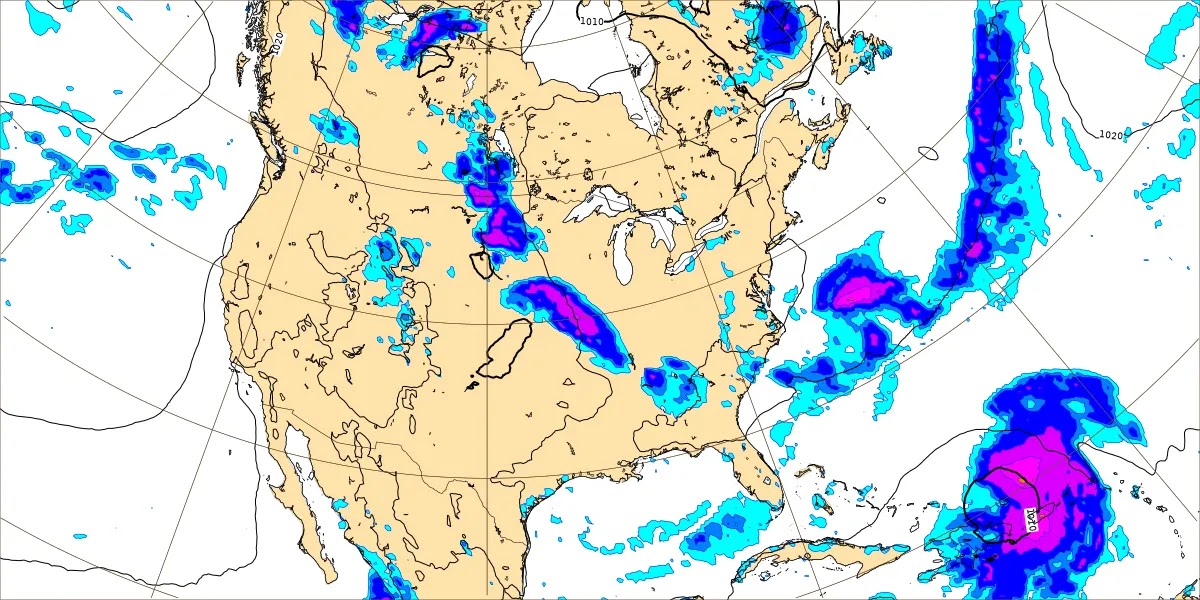
We have zonal flow from the West at the upper levels of the atmosphere, and at the surface we have high pressure moving in behind yesterday's front, which is now at about Atlanta or just East of there, stretching down into the Gulf waters.
We'll have a sunny day around here with a High of about 86 or 87 degrees, and the humidity will be a lot lower than we've felt in a while. We'll be breezy at times with winds from the North.


Sunday also looks sunny with quite a blast of drier air, starting the day at only about 60-63 degrees and then only warming to about the 86-88 degree range in the afternoon again.


The more typical summer moisture will start to return to the region on Monday. We'll still be mostly sunny with little or no rain around these parts, High near 90, Low in the lower 60's.


Basically the same for Tuesday with a High in the lower 90's, Low in the mid/upper 60's.


Then on Wednesday the setup with a high pressure center out West advancing in our direction and also Northwest upper-level wind flow ahead of that looks like a favorable setup for a possible mesoscale convective system, those storm clusters we get some summer days coming from Missouri or Arkansas, always have to watch and see if those remain at severe limits by the time they get here, can produce damaging winds or large hail sometimes.
The European model is a lot more sold on that potential than the American one, and at this time range, it tends to do well. So I'm going to put the thunderstorm chance on Wednesday at 40%. And I may adjust each day's rain chances by the time we're through here. But talking it out as I go.
Wednesday's High should be about 90 or so, Low near 70. Even if we do get an MCS, not everybody gets the rain (or hail/winds), plus it can come in during the late evening or even the night hours sometimes.


For Thursday any rain should be more isolated in nature so will trim chance back to 20% and forecast a High in the lower 90's, Low of 70 or so.


More scattered rain/thunderstorm chances for Friday. And after seeing this pattern, I think it needs modifying. Going to add a 20% chance of rain for Tuesday, increase rain chance to 40% for Wednesday, then 30% for Thursday, then here on Friday, back to 40%. Between Wednesday and Friday, the models hint at MCS potential, and I don't think there's a lot of skill in pinpointing which day we'll get one . . . if we do.
High Friday should be 90 or so, Low 70 or so.


Then forecasting a 30% chance of rain for Saturday, not much change in temperatures.


We do have a tropical wave in the Atlantic that will likely form into a tropical depression by the time it gets to the Lesser Antilles, which will probably be about midweek.
The remnants of Tropical Cyclone Debby are moving up across the Canadian border now out of New England. That messy system did produce a good bit of flooding and a few tornadoes.

Our rainfall totals should average between 0.5-1 inch. But with MCS potential, rainfall distribution is likely to be very uneven. Summer is not over yet.


No comments:
Post a Comment