

FORECAST:
Friday (High 91, Low 75): Mostly cloudy with showers and thunderstorms possible during the day and into the night. Heat Advisory in effect - Heat Index could get up to at least 105 degrees at times.
Saturday (High 90, Low 70): Partly to mostly sunny. Isolated showers and thunderstorms are possible.
Sunday (High 92, Low 66): Mostly sunny. An isolated shower or thunderstorm is possible.
Monday (High 91, Low 69): Partly cloudy. Widely scattered showers and thunderstorms are possible.
Tuesday (High 90, Low 70): Partly cloudy. Widely scattered showers and thunderstorms are possible.
EXTENDED OUTLOOK:
Wednesday (High 89, Low 71): Partly cloudy with a 30% chance of showers/thunderstorms.
Thursday (High 91, Low 70): Partly cloudy with a 20% chance of showers/thunderstorms.
Friday July 12 (High 90, Low 70): Partly cloudy with a 30% chance of showers/thunderstorms.
Saturday July 13 (High 92, Low 71): Partly cloudy with a 20% chance of showers/thunderstorms.
Sunday July 14 (High 91, Low 72): Partly cloudy with a 30% chance of showers/thunderstorms.
BEACH FORECAST:
Friday (High 89, Low 81): Mostly cloudy with numerous showers and thunderstorms possible. Dangerous rip currents expected.
Saturday (High 91, Low 80): Showers and thunderstorms likely. Dangerous rip currents expected.
Sunday (High 89, Low 79): Mostly cloudy with numerous showers and thunderstorms possible. Dangerous rip currents expected.
Next Week (Highs ~90, Lows ~80): Partly cloudy with a 40% chance of scattered showers and thunderstorms.
PRONÓSTICO:
Viernes (Máxima 91, Mínima 75): Mayormente nublado con posibles lluvias y tormentas eléctricas durante el día y la noche. Aviso de calor vigente: el índice de calor podría alcanzar al menos 105 grados en ocasiones.
Sábado (Máxima 90, Mínima 70): Parcialmente a mayormente soleado. Es posible que se produzcan lluvias y tormentas aisladas.
Domingo (Máxima 92, Mínima 66): Mayormente soleado. Es posible que se produzcan lluvias o tormentas aisladas.
Lunes (Máxima 91, Mínima 69): Parcialmente nublado. Es posible que se produzcan lluvias y tormentas eléctricas muy dispersas.
Martes (Máxima 90, Mínima 70): parcialmente nublado. Es posible que se produzcan lluvias y tormentas eléctricas muy dispersas.
PERSPECTIVA EXTENDIDA:
Miércoles (Máxima 89, Mínima 71): Parcialmente nublado con un 30 % de probabilidad de lluvias/tormentas eléctricas.
Jueves (Máxima 91, Mínima 70): Parcialmente nublado con un 20 % de probabilidad de lluvias/tormentas eléctricas.
Viernes 12 de Julio (Máxima 90, Mínima 70): Parcialmente nublado con un 30 % de probabilidad de lluvias/tormentas eléctricas.
Sábado 13 de Julio (Máxima 92, Mínima 71): Parcialmente nublado con un 20 % de probabilidad de lluvias/tormentas eléctricas.
Domingo 14 de Julio (Máxima 91, Mínima 72): Parcialmente nublado con un 30 % de probabilidad de lluvias/tormentas eléctricas.
PRONÓSTICO DE LA PLAYA:
Viernes (Máxima 89, Mínima 81): Mayormente nublado con numerosas lluvias y tormentas eléctricas posibles. Se esperan corrientes de resaca peligrosas.
Sábado (Máxima 91, Mínima 80): Probables lluvias y tormentas eléctricas. Se esperan corrientes de resaca peligrosas.
Domingo (Máxima 89, Mínima 79): Mayormente nublado con numerosas lluvias y tormentas eléctricas posibles. Se esperan corrientes de resaca peligrosas.
Próxima Semana (Máximas ~90, Mínimas ~80): Parcialmente nublado con un 40% de probabilidad de lluvias y tormentas eléctricas dispersas.
NOTE:
Hurricane Beryl is close enough to cause hazardous rip currents, so here is a reminder about how to stay safe at the beach at times like this.
DISCUSSION:


At 6 AM skies are mostly cloudy in Cullman. The temperature is 73 degrees. The dewpoint is also 73 degrees, making for a relative humidity of 100%. Winds are out of the South at 5 miles per hour. The pressure is 30.05 inches and steady. Looks like 72 was our morning Low.
It is overcast in Jasper, still some fog clearing up too with a temperature of 73 degrees. The dewpoint is also 73, so 100% relative humidity at this hour. Winds are calm. The pressure is 30.03 inches and steady. The visibility is down to 7 miles and got all the way down to 5 miles within the last hour. Low was 72 also here.
Skies are fair in Haleyville with a temperature of 74. (The Low was 73.) Got 100% humidity here too. Winds are South at 5 mph. The pressure is 30.05 inches/1015.8 millibars and rising slowly.
It is 76 degrees in Huntsville, which looks like the Low. Dewpoint is 74, making the relative humidity 94%. By the way I'm rounding these temperatures to the nearest degree, because people probably already think I'm a smart-aleck by still posting this blog at all. And we all know the old joke about why they don't send donkeys to college. (I'm a dropout.) So for now I usually don't bother to say it's 75.9 degrees. Winds are out of the Southeast at 6 mph. The pressure is 30.01 inches/1015.2 millibars and holding steady for the moment.
It's partly cloudy and 78 degrees in Nashville. The dewpoint is 71, making the relative humidity 79%. Winds are South at 5 mph. The pressure is 29.98 inches/1014.4 millibars and actually falling slowly at the moment. This current temperature of 78 looks to be the morning Low. And that means . . . muggggggyyyyyyy . . .
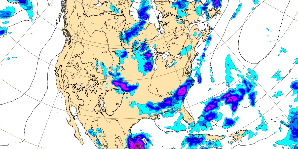
We've got a cold front stretching through mainly the Mid-South and the Ohio River Valley. It may bring some organized severe thunderstorms today mainly in Southern Missouri, Northern Arkansas, back into Eastern Oklahoma. Seems like there was another spot in the Midwest that might have to watch things. Let's take a look at that SPC outlook map after all.

There is that other pocket up in Iowa, Wisconsin, and Minnesota where they need to watch things. A lot of places have that marginal risk level for an isolated severe thunderstorm or two, and that actually includes around Nashville. This is summertime, so I wouldn't get worked up about it or anything. But this cold front could give the heat and humidity something to work with to produce a stronger thunderstorm or two in Central and Northern Tennessee up into Kentucky and the other places you see outlined in green. But for the most part, just those folks in the yellow Slight Risk (Level 2/5) are the spots people have to watch today for any organized severe thunderstorms. If anything happens in Tennessee, it is expected to be unorganized and isolated today. Probably anybody that sees a regular thunderstorm or shower will count themselves lucky. I saw where a broadcast meteorologist up there said the other day that she had reached her limit with all this heat. We sure didn't ease into it gradually this year.
Remember that around here, we are under a Heat Advisory today because the combination of heat and humidity could produce Heat Index values in the 105-109 degree range. Just a reminder that this isn't just what the temperature feels like. People can get heat exhaustion, get sick, or in the worst cases, get actual heatstroke, just as if it was really at least 105 degrees on days like this. I wouldn't leave anybody in a hot car even five minutes if you're out buying snacks or fireworks. It's really never a good idea to do that. As John Gordon from NWS Louisville came up with the slogan: Beat the heat, check the back seat!
Around here, today looks like a mix of sun and clouds, High near 93-94 although again, it may feel 10 degrees hotter than that because of the humidity at times. The chance of rain is about 1-in-3 for any one spot. Showers and thunderstorms should stay pretty widely scattered around here.
Just an aside about the holiday, when we were kids, our dad liked to talk really southern, but our mom liked to make fun of it more if somebody sounded too redneck for her tastes. They had a difference of opinion about a gospel group called the McKameys. And it flip-flopped actually. After my ole' man decided that nobody should use musical instruments in gospel music, my mother decided she liked that group even though she'd originally deemed them a bunch of hicks.
So anyway it was our Papaw on my mom's side who usually celebrated this holiday the most. He made it really fun. When I think shooting fireworks, there is only one person my mind goes too.
And at the moment, I feel like my siblings and I could be terrible kids sometimes. Because one night we kept getting close to . . . well I can't remember what was burning now or if it was some kind of torch lighter. But now that I'm old enough I've watched some kids in my family do some crazy stuff, like lay down in the road . . . even if no cars are around, that's really alarming. And you have to make them stop crazy stuff like that. So I see where he was coming from. We kept getting close to something that was burning. He knew how to do fireworks safely out in the country. But we were wearing on his nerves because he kept warning us back and we kept getting too close to whatever was burning.
And he very emphatically said: "STAY AWAY . . . from the FIRE!"
Except it sounded more like, "STAY AWAY . . . from the FARR!"
So one of my brothers and I started laughing and imitating it while he got the next fireworks ready. "FAR! FARRR! Stay away from the FAR!!"
And he turned back and noticed it.
And just wearily growled, "FIRE . . ."
Poor guy. Putting up with us.
I guess if you can't watch any fireworks tonight and get really bored, you could go back and read the Declaration of Independence. I just skimmed it because I find it depressing to read the whole thing. People are actually out there now trying to rewrite history and say that Joseph McCarthy was such a great guy in the 1950's. So I get depressed at how far away things are from those ideals even with people feeling so patriotic. But if I only skim, it's not depressing, because it says things like all of us were endowed by our Creator with rights to life, liberty, and the pursuit of happiness. And that just works so much better than trying to point the finger and call everybody a Communist or a Nazi or something. Or maybe that's just me.


It is now looking like this next frontal boundary is going to significantly increase our rain chances tomorrow.

The WPC graphics are easier to read than the raw model output from the GFS. So here we are with the front getting to about the Shoals by 7 PM tomorrow evening. Expecting a High near 90 and Low in the lower to mid-70's so about 74-75. And I'm going to cap the chance of rain at 50%. But a lot of us will see showers or a thunderstorm tomorrow. And that's why the heat advisory is allowed to expire tonight.
Actually I double-checked this and it looks like the Heat Advisory has been extended through tomorrow after all. So much for the half-baked optimism in early July. We all know you have to take it easy in this kind of heat and just see how it is from day to day regardless of the specific forecast.


The GFS shows us in the clear on Saturday. And it's probably not going to work that way. I could show the ECMWF for comparison where it's got a blobby mess of rain hanging around the Southeast. But that seems like ridiculous overkill for July. I may move away from using so much raw model data this time of year. It isn't always terribly reliable anyway. It's more of a habit, like it's standard to check the GFS model before looking at other stuff and second-guessing it.

The frontal boundary that we'll be on the "cool" side of (don't throw any tomatoes, but I know that sounds like a joke) should be parked down around Birmingham or just South of there. And we'll likely see a High near 90, Low closer to 70 instead of mid-70's and still a chance of rain but minimal, 20% chance, so about 1-in-5 shot of seeing a shower or thunderstorm.


Then that front is going to do what most "cold fronts" do around here in the summer, stall out and then wash out.
But I decided to show the model output for Sunday at 1 PM because the GFS shows a landfall for Hurricane Beryl in South Texas.
The ECMWF has a slightly more southerly track that would make it more of an issue for Mexico.
Definitely been an interesting storm. We'll look at tropics specifically after running through the next 7-10 days of local weather.
It does look like we'll briefly have a shot of drier air on Sunday with more sun than clouds, the morning Low only in the mid-60's, the High still making it to 90 or so. And I started to take out rain chances for Sunday but am going to leave in the standard minimal 20% chance you see just about any summer day. It is too close a call with this front stalling out.


Monday looks to continue that unsettled summer pattern with a stalled front sort of fizzling over the region but with mesoscale boundaries remaining to kick off showers and thunderstorms that seem random in the region. Will bring rain chance back to 30% here and forecast a High near 90 or lower 90's, the Low close to 70 or at least upper 60's again. Sunday is our driest day any time soon. Then the humidity starts to ramp back up Sunday night into Monday.


Then Tuesday looks like a mix of sun and clouds, about a 30% chance of rain again, High near 90, Low near 70. So we get minor variations from day to day but the weather doesn't change all that drastically once we get in this summer pattern.


And it's tough to know what model guidance to believe for Wednesday, the ECMWF is a lot drier than this from the GFS. So going with a persistence forecast of 30% chance of rain and a High in upper 80's, Low near 70.


By Thursday I definitely fell all right about decreasing the rain chance back to 20%. The ECMWF has a much drier look even though I'm only showing the GFS. And it fits the local climatology to trim rain chances back. High should be near 90, Low near 70.


Then next weekend, looks like Highs in the lower 90's, Lows in the lower 70's, rain chances staying about 20-30%.


That tropical wave behind Hurricane Beryl is going to struggle to develop into anything even though it is taking a similar track. The upwelling from this hurricane has made the atmosphere and the waters a lot less favorable. The only time I'd watch this system for any significant weather is by the time it gets into the Bay of Campeche roughly a week from now. Depends on what the Gulf waters are like then and the exact track. But at this point, looks like its chances of becoming a tropical cyclone are very low.


Hurricane Beryl has started to encounter some westerly/northwesterly wind shear and has begun to weaken. But winds are still sustained at 120 mph as it moves through the Cayman Islands today. It affected the island of Jamaica yesterday. The stop for tomorrow is the Yucatan Peninsula where Hurricane Warnings are in effect for the East side, Tropical Storm Warnings on the Northern/Western side. The tropical cyclone is expected to weaken to a tropical storm as it passes over that land. And then will move into the Bay of Campeche where it should be able to strengthen back to a hurricane (probably just a minimal hurricane, but any hurricane is worth respecting IMHO) before it makes its final landfall in South Texas or perhaps in Northeastern Mexico, should be in that general area early next week.
The only impacts close to here are that the beaches around places like Mobile will have a risk for dangerous rip currents while that thing is close enough to affect them.

The heavy rains will of course be along or near the track of the hurricane. Folks in Texas could use some rain, and sometimes the only way you get it this time of year is a tropical system. Around here, our rainfall totals will average about an inch. Of course in July the distribution can be pretty uneven.
And we'll be swingin' on the 4th of July . . .
Fa mi fa . . .
(slap)
Just don't sing it.


No comments:
Post a Comment