Thursday, October 19, 2023

A Little Rain Today and Tonight, Otherwise Dry and Mild Pattern

(Forecast)

Today (High 70): Partly cloudy with scattered showers possible during the day. Showers are likely at night. 

Friday (High 72, Low 53): Clearing and becoming sunny through the morning and rest of the day. Cool and breezy.

Saturday (High 77, Low 46): Sunny. Mild and breezy.

Sunday (High 69, Low 47): Mostly sunny. Cool.

(Extended Outlook)

Monday (High 72, Low 45): Sunny. 

Tuesday (High 73, Low 50): Mostly sunny.

Wednesday (High 73, Low 52): Mostly sunny.

Thursday (High 74, Low 55): Partly cloudy.

(Reading Tea Leaves)

Friday October 27th (High 75, Low 58): Partly cloudy with a 20% chance of showers.

Saturday October 28th (High 74, Low 60): Partly cloudy with a 20% chance of showers.

Sunday October 29th (High 73, Low 59): Partly cloudy with a 20% chance of showers. 

(Pronóstico)

Hoy (Máxima 70): Parcialmente nublado con posibles lluvias dispersas durante el día. Es probable que haya lluvias por la noche.

Viernes (Máxima 72, Mínima 53): Despejándose y volviéndose soleado durante la mañana y el resto del día. Fresco y ventoso.

Sábado (Máxima 77, Mínima 46): Soleado. Suave y ventoso.

Domingo (Máxima 69, Mínima 47): Mayormente soleado. Fresco.

(Perspectiva Extendida)

Lunes (Máxima 72, Mínima 45): Soleado.

Martes (Máxima 73, Mínima 50): Mayormente soleado.

Miércoles (Máxima 73, Mínima 52): Mayormente soleado.

Jueves (Máxima 74, Mínima 55): Parcialmente nublado.

(Leyendo Hojas de Té)

Viernes 27 de Octubre (Máxima 75, Mínima 58): Parcialmente nublado con un 20% de probabilidad de lluvias.

Sábado 28 de Octubre (Máxima 74, Mínima 60): Parcialmente nublado con un 20% de probabilidad de lluvias.

Domingo 29 de Octubre (Máxima 73, Mínima 59): Parcialmente nublado con un 20% de probabilidad de lluvias.

(Notes)

The National Weather Service in Birmingham is holding SKYWARN classes since we are almost into November. And the National Weather Service in Nashville is holding Weather101 classes with a broader range of topics. Hats off to both offices for doing that. 

While I would encourage anyone to take a class there (especially since they are free), I also wrote up some reminders about severe weather safety, that hopefully you may find helpful if you need to review your severe weather safety plan before we get any storms like we often do in November. 

(Discussion)


At 11:15 AM skies are sunny in Cullman with a temperature of 64 degrees. The dewpoint-temperature is 54 degrees, making the relative humidity 68%. Winds are from the Southwest at 8 miles per hour, with higher gusts up to 15 mph. The pressure is 30.08 inches and fairly steady. The Low this morning was 48. 

Light rain is falling in Jasper, with a temperature of 63 degrees. The dewpoint is 59, making the relative humidity 88%. Winds are calm right now and have been light and variable through the morning. Pressure is 30.07 inches and steady. Visibility is currently down to 9 miles. The Low this morning was 41. 

Haleyville is mostly sunny, a few clouds around, with a temperature of 61 degrees. The dewpoint is 53, making the relative humidity 75%. Winds are from the Southwest at 7 miles per hour. Barometric pressure is 30.09 inches or 1017.6 millibars and steady. This morning's Low was 49. 

Fort Payne is sunny with a Southwest breeze and 68 degrees. Gadsden is sunny and 68. Decatur is mostly sunny and 68, a bit of a southerly breeze there. Huntsville is mostly cloudy and 68. Muscle Shoals is also mostly cloudy and 68, more of a breeze there, winds from the South. 

Elsewhere around the region, Birmingham is partly cloudy and 69 degrees. Atlanta is partly cloudy and 66. Nashville is mostly cloudy, breezy, and 65. Memphis is mostly cloudy, quite breezy, and 70 degrees. Tuscaloosa has clear skies and 69 degrees. And Tupelo is overcast and 63. 


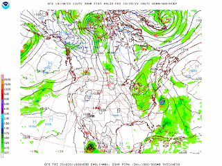
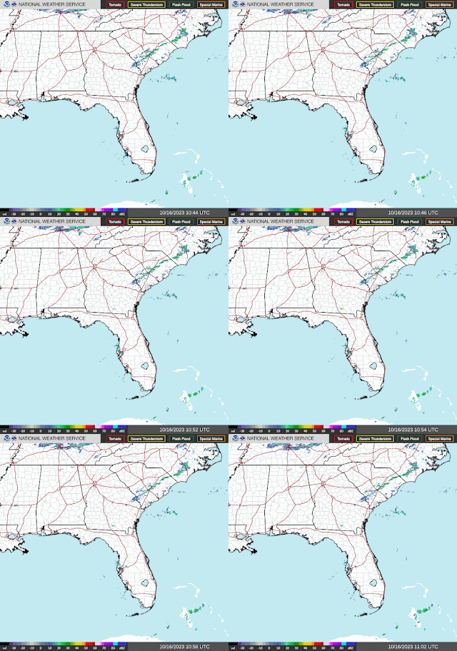
So that cold front and trough is approaching our region now from back in Arkansas and Missouri. We'll probably only get up to about 70 degrees today with scattered showers. Some of us are already seeing some of those showers. But most of the rain will be overnight tonight, when rain will likely be widespread over the region. It is still not looking like a big rain. 


Most places will probably see less than a tenth of an inch, though some places in Tennessee might see closer to a quarter-inch. These are still low amounts as we remain in one of our driest times of the year. 


Skies should quickly become sunny behind the front tomorrow, could still see an isolated shower or at least some clouds lingering in the early morning, but then rapid clearing. Winds will shift around to the Northwest behind the front, and it will stay quite breezy, with gusts up to 20 miles per hour or greater at many times throughout the day. The actual temperature should only get up to about 72-73, Low around 53 tonight, but with that much wind, it'll feel cooler for a lot of us. 


And it will stay breezy on Saturday under sunny skies, the High making it up into the upper 70's but the Low down in the mid-40's with good radiational cooling. 


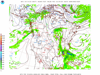
The reason temperatures won't cool much tomorrow and Saturday is that this front is moving more from West to East without so much of a Southward component to its motion right away. But notice as we get into Sunday, high pressure starts to build in to our North mainly, but enough to bring us some cooler air. 


That is because we have a reinforcing dry cold front set to move through the region Saturday night into Sunday. So Sunday should feature more sunshine than clouds, with a High near 70, or at least upper 60's, and a Low in the upper 40's. 


Then as we get into the extended period, the new workweek, Monday the high pressure should move to the East coast. We're looking at sunny skies around here, High in lower 70's, Low in mid-40's.


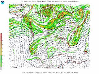
On Tuesday a low pressure system will bring some rain to places like Texas and the Plains, but around here, we'll remain under enough ridging to see mostly sunshine and another day of Highs in the lower 70's. The Low will probably rebound to near 50, enough moisture return for that, but not enough to worry about any rain. And we could use some rain right now, are in drought conditions. 


And that system is going to move slowly, ridging staying in place for us again on Wednesday. Might see an increase in clouds, but basically another dry day, or rain chances too low to even worry about (less than 20%), High in lower 70's, Low of about 50 or so. 


The ridge may finally start to break down by next Thursday. Might introduce a 20% rain chance here, but it is a toss-up. Expecting a High in lower-to-mid-70's and a Low in lower-to-mid-50's.


Then looking at next Friday, in the land of tea leaves now, reading tea leaves almost, definitely seems reasonable to bring back a 20% chance of rain. Lows will probably edge into upper 50's by this time. 


But even on Saturday as the front comes through, going to keep the rain chance low at 20%. Doesn't look like a ton of moisture available, if we can trust these latest model runs. And when you get this far out in an outlook, that's hard to pin down, you're looking more at general trends. Probably see a High more toward the lower 70's again and a Low approaching 60. 


And it looks like this front may try to stall out, so Sunday, again a 20% chance of rain, and similar temperatures to Saturday. 

And I'm only going to do a 10-Day-Outlook once or twice a week at the most. They are notoriously unreliable in dynamic weather patterns. But this pattern is kind of quiet, like in a typical summer. We actually had a pretty active summer this year, and have only had the quieter patterns as we got into Fall. When the weather is active, 7 Days is about as far ahead as you can expect to have any accuracy. 

Things are really looking dry, even next weekend's rain chances minimal, but of course, November tends to bring us many chances for rain and storms. So if you're wanting rain, wait another couple weeks or so, the drought can't last forever, and this is just part of the ebb and flow of our local climatology.


Tropical Storm Tammy is expected to affect the Lesser Antilles tomorrow, where a Tropical Storm Warning is in effect. Elsewhere in the Leeward Islands, tropical storm or even hurricane conditions will be possible. There are some hurricane watches on the board for this storm too. Over the weekend, heavy rainfall from this tropical storm will spread into the British and U.S. Virgin Islands as well as the Island of Puerto Rico. There may be isolated flooding issues as well as mudslides. 


There is more uncertainty with Hurricane Norma, which right now is a powerful hurricane with winds sustained at 115 knots, or 130 miles per hour. If this were to move faster than expected, then it could actually hit Western Mexico while it is still stronger. So that's something to keep in mind if you know anybody down that way. But the most likely scenario is that the southerly shear is going to increase in the storm over the next couple days, and then the Southern tip of Baja California can expect hurricane conditions this weekend. Depending on whether it slows down and changes direction as some models are showing, or whether it moves more quickly toward the Mexican mainland, that could make a lot of difference in how much hurricane impacts there are. Regardless, the heavy rains should start to impact California Baja Sur late tomorrow (Friday), and those heavy rains should continue to spread through the path of the hurricane through Sunday, with a risk for at least isolated instances of flooding and mudslides. You have to remember that the terrain here is mountainous and that they deal with different hazards than we do on the coasts of places like Alabama and Florida. 

All right, wishing you a good weekend, thanks for reading. 

Monday, October 16, 2023

Fall Severe Weather Safety

North Alabama and Southern Middle Tennessee mainly have severe weather season during the Spring months of March, April, and May. 

But we also have a secondary peak in the cool season, usually during the month of November. This is when we are trying to change to Winter. Usually the cold fronts that hit this time of year only bring some rain and gusty winds. But if the air gets warm and muggy enough, sometimes that same wind energy can produce powerful thunderstorms and even tornadoes. 


I recently saw where a storm chaser was forced to shelter in one of the worst possible ways in a school. According to this thread, he tried to get himself and others to a bathroom, a much safer place in the building to shelter, and the staff wouldn't let him. 

So there is a lot of work left to do reminding people of basic safety during tornadoes and severe thunderstorms. 

Let's start with definitions. 

A severe thunderstorm is a thunderstorm that produces winds of at least 50 knots (so 58 miles per hour) or hail at least an inch in diameter (about the size of a quarter). These thunderstorms are thought to be an immediate threat to life and property. 

For the technical definition of a tornado and the official government guidelines, check out this page. But if you've lived around here any length of time, you know what a tornado is. It does have to be in contact with the ground to be a tornado. If it's up in the air, it is still a funnel cloud. Lots of times around here, you can't see the funnel extending all the way to the ground, but might only see debris coming up from the ground, or dirt being picked up. Unfortunately a lot of our tornadoes, you can't see at all. We have too many hills and trees restricting visibility. And a lot of our tornadoes come from "high-precipitation supercells", which basically means they are wrapped in rain. So if you wait to see or hear it, it'll be too late to get to a safe place by the time you do.

That's why it's extra important to heed warnings in this part of the world, especially at night, but really any time. 

The best way to do that is with a NOAA Weather Radio, one with battery backup in case of a power failure. You can get one online or at most stores for about $30. I've had the same one for well over ten years. So the investment is definitely worthwhile. As an alternative or extra layer of awareness, some people might prefer a service like WeatherCall or similar cell phone app. WeatherCall has been around a long time, and I consider it to be reliable. 

Don't rely on outdoor warning sirens, as they play a very limited role in letting people know something is going on. If you don't want to use a weather radio or good phone service, you can still enable Wireless Emergency Alerts on your cell phone and/or stay tuned to a reliable radio station that will cut in for severe weather. 

A Tornado Watch means that conditions are favorable for the development of severe thunderstorms, that are capable of producing tornadoes, in and close to the watch area. People in those areas need to stay alert for rapidly changing weather conditions, and listen for later statements, or possible warnings. 

A Tornado Warning means that a tornado is believed to be developing or already occurring, based on radar data and/or a reliable report, in the warned area. Warnings are usually only issued for a small part of a county at a time now, drawn as a warning polygon on the map. People within that warning polygon should shelter first and gather more information later. 

A Severe Thunderstorm Watch means that conditions are favorable for severe thunderstorms to develop, but without tornadoes being likely, more of a threat for damaging straight-line winds and/or large hail. A Severe Thunderstorm Warning means that the storm is believed to be producing damaging winds or hail. Which can still be dangerous. 

And if the environment already favors tornadoes, then a tornado could develop before a tornado warning officially comes out. That has happened many times over the years, to the point that if someone is under a tornado watch and a severe thunderstorm warning at the same time, I'd rather know they're already going to a safe place, instead of waiting to see if a tornado warning is required later. 

Meteorology has come a long way, but even with dual-polarization radar, the science is not perfect. And a lot of times, I think it's as important for people to use their common sense and trust their instincts as to stay tuned to a good source of weather information. In some of the tornado outbreaks in the distant past, when most weather information was by word-of-mouth, people might camp out at each other's storm cellars for an hour or more, watching the sky and noticing how the air was changing. While they listened to the radio too for any updates. 

Most people these days do not have a storm shelter or basement. Which are the best protection against severe thunderstorms or tornadoes. So we do the best we can sheltering on the ground floor. Nine times out of ten, people will survive by sheltering properly on the ground floor, without getting underground. 

Now you do have to get out of a mobile home if a tornado is approaching. If you live in a trailer or another very weak structure, you might want to look into public storm shelters. Or if you have a friend of family member with a site-built home, properly anchored to the ground, then you might find that friendlier, to be able to bring pets and be around people you can share some good times with. Most public shelters do not allow pets, but the people usually are friendly. If you live in Tennessee in a mobile home, then I definitely advise you to set something up with a friend or family member ahead of time, to stay in a sturdy house during a severe weather event. Because there are not many shelters in Tennessee compared to in Alabama. Probably because they only got grazed by the 2011 outbreak while Alabama got slammed. 

If you want to call your county's Emergency Management Agency to ask about public shelters, then please try to do it before a severe weather event gets underway, at a time the weather is calm, and they are not busy. Here is the directory for Alabama and for Tennessee

And it's important to familiarize yourself with where you are on a map, what county you live in, and what counties border you. That is very easy to look up now with the internet. 

Assuming you have a sturdy house or other strong building to shelter in (not a small point, lots of people, even people with decent jobs, cannot afford to buy a house, so many manufactured homes in this part of the world), the guidelines are:

* Stay away from windows, and don't waste time opening them like people did in the old days. 

* Get to the lowest floor, where any winds will be lowest.

* Get into a small room, such as a bathroom, closet, or hallway - where the walls are less likely to collapse under the winds, even tornado winds. 

* Make that safe space as near the center of the building as you can - as many walls between you and the storm outside as possible. 

* If you have time, shield your body in some way from falling or flying debris. Especially protect your head. A lot of deaths from tornadoes come from head and neck injuries. 

And if you do that, you are very likely to survive, and actually are pretty likely to survive without any serious injury. 

If you do have the option to get into an actual storm shelter before a tornado hits, then of course you should use that. But the odds are in your favor sheltering above-ground in a well-built house. The last place you ever want to shelter is in a mobile home. Usually you'll have a better chance of surviving lying in a low spot outside, such as an unflooded culvert or ditch, than if you stayed in a mobile home. 

Another place you don't want to get stuck, if you can do anything about it, is in a car. There is an old myth about getting up under a bridge, and there are some people (especially storm chasers) now who say they'd maybe take their chances staying inside a car. But my personal opinion is that if a tornado is coming at you, your chances are much better if you abandon the vehicle and lie flat in the lowest spot you can find, covering your head the best you can. In a cold-season outbreak in 2008, I remember a story of a truck driver who survived by abandoning his truck and hanging onto a tree while an E/F-4 tornado sideswiped the house he had hoped to be able to shelter in. He pulled over and tried to get the people up to let him in the house, but he had waited until the tornado was too close. His truck was thrown and severely damaged some distance away, and even though all he did was hold on to a tree as a last resort, split-second decision, he survived with only minor injuries. And I remember another story of a couple who survived the 2011 E/F-5 that ravaged Hackleburg and Phil Campbell by leaving a trailer and getting into a ditch before the storm hit. Of course this is a last-resort situation, but if you're ever in that situation, I would favor sheltering down at ground level instead of staying in a vehicle. I guess it is a personal judgement call, because some meteorologists and storm chasers have told me they would stay in the vehicle and hope for the best. But in most circumstances, with a tornado coming, I would strongly favor leaving the vehicle, if I was down to a last resort choice like that. The only time I think I would stay in the vehicle is if there was flooding going on. 

Really the best thing to do, and here I have to salute Tim Troutman from the National Weather Service, is to work out at least three or four places in your mind where you could take shelter, along any route you drive regularly. That can be as simple as a gas station or small restaurant where you could get inside, away from glass. Planning ahead can help you out a lot. 

Some extra precautions you could take in a site-built house are to wear a safety helmet, like you would for riding a bike or playing football. If you don't have that, then a pillow or some blankets may offer good-enough protection. Or if you remember tornado drills in school, sometimes they'd get you to put a book on your head. Sometimes people's lives have been saved by simple measures to protect the body from falling or flying debris, especially if it stops someone from getting a head injury. 

Another thing to consider is that a lot of our tornadoes happen at night, and if you can remember to, try to have shoes on when you go to your shelter, and your strongest pair of shoes or boots. Because after a tornado, there will likely be broken glass and other debris. If you've been in a car wreck before, you know how you go into a weird state of shock, where things don't quite feel real? People do that after a tornado too. And they can step on sharp objects while only wearing socks or a pair of slippers and get cut up. So it may seem like a small point, but if you can, try to wear your strongest pair of shoes or boots with harder soles ahead of time, since that can reduce a risk of injury. And if you have supplies in your house like an air horn or whistle, can take that to your safe place so that if you are trapped by debris after a tornado, you can make a sound that lets emergency workers know where to look for you. Sometimes they do have to dig people out from under some rubble. Not trying to make this extra-scary, but it does happen sometimes, and it's best to prepare for that if you can. A flashlight can also come in handy, even if you do not take a direct hit from a tornado, since the power might go out. If you are someone who really likes to prepare bigtime, you might keep things like a first-aid kits and some snacks or bottled water in your shelter room, and make sure anybody who takes medicine every day has their medicines with them. In my case, sometimes I take a can of sardines to the closet, which makes a nice reward for my cat staying in a confined space, and also a nice snack for me. I've got one of those wind-up flashlights with a radio and weather band on it. 

Hopefully you never need a lot of these extra precautions. The basic idea is to be in a sturdy house or other strong building, and to get as low down as you can, and as near the center as you can, staying well away from any windows and shielding your body, especially your head. 

So what was wrong with that school that Jake, the storm chaser, had to shelter in? The school officials were putting people in an open area with what appeared to be weak roofing. Looks like they were on the ground floor, so they got that part right. And they had the right general idea with getting people to crouch down and cover their heads. But they missed the obvious, that a wide, open room like that is easily damaged or destroyed by a tornado, and that you never want to put people close to windows during a tornado. Sometimes when there is no other damage to a house in a quick, relatively weak tornado, it'll still break one or two of the windows out. And I can remember cases where people were injured or killed simply because they were beside a window that blew out. So these basic, simple things can make a huge difference when it comes to safety. The storm chaser had the right idea in wanting to get everyone into a nearby bathroom without any windows in it. Fortunately the tornado did not hit the school building. Nobody was hurt. 

But sometimes the tornado does hit the building where people are. And when that happens, we want them in the safest place they can be. Most people are sheltering in a house or at a friend or family member's house. And in there, all of us who care about severe weather safety hope they are in the lowest, most central part of that house, body shielded from any debris, the best that is within their means. 

So I hope this write-up helps you develop your own severe weather safety plan. Usually if you just keep the basic ideas in mind and are aware that a severe thunderstorm or tornado is coming, then you'll be fine. 

Programming a weather radio is not as daunting as it first appears. Here is an excellent video from Taylor Sarallo in case any of you get a headache about it like I did the first time I bought a digital weather radio. Which was different from the really old one my great-grandmother had. I like the Midland models, but shop around if you like, and find whichever one suits you best. There are some where you can program out certain alerts you don't want to get. 

About the WEA on cell phones, they usually don't alert you for Severe Thunderstorm Warnings unless the storm looks particularly dangerous. Any time you hear or see the term Particularly Dangerous Situation attached to a watch or a warning, that is what it sounds like. They don't have specific criteria for that, just a judgement call a forecaster can make to let people know that the weather is extra-dangerous. In the hope that people who weren't paying attention before will start paying attention and take the situation seriously. 

The time to prepare for severe weather is a time like right now, when the weather is still calm. That way you can have peace of mind when the weather gets threatening. You already have your plans in place. One thing I've heard a lot lately is, don't let the fact that you can't make a perfect plan, get in the way of making a plan that is good-enough. Most tornadoes are survivable even if your access to shelter is less than ideal. And above I gave two examples of people surviving some of the rare, really bad tornadoes by abandoning a mobile home or vehicle to simply take shelter low to the ground outside. The odds are really in your favor. And there is plenty you can do to stack them more in your favor if you plan ahead. 

In case anyone has trouble finding good local maps, I'd check out www.geology.com. That's one of those bits of knowledge we've lost with technological advances, where a lot of people no longer bother to find out where they live on a map. And it is quick and easy to learn. 

Here is a link to tornado safety info in Spanish, and also the Spanish version of preparedness in general. That was one thing that everybody learned from the April 2011 outbreak, that we could do a better job reaching Hispanics in our region with weather safety information. Hopefully somebody finds this useful. May tweak it later depending on how active a Fall severe weather season we have this year. 

Sunshine and Cool Temperatures Through Mid-Week

Today (High 60): Mostly sunny. Cool and breezy.

Tuesday (High 67, Low 40): Sunny. Cool.

Wednesday (High 70, Low 42): Sunny. Cool.

Thursday (High 71, Low 46): Partly to mostly sunny with an isolated shower possible during the day. Rain showers are likely at night.

Friday (High 69, Low 51): Mostly cloudy with a 40% chance of showers.

Saturday (High 67, Low 45): Sunny.

Sunday (High 69, Low 42): Sunny.

Monday (High 72, Low 44): Sunny.

Hoy (Máxima 60): Mayormente soleado. Fresco y ventoso.

Martes (Máxima 67, Mínima 40): Soleado. Fresco.

Miércoles (Máxima 70, Mínima 42): Soleado. Fresco.

Jueves (Máxima 71, Mínima 46): Parcialmente a mayormente soleado con posible lluvia aislada durante el día. Es probable que haya lluvias por la noche.

Viernes (Máxima 69, Mínima 51): Mayormente nublado con un 40% de probabilidad de lluvias.

Sábado (Máxima 67, Mínima 45): Soleado.

Domingo (Máxima 69, Mínima 42): Soleado.

Lunes (Máxima 72, Mínima 44): Soleado.

As we approach daybreak this morning, skies are overcast in Cullman. The temperature is 45 degrees, and it looks like 43 was our Low for this morning. The dewpoint is also 45 degrees, making the relative humidity 100%. Winds are calm. The pressure is 30.01 inches and steady.

Skies are clear in Jasper with a temperature of 41 degrees, also 100% humidity there. Winds are from the West at 5 miles per hour. The pressure is 30.04 inches and rising slowly. 

We also have clear skies in Haleyville, temperature of 45, humidity 100%. Winds are Northwest at 6 mph. The pressure is 30.05 inches or 1016.8 millibars and rising slowly.


We have cold air advecting into the region today behind that front this weekend. Some very light showers are moving southward through Middle Tennessee. Overall today will be dry around here, with more sun than clouds, and a High near 60 degrees. Winds will be from North/Northwest and could still gust up to 15 or 20 miles per hour. 

Strong high pressure will build over the region tomorrow, and we'll start the day around 40 degrees. Winds should be from the Northwest but much calmer, and with plenty of sunshine, we should warm up to the upper 60's, about 66-67.

Then on Wednesday, the high pressure shifts more to the Mid-Atlantic coast. But our skies will stay sunny, and we'll warm to about 70 degrees again in the afternoon, after starting the day in the lower 40's.

Then as we get into the extended period, a trough will be swinging our way Thursday. It will probably be Thursday night before we see a chance for any widespread rain around here, the way the models are making the timing of this trough/front look right now. Might see something isolated during the day, but more likely just an increase in clouds Thursday, with a High near 70 again, Low creeping back up toward the upper 40's.

Then for Friday, looks like a 40% chance of rain. Mostly cloudy skies. High should be in upper 60's, Low in lower 50's. As the front moves through.

Looks like rapid clearing behind the front on Saturday, sunny skies returning, but with similar High temperatures, upper 60's, but with the Low dropping back down to mid-40's.

Then similar weather for Sunday except the Low should make it down into lower 40's with even drier air. And then on Monday similar temperatures except abundant sunshine may warm the High up a few degrees. Since my posts can be sporadic lately, going ahead and making it an 8-day outlook if you count today in it. In this pattern, I think you can do that and maintain accuracy.


We do have a disturbance in the Central Tropical Atlantic that is producing disorganized showers for now, and is not likely to develop over the next couple days, but later this week, is likely to become a tropical depression as it continues to move West/Northwest. 


Most of us will probably see a quarter-inch or less of total rainfall for this forecast period. As you get up into the Cumberland Plateau, there is a better chance of seeing up to a half-inch. 

This week is Severe Weather Awareness Week. We are almost to November. The National Weather Service in Birmingham is holding SKYWARN classes to get ready for that. And today NWS Nashville starts their Weather101 classes back up, first class this morning being on The Basics

Saturday, October 14, 2023

Plenty of Sunshine, More Cool Temperatures on the Way

(Forecast)

Today (High 70): Fog, clouds hanging around in the morning with an isolated shower possible in the morning. Then becoming mostly sunny and breezy. 

Sunday (High 59, Low 50): Partly to mostly sunny. Cool and breezy.

Monday (High 60, Low 43): Mostly sunny. Cool and still a little breezy.

Tuesday (High 63, Low 38): Sunny. Cool.

(Extended Outlook)

Wednesday (High 68, Low 40): Sunny. 

Thursday (High 70, Low 44): Partly to mostly sunny with a 20% chance of showers.

Friday (High 69, Low 49): Mostly cloudy with a 40% chance of showers.

Saturday (High 67, Low 51): Partly to mostly sunny with a 30% chance of showers. 

(Pronóstico)

Hoy (Máxima 70): Niebla, nubes flotando por la mañana con posible lluvia aislada por la mañana. Luego se vuelve mayormente soleado y ventoso.

Domingo (Máxima 59, Mínima 50): Parcialmente a mayormente soleado. Fresco y ventoso.

Lunes (Máxima 60, Mínima 43): Mayormente soleado. Fresco y todavía un poco ventoso.

Martes (Máxima 63, Mínima 38): Soleado. Fresco.

(Perspectiva Extendida)

Miércoles (Máxima 68, Mínima 40): Soleado.

Jueves (Máxima 70, Mínima 44): Parcialmente a mayormente soleado con un 20 % de probabilidad de lluvias.

Viernes (Máxima 69, Mínima 49): Mayormente nublado con un 40 % de probabilidad de lluvias.

Sábado (Máxima 67, Mínima 51): Parcialmente a mayormente soleado con un 30% de probabilidad de lluvias.

(Notes)

The National Weather Service in Birmingham is holding SKYWARN classes to get ready for our secondary peak in severe weather that November often brings. They are also having Open House today, Saturday the 14th. 

We also have a solar eclipse today, which is kind of interesting when you think about all the football games going on, wonder if it will affect any of them. Fun to watch regardless, just be sensibly safe about it. 

The National Weather Service in Nashville is holding Weather101 classes starting Monday. 

(Discussion)


Just after the Midnight hour, it is overcast in Cullman with the visibility down to 9 miles. The temperature is 64 degrees, and the dewpoint is the same, making the relative humidity 100%. Winds are from the Southwest at 6 miles per hour. The pressure is 29.90 inches and steady. Yesterday's High was 68, and the Low was 59. 

It is overcast in Jasper with a visibility of 8 miles. They are having some fog off and on as well. Temperature and dewpoint are 64 degrees, 100% relative humidity. Winds are calm. The pressure is 29.89 inches and falling slowly. The High yesterday was 70, with a morning Low of 55. 

It is overcast in Haleyville, but the visibility is still 10 miles. Temperature and dewpoint are 64 degrees, 100% relative humidity. Winds are from the Southwest at 6 mph. The pressure is 29.91 inches and falling slowly. Looks like the High was 69, but the observations are missing for Friday morning and all of Thursday the 12th. 

Heavy fog with visibility of only 2 miles in Fort Payne, 63 degrees there. Also really foggy in Gadsden, 65 degrees, visibility down to 3 miles. It is overcast and 66 in Decatur. Overcast and 65 in Huntsville. Mostly cloudy and 67 in Muscle Shoals.

Elsewhere around the region, Birmingham has heavy fog and 67 degrees. Atlanta is overcast with drizzle and heavy fog, 63 degrees. Nashville is mostly cloudy and 67. Memphis is mostly cloudy and 68. Tupelo is overcast and 68. 


A cold front will continue pushing through the region today and will leave us breezy and cool conditions in its wake. 


Clearing will be rapid, and we might see an isolated shower this morning along with some fog hanging around, but as we go through the day, clouds will decrease, and we'll see a lot more sunshine, High near 70. And it will be breezy. Winds could gust as high as 20 miles per hour, including tonight (meaning not the night I'm writing this but Saturday night).


Breezy again tomorrow with a few clouds coming back as a shortwave moves through Southern Middle Tennessee around the larger trough axis. Could even see an isolated shower up that way, but mainly we'll just have a cool, breezy Sunday, winds could again gust up to at least 20 mph. High should be near 60, Low near 50. The clouds may keep temperature down more like 57-59 range, and really, with all that wind, it will feel cooler than that. 


On Monday with Northwest upper-level wind flow and high pressure moving in front out West, skies should be mostly sunny with a High near 60 again, maybe upper 50's, and a Low in the lower 40's with good radiational cooling conditions overnight. Could still be a little breezy, but winds should die down by Monday night. 


Then Tuesday under high pressure, expecting sunny skies, a High in the lower 60's and a Low near 40, could even dip to upper 30's.


Similar weather on Wednesday, but the High will probably get back into the upper 60's.


Then on Thursday, we have another cold front moving through the Midwest and Mid-South. We'll probably see more sun than clouds overall, but could see an isolated shower out ahead of this, a High near 70, Low more toward the mid-40's. Rain chances may increase as early as Thursday night.


Then as the front pushes through on Friday, rain chances may increase to 40-50%, High near 70 again, Low near 50. 


The GFS shows rapid clearing on Saturday.


As is often the case, the ECMWF is a little slower and more gradual with the clearing. 

So rain chances should be low, about 20-30%. And the High probably in upper 60's, Low in lower 50's, about 50 or so. 


And if we want to peek into the land of tea leaves, through Tuesday of the following week, looks like high pressure sets up again, plenty of sunshine, Highs roughly around 70, Lows roughly around 50. 


We have Tropical Storm Sean and another disorganized system behind it that will probably form into a tropical depression over the next few days. 


Tropical Storm Sean is looking pretty puny and is expected to dissipate by Monday. 


Most of us will probably only see up to a tenth of an inch of rainfall totals for this forecast period. Northeast Alabama up into parts of the Cumberland Plateau in Tennessee, maybe more like a quarter-inch or even a half-inch in isolated places. But this is typically our driest time of the year. 

Some Rain to Start the New Workweek, Then Another Cold Dry Spell

FORECAST: Sunday (High 55, Low 33): Partly to mostly cloudy during the day with an isolated shower or two possible. After dark, rain showers...