(Forecast)
Sunday (High 78, Low 52): Mostly sunny. An isolated shower cannot be ruled out, especially in the morning.
Memorial Day (High 75, Low 53): Mostly sunny. Mild.
Tuesday (High 81, Low 56): Mostly sunny. A little warmer but staying dry.
(Extended Outlook)
Wednesday (High 84, Low 61): Partly cloudy.
Thursday (High 83, Low 63): Partly cloudy with a 40% chance of showers and thunderstorms.
Friday (High 85, Low 64): Partly cloudy with a 30% chance of showers and thunderstorms.
Saturday (High 87, Low 66): Partly cloudy with a 20% chance of showers and thunderstorms.
(Tea Leaves Territory)
Sunday (High 88, Low 67): Partly cloudy with a 20% chance of showers and thunderstorms.
Monday (High 89, Low 68): Partly cloudy with a 20% chance of showers and thunderstorms.
Tuesday (High 88, Low 69): Partly cloudy with a 20% chance of showers and thunderstorms.
(Discussion)
We had a mostly sunny day in the Tennessee Valley with a High of 75, Low of 61 in Cullman. Jasper saw a High of 79 and Low of 55. In Haleyville the High was 76 after a morning Low of 58.
And at this late hour (after 10 PM) we do have a few isolated showers and storms moving through Limestone, Marshall, and also up in Lawrence/Wayne Counties in Tennessee. The one near Athens looked like it was producing the most lightning. But this is typical summer convection, even if summer has come a little early this year, and we're still kind of mild. We'll warm up more next week.
The bigger rains are up in the Carolinas and Virginias, where a frontal low is producing disorganized showers/storms and gusty winds, also prompting some gale and storm warnings there for hazardous marine conditions over those waters.
That activity is showing up well on satellite imagery even at night. And back out along the Rocky Mountains into the Plains and Dakotas, we have thunderstorms going on.
There is another low pressure system over our region, but the weak front associated with it has pretty well dissipated already. That front that is occluding off the Carolina coast is not expected to develop into a tropical or even subtropical cyclone as that disorganized activity moves more into the Atlantic Ocean.
Taking the national view, we have high pressure and fair weather up in New England, the Great Lakes region, and by contrast we have plenty of rain along and West of the Rocky Mountains region. Some severe thunderstorm potential in Western Texas and another area further North. Some flash flooding risk in Texas and also up in Montana.
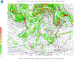
Tomorrow the GFS shows that Low trying to move out of our region but hanging around enough to kick up enough moisture for just a few isolated showers or thunderstorms.
The NAM has us high and dry. Sometimes it is better at this time range, but taking into account all the model runs I've seen the last few days, I think it's reasonable to allow for an isolated shower or two, at least early tomorrow. Overall the day should feature much more sunshine than even any clouds. Should see a High near 77-78 and a Low near 52-53.Again on Monday the 5th of June, some high pressure may keep us dry. It's a close call, this far out, how much to believe model forecasts and how much to defer to climatology, so may keep a minimal chance of rain in the forecast. But we could get up to 90 degrees with this setup.
Then on Tuesday June 6, it is showing that High moving off into the Atlantic and relaxing things enough we'd definitely need to bring back the 20% rain chance around here. And I'm not sure how much I buy into these model trends this far out, even this time of year. But a lot of people are doing 10-day forecasts again these days. If they really think the science is that good, then I'll give a try too, but urge you to take any such forecasts with a shovel full of salt. In the official forecast above, I compare it humorously to trying to read tea leaves. I had someone in my family who read fortunes, and I could sort of see where some of it, like reading cards or reading someone's palm had some structure to it, maybe people believe they're really doing something. But I never did buy into tea leaf reading. This gal's mom that I used to work with would come by to visit her daughter and would read tea leaves sometimes at a restaurant. And I just never bought it. I don't think you can look at tea leaves and make anything out, and I always thought people who said they were reading tea leaves were just making it up as they went along. Recently I saw a lawyer on YouTube who called his personal hunches reading tea leaves. So that's what I call it when I venture beyond seven days for a forecast. Don't take it to the bank. It's better than the Farmer's Almanac, but it's really not much better than what you could figure out for yourself with your experience of what the weather does this time of year, and watching the sky. Now out to 5-7 days, the forecasts are pretty good, especially in summer when things get kind of boring compared to other seasons. Beyond that, I strongly urge you to roll your eyes at it, even when I'm the one doing it. By days 8-10, we are looking at trends, at best.
Rainfall totals should average a quarter-inch or less over the next seven days. And I'm rarely going to show that in summer. Because of the hit-or-miss nature of the showers and storms.


No comments:
Post a Comment