Tuesday (High 73, Low 56): Mostly sunny. Mild.
Wednesday (High 61, Low 46): Partly cloudy. Isolated showers are possible.
Thursday (High 58, Low 48): Partly to mostly cloudy. Scattered showers are possible.
Friday (High 67, Low 54): Rain likely - thunderstorms possible.
Saturday (High 60, Low 41): Mostly sunny.
Sunday (High 70, Low 49): Thunderstorms likely.
Monday (High 52, Low 42): Partly to mostly sunny.
There is a SKYWARN class 6 PM Wednesday at Trinity Town Hall. Then 6 PM Thursday there is a class at Haleyville City Hall, rescheduled from February 16.
Our high pressure system has moved off into the Atlantic Ocean, and the next low pressure system/front is moving through the Midwest. We were sunny with a Southwest breeze in the Tennessee Valley today. The High in Cullman was 77, and the Low this morning was 46. Jasper saw a High of 82 and Low of 41. In Haleyville the High was 79 after a morning Low of 45.
Tonight and tomorrow a weak cold front, the one we saw in the Midwest, will drop down to about the Gulf Coast. It looks like the front will only bring us an increase in clouds overnight, with a Low of about 56. The High tomorrow should be about 73, not quite as warm as today, but this is a weak/dry front.
Then on Wednesday that front will slowly start to drift back northward at the same time as a shortwave from a system in the Plains starts to drift eastward toward our region.
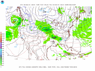
The GFS has really picked up the tempo for bringing moisture in here Thursday though.
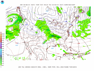
The NAM is in decent agreement this time. But at 72 hours it starts to get less reliable, being a mesoscale model focused on North America, not a longer-range global model.
I think the ECMWF has had the best handle on the slow progression of this system all along. And I'm going to base my forecast mostly on it. Only bumping rain chance up to 40%. High in upper 50's, Low in upper 40's.
Part of me wants to change Wednesday to 30% rain chance and 50% for Thursday. But I just think the GFS/NAM are being too aggressive with it. This evening I am in a mood to take a chance on going more with my gut and personal experience than what would be more "proper". If the forecast busts, then maybe those people who say "you can't beat the models" are right. Tim Coleman used to say that you can beat the models if you use your brain. That's what I'm trying to do here. But it is coming at the end of a sort of rough day in which I got as frustrated at a computer as a dearly departed auto mechanic in my family tree uses to get at the cars and other bits of machinery at his shop. It seems like more people are starting to read this, so maybe I should keep such experiments minimal. But this is not what you'd call really high-impact weather. It's just scattered rain. I'm only taking a gamble on how scattered it is in percentages. I'm gambling on saying that there may be less of it than a lot of the guidance is showing, for at least these two days.
Thursday night into Friday, the cold front should pass through our region.
Saturday we catch a break in the action, mostly sunny skies, and a pretty good punch of cooler air behind that front, High near 60, Low near 40.
And here is a case where I owe the GFS an apology for being so dismissive of its guidance yesterday, picking up on this Sunday storm system.
The Euro has also started to pick up on it, and we will have to watch this system for severe weather potential.
For now the GFS has the better instability staying to our South and West, but experience tells me, this kind of a look six days out, keep an eye on it.
The ECMWF is already bringing dewpoints high enough to support some stronger storms into at least Northwest Alabama. And this far out, when the models are just now starting to agree on the system happening to begin with, the exact parameters are not going to be all that clear. But these trends make me think there may be some risk for organized severe weather trying to shape up in the Southeast on Sunday from this system. Forecasting a High back near 70 and a Low near 50.
Then should see more sun than clouds behind the front on Monday of next week, High in lower 50's, Low near 40.
And we could see up to about 2 inches of total rainfall for this forecast period.


No comments:
Post a Comment