Tuesday, February 28, 2023

Severe Weather Possible Mainly Thursday into Friday

Today (High 77): Sunny. Light winds from the Southwest. 

Wednesday (High 78, Low 56): Partly to mostly cloudy and breezy with isolated showers/thunderstorms possible during the day, then rain and storms becoming likely at night. Any storms that form may be strong, and some may even reach severe limits.

Thursday (High 75, Low 63): Thunderstorms likely - some possibly severe. A few severe thunderstorms cannot be ruled out during the day, but the main threat for organized severe weather will be in the overnight hours. 

Friday (High 70, Low 60): Lingering showers and storms early. 

Saturday (High 60, Low 41): Mostly sunny.

Sunday (High 62, Low 37): Sunny.

Monday (High 67, Low 40): Mostly sunny. 

At 4 AM skies are clear and winds are calm in Cullman, with perfect visibility and a temperature of 54 degrees. The dewpoint is 41, making the relative humidity 63%. Pressure is 29.84 and steady. Our Low this morning was 50. Jasper had a Low of 43 and is now at 45 degrees with visibility of 9 miles but mostly clear skies and calm winds. The dewpoint is also at a temperature of 45, making their relative humidity 100%. Pressure is 29.84 and rising. Haleyville got down to 49 this morning and is now at 50 degrees with clear skies, visibility of 10 miles, and calm winds. Their dewpoint is 41, making the relative humidity 71%. Barometric pressure there is 29.85 inches and rising. That's 1009.7 in millibars. 


So we catch a break in the action today, with sunny skies expected and a High near 77. Winds should be light from the Southwest. 


But that same storm system that is bringing snow to much of the rest of the country is going to bring us some severe weather potential, and now it is looking like some of it could occur as early as tomorrow. So let's dive right in. 


It still looks like any showers or storms tomorrow afternoon and evening will stay isolated, about a 1-in-5 chance of any one spot getting wet. But then at night, rain becomes likely, and some isolated thunderstorms are possible in the mix. And some could reach severe limits. The best chance of that is from Northern Mississippi back into Southern Arkansas. Around here in North Alabama and Southern Middle Tennessee, we only have a marginal 5% risk of damaging winds or large hail in some storms, and the tornado threat is looking minimal here for this time period. 

Expecting a High near 78 tomorrow. Tonight's Low about 56. Winds will pick up tomorrow and tomorrow night even outside of specific storms, gusts up to 20-30 miles per hour will happen for some people. 


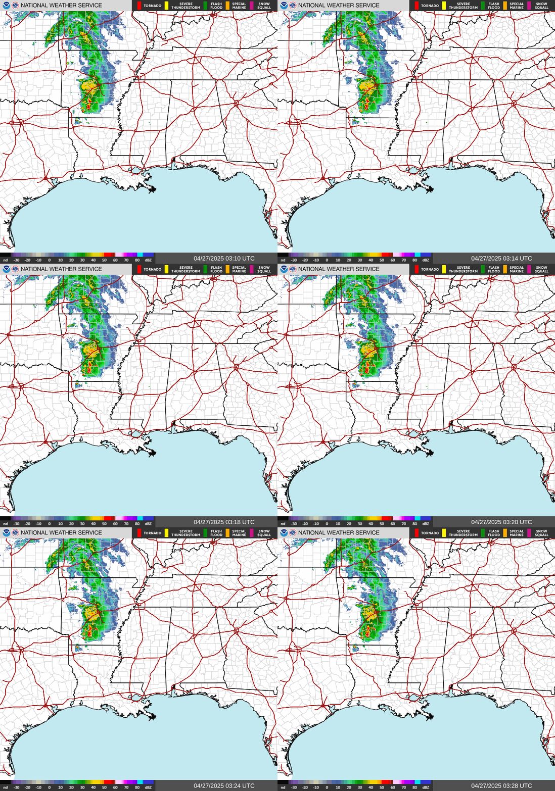
The main event is Thursday, and it's mainly Thursday night we'll have to watch for severe weather potential. The initial supercells are expected to form back over East Texas, Southern Arkansas, Northern Louisiana, and Western Mississippi. These have the best chance of producing really significant damage. This could end up being a severe weather outbreak. As of right now, it is looking like in the Tennessee Valley, we may get the leftovers after the storms form into a squall line later Thursday night into Friday morning. But even if it is folks to our West who get the worst of this system, this threat is well worth respecting. We can have organized severe thunderstorms capable of producing damaging winds, large hail, and tornadoes, even if it is in the form of a squall line rather than discrete supercells out by themselves. They had a rough squall line the other night in Oklahoma that mainly did straight-line wind damage but also had some supercells embedded in it that produced tornadoes. So let's take this seriously even if we end up being in one of the lower threat levels, the way it is looking right now. That 15% risk is still the basic risk for severe weather. 

Look for a High of about 75 on Thursday, Low of about 63. It is going to be windy on Thursday, at least by the night hours. The wind fields with this low pressure system and front are going to be impressive. So even if our unstable air is limited, the combination of that strong wind shear and the strong source of lift along the front can probably overcome that to produce severe weather, perhaps a fairly significant round of severe weather. 

If I have time to post another update this evening or tonight, then I'll try to go into more details and show more of my own reasoning about the forecast, and guess at the timing of the several rounds of severe potential we may have between tomorrow afternoon/evening and Friday morning. For now I'm just showing the broad brushstrokes and explaining what the experts are forecasting. 

I'm having some technical issues, and I do not know if they will be resolved by Thursday or not. If they are, I may be able to provide some real-time updates on the storms as they move in. And I may try to wing it anyway. That's what I've been doing with the forecasts the last two or three days. It takes longer than usual to do graphics and organize everything right now. 


After daybreak on Friday, we are still under that basic 15% severe weather risk, which extends all the way through Georgia and into the Carolinas. The storms are expected to be over by about Noon though. This is looking more and more like an overnight/early morning event. And most people will be trying to sleep or just getting up for work if this verifies. That's why having a weather radio is important. If you know somebody in the path of a tornado or really bad storm during this event, maybe call and wake them up before it gets to them. They might fuss at you, but it could keep somebody from getting hurt. Most people involved in meteorology kind of dread these overnight events, because an awful lot of people do not know what's going on and have a way to wake up if they are in the path of a severe storm or a big squall line of severe storms. 

Anyway it is now looking more like a High near 70, Low near 60 for Friday, and like I said, gradual clearing by about Noon. Should stay breezy throughout the day. 

And the temperature guidance behind the front is not trending as cold now. We turn mostly sunny for Saturday but the High should be about 60 instead of in the 50's as previously thought. Overnight Low about 40 or so. Then on Sunday, sunny, start the day in the upper 30's, so still sort of a cold morning, and then warm to the lower 60's. And then Monday, mostly sunny and the High quickly rebounding into the upper 60's, Low staying about 40 or so. It'll be at least Tuesday before we have to bring back rain chances, much less any chance for any stronger storms. But tomorrow through early Friday, we will have to watch. Tomorrow's threat, even at night, looks very low around here, but something isolated could go severe. There may be more than one round of severe weather Thursday, but the main threat looks like Thursday night through Friday morning, the hours when almost everyone is either asleep or going to work. And Thursday/Thursday night does have the potential to be a severe weather outbreak, at least for some places to our West, that were shown in that hatched area on the map above, that had the "Enhanced Level 3 Risk" in the basic outline, and then the map under that showed the percentages and the hatching. Even if we are not in the highest risk area (as of yet . . . forecast may be fine-tuned over next day or so), it is well worth taking seriously. Let people know that this could be a serious situation with potential for damaging winds, large hail in thunderstorms, and potential for a few tornadoes in the region as well. Even if they are tornadoes embedded in a squall line, instead of from storms that are totally out by themselves, any tornado is dangerous. And sometimes you can get significant damage from one even if it is in a squall line. It's better not to play guessing games about how damaging a storm is going to be. But to take shelter before it gets to you. And even if it is damaging straight-line winds in a thunderstorm, sometimes those can do damage similar to a tornado, and pose a threat to life. The way this is looking right now, it could be an unusually potent squall line. After what they had out in the Plains the other night, I'd rather not fool around with it, gonna' take it seriously. 


Until we get to the weekend, the weather this week is a headache. We may see between 1-3 inches of average rainfall totals, higher amounts generally across the Tennessee border. And by the time Thursday gets here, some places may already be having some issues with flash flooding. And when you have a lot of rain like that, it can make it easier for trees to come down. So some of us may be in for a wild ride. After about midday Friday, things calm down for the rest of the forecast period. 


You can use these maps as a general guideline for making plans, but the idea for now is that all of us have a basic risk for severe weather on Thursday, mainly overnight into Friday morning. So everyone needs to be prepared, don't wait on a higher threat level to be upgraded later before taking it seriously. We could get a few severe thunderstorms before Thursday night, but that is expected to be the main event. 

Need to be able to get into a small central room (or hallway) on the lowest floor of a sturdy house or other strong building in advance of these storms, and not get caught in a mobile home. Anybody driving those hours for work needs to try to plan to be able to get into a building that will be open for shelter if severe weather approaches. Seriously, a lot of our serious injuries or even deaths now still come from simple things like trees coming down in the road where people are driving, or a tree falling on a trailer. Now the other night in the Plains, they got by without anyone losing their lives, but did have about a dozen people injured. So please encourage the people around you to use good sense and do whatever is within their means to stay safe during this event, whatever it ends up doing, and where. 

Lately I wrote a thorough post about severe weather safety, so linking to it here while I'm thinking about it. I think it may still need some editing, but for now, it's what I've got here. You can also look at the official government advice on severe thunderstorms and tornadoes. They also have a good page on flood safety

Monday, February 27, 2023

Sunny Tomorrow, Severe Weather Possible Thursday Into Friday

Tuesday: Sunny. Cool morning, mild afternoon. High 75, Low 47

Wednesday: Partly cloudy and breezy during the day with isolated showers/thunderstorms possible. At night, rain is likely, and any thunderstorms that form will be capable of hail and strong winds. High 78, Low 53

Thursday: Thunderstorms likely. Some possibly severe, especially going into the night hours. High 73, Low 61

Friday: Breezy with gradual clearing. High 66, Low 54

Saturday: Mostly sunny. High 57, Low 37

Sunday: Sunny. High 60, Low 34

Monday: Mostly sunny. High 63, Low 36

Sunday, February 26, 2023

Windy and Rainy Tomorrow, Sunshine Mid-Week, Stormy Thursday

Monday (High 72, Low 59): Rainy. Windy. 

Tuesday (High 75, Low 48): Sunny. Cool in the morning, mild in the afternoon.

Wednesday (High 77, Low 54): Partly cloudy with a few isolated showers possible during the day. Clouds increasing and rain becoming likely at night. 

Thursday (High 73, Low 61): Thunderstorms likely - some possibly severe.

Friday (High 62, Low 53): Gradual clearing.

Saturday (High 55, Low 36): Sunny.

Sunday (High 58, Low 30): Sunny.

Wind Advisory

URGENT - WEATHER MESSAGE

National Weather Service Huntsville AL

234 PM CST Sun Feb 26 2023


ALZ001>010-016-TNZ076-096-097-271215-

/O.CON.KHUN.WI.Y.0008.230227T1200Z-230228T0000Z/

Lauderdale-Colbert-Franklin AL-Lawrence-Limestone-Madison-Morgan-

Marshall-Jackson-DeKalb-Cullman-Moore-Lincoln-Franklin TN-

Including the cities of Florence, Muscle Shoals, Sheffield,

Tuscumbia, Russellville, Red Bay, Moulton, Town Creek, Athens,

Huntsville, Decatur, Albertville, Boaz, Guntersville, Arab,

Scottsboro, Fort Payne, Rainsville, Cullman, Lynchburg,

Fayetteville, Winchester, Sewanee, Decherd, Estill Springs,

and Cowan

234 PM CST Sun Feb 26 2023


...WIND ADVISORY REMAINS IN EFFECT FROM 6 AM TO 6 PM CST MONDAY...


* WHAT...Southwest winds 20 to 30 mph with gusts of 40 to 50 mph

  expected.


* WHERE...Portions of north central, northeast and northwest

  Alabama and southern middle Tennessee.


* WHEN...From 6 AM to 6 PM CST Monday.


* IMPACTS...Gusty winds could blow around unsecured objects.

  Tree limbs could be blown down and a few power outages may

  result.


PRECAUTIONARY/PREPAREDNESS ACTIONS...


Use extra caution when driving, especially if operating a high

profile vehicle. Secure outdoor objects.


&&


$$

20

URGENT - WEATHER MESSAGE...UPDATED

National Weather Service Jackson MS

242 PM CST Sun Feb 26 2023


ARZ074-075-LAZ007>009-016-MSZ018-019-025>052-270445-

/O.CON.KJAN.WI.Y.0006.230227T1200Z-230228T0000Z/

Ashley-Chicot-Morehouse-West Carroll-East Carroll-Madison LA-

Bolivar-Sunflower-Leflore-Grenada-Carroll-Montgomery-Webster-Clay-

Lowndes-Choctaw-Oktibbeha-Washington-Humphreys-Holmes-Attala-

Winston-Noxubee-Issaquena-Sharkey-Yazoo-Madison MS-Leake-Neshoba-

Kemper-Warren-Hinds-Rankin-Scott-Newton-Lauderdale-

Including the cities of Crossett, North Crossett, Hamburg,

West Crossett, Dermott, Lake Village, Eudora, Bastrop, Oak Grove,

Epps, Lake Providence, Tallulah, Cleveland, Indianola, Ruleville,

Greenwood, Grenada, Vaiden, North Carrollton, Carrollton, Winona,

Eupora, Mathiston, West Point, Columbus, Ackerman, Weir,

Starkville, Greenville, Belzoni, Isola, Durant, Tchula,

Lexington, Pickens, Goodman, Kosciusko, Louisville, Macon,

Brooksville, Mayersville, Rolling Fork, Anguilla, Yazoo City,

Ridgeland, Madison, Canton, Carthage, Philadelphia, Pearl River,

De Kalb, Scooba, Vicksburg, Jackson, Pearl, Brandon, Richland,

Forest, Morton, Newton, Union, Decatur, Conehatta, and Meridian

242 PM CST Sun Feb 26 2023


...WIND ADVISORY REMAINS IN EFFECT FROM 6 AM TO 6 PM CST MONDAY...


* WHAT...Southwest winds 20 to 30 mph with gusts greater than 40

  mph expected.


* WHERE...Portions of central, east central, north central and

  northeast Mississippi.


* WHEN...For the Wind Advisory, from 6 AM to 6 PM CST Monday.


* IMPACTS...Gusty winds could blow around unsecured objects.

  Tree limbs could be blown down and a few power outages may

  result.


PRECAUTIONARY/PREPAREDNESS ACTIONS...


Use extra caution when driving, especially if operating a high

profile vehicle. Secure outdoor objects.


&&


$$

22

URGENT - WEATHER MESSAGE

National Weather Service Nashville TN

145 PM CST Sun Feb 26 2023


TNZ005>011-023>034-056>066-075-077>080-093>095-270900-

/O.CON.KOHX.WI.Y.0007.230227T1200Z-230228T0000Z/

Stewart-Montgomery-Robertson-Sumner-Macon-Clay-Pickett-Houston-

Humphreys-Dickson-Cheatham-Davidson-Wilson-Trousdale-Smith-

Jackson-Putnam-Overton-Fentress-Perry-Hickman-Lewis-Williamson-

Maury-Marshall-Rutherford-Cannon-De Kalb-White-Cumberland-Bedford-

Coffee-Warren-Grundy-Van Buren-Wayne-Lawrence-Giles-

Including the cities of Dover, Clarksville, Springfield,

Hendersonville, Gallatin, Goodlettsville, Lafayette, Celina,

Byrdstown, Erin, Tennessee Ridge, Waverly, New Johnsonville,

McEwen, Dickson, Ashland City, Kingston Springs, Nashville,

Lebanon, Mount Juliet, Hartsville, Carthage, South Carthage,

Gordonsville, Gainesboro, Cookeville, Livingston, Jamestown,

Allardt, Linden, Lobelville, Centerville, Hohenwald, Franklin,

Brentwood, Columbia, Lewisburg, Murfreesboro, Smyrna, La Vergne,

Woodbury, Smithville, Sparta, Crossville, Shelbyville, Tullahoma,

Manchester, McMinnville, Altamont, Coalmont, Spencer, Clifton,

Waynesboro, Lawrenceburg, and Pulaski

145 PM CST Sun Feb 26 2023


...WIND ADVISORY REMAINS IN EFFECT FROM 6 AM TO 6 PM CST MONDAY...


* WHAT...Southwest winds 20 to 30 mph with gusts up to 45 mph

  expected.


* WHERE...Portions of Middle Tennessee.


* WHEN...From 6 AM to 6 PM CST Monday.


* IMPACTS...Gusty winds could blow around unsecured objects.

  Tree limbs could be blown down and a few power outages may

  result.


PRECAUTIONARY/PREPAREDNESS ACTIONS...


Use extra caution when driving, especially if operating a high

profile vehicle. Secure outdoor objects.


&&


$$


10

URGENT - WEATHER MESSAGE

National Weather Service Morristown TN

245 PM EST Sun Feb 26 2023


NCZ060-061-TNZ012>017-035>040-042-044-046-067>071-073-081>086-

098>101-VAZ001-002-005-006-008-270500-

/O.CON.KMRX.WI.Y.0010.230227T1500Z-230228T0000Z/

Cherokee-Clay-Scott TN-Campbell-Claiborne-Hancock-Hawkins-

Sullivan-Morgan-Anderson-Union-Grainger-Hamblen-Northwest Cocke-

Northwest Greene-Washington TN-Northwest Carter-Roane-Loudon-Knox-

Jefferson-Northwest Blount-North Sevier-Sequatchie-Bledsoe-Rhea-

Meigs-McMinn-Northwest Monroe-Marion-Hamilton-Bradley-West Polk-

Lee-Wise-Scott VA-Russell-Washington VA-

Including the cities of Andrews, Marble, Topton, Hiawasse Dam,

Murphy, Unaka, Violet, Shooting Creek, Brasstown, Hayesville,

Tusquitee, Big South Fork National, Oneida, Smokey Junction,

Elgin, Huntsville, Norma, Slick Rock, Fincastle, La Follette,

Elk Valley, Jellico, White Oak, Caryville, Royal Blue,

Lone Mountain, Sandlick, Springdale, Arthur, Harrogate-Shawanee,

Clairfield, Howard Quarter, Evanston, Sneedville, Treadway,

Kyles Ford, Mooresburg, Kingsport, Bristol TN, South Holston Dam,

Pine Orchard, High Point, Petros, Oak Ridge, Clinton,

Maynardville, Norris Lake, Paulette, Rose Hill, Sharps Chapel,

Luttrell, Bean Station, Alpha, Morristown, Russellville, Bybee,

Newport, Greeneville, Johnson City, Elizabethton, Harriman,

Eagle Furnace, Rockwood, Bradbury, Fairview, Kingston,

Oliver Springs, Lenoir City, Loudon, Bearden, Knoxville,

Lake Forest, Jefferson City, Strawberry Plains, Chestnut Hill,

Dandridge, White Pine, Maryville, Alcoa, Harrisburg, Kodak,

McMahan, Sevierville, Seymour, Pigeon Forge, Cagle, Dunlap,

Cartwright, Lone Oak, Old Cumberland, Palio, Melvine,

Mount Crest, Pikeville, Brayton, Dayton, Evensville,

Old Washington, Grandview, Spring City, Big Spring, Athens,

Clear Water, Dentville, Etowah, Sweetwater, Madisonville,

Bullet Creek, South Pittsburg, Haletown (Guild), Jasper,

Martin Springs, Whitwell, Powells Crossroads, Monteagle,

Chattanooga, Lookout Mountain, Signal Mountain, Cleveland, Tasso,

Conasauga, Archville, Benton, Parksville, Reliance,

Big Stone Gap, Norton, Wise, Coeburn, Appalachia, Pardee,

Hiltons, Hansonville, Lebanon, Dye, Castlewood, Honaker,

Rosedale, Benhams, Bristol VA, and Abingdon

245 PM EST Sun Feb 26 2023 /145 PM CST Sun Feb 26 2023/


...WIND ADVISORY REMAINS IN EFFECT FROM 10 AM EST /9 AM CST/ TO

7 PM EST /6 PM CST/ MONDAY...


* WHAT...Southwest winds 15 to 30 mph with gusts of 40 to 50 mph

  expected.


* WHERE...Portions of southwest North Carolina, east Tennessee

  and southwest Virginia.


* WHEN...From 10 AM EST /9 AM CST/ to 7 PM EST /6 PM CST/ Monday.


* IMPACTS...Gusty winds could blow around unsecured objects.

  Tree limbs could be blown down and a few power outages may

  result.


PRECAUTIONARY/PREPAREDNESS ACTIONS...


Use extra caution when driving, especially if operating a high

profile vehicle. Secure outdoor objects.


&&


$$

URGENT - WEATHER MESSAGE

National Weather Service Peachtree City GA

235 PM EST Sun Feb 26 2023


GAZ001>009-011>016-019>025-027-030>039-041>058-066>068-270600-

/O.CON.KFFC.WI.Y.0005.230227T1500Z-230228T0000Z/

Dade-Walker-Catoosa-Whitfield-Murray-Fannin-Gilmer-Union-Towns-

Chattooga-Gordon-Pickens-Dawson-Lumpkin-White-Floyd-Bartow-

Cherokee-Forsyth-Hall-Banks-Jackson-Madison-Polk-Paulding-Cobb-

North Fulton-Gwinnett-Barrow-Clarke-Oconee-Oglethorpe-Wilkes-

Haralson-Carroll-Douglas-South Fulton-DeKalb-Rockdale-Walton-

Newton-Morgan-Greene-Taliaferro-Heard-Coweta-Fayette-Clayton-

Spalding-Henry-Butts-Troup-Meriwether-Pike-

Including the cities of Calhoun, Dahlonega, Cleveland, Rome,

Cartersville, Gainesville, Marietta, Atlanta, Lawrenceville,

Athens, Carrollton, Douglasville, East Point, Decatur, Conyers,

Covington, Newnan, Peachtree City, and Griffin

235 PM EST Sun Feb 26 2023


...WIND ADVISORY REMAINS IN EFFECT FROM 10 AM TO 7 PM EST

MONDAY...


* WHAT...Southwest winds 15 to 25 mph with gusts up to 40 mph

  expected.


* WHERE...Portions of central, east central, north central,

  northeast, northwest and west central Georgia.


* WHEN...From 10 AM to 7 PM EST Monday.


* IMPACTS...Gusty winds could blow around unsecured objects.

  Tree limbs could be blown down and a few power outages may

  result.


PRECAUTIONARY/PREPAREDNESS ACTIONS...


Use extra caution when driving, especially if operating a high

profile vehicle. Secure outdoor objects.


&&


$$

URGENT - WEATHER MESSAGE

National Weather Service Birmingham AL

524 AM CST Sun Feb 26 2023


ALZ011>015-017>044-270300-

/O.CON.KBMX.WI.Y.0008.230227T1200Z-230228T0000Z/

Marion-Lamar-Fayette-Winston-Walker-Blount-Etowah-Calhoun-

Cherokee-Cleburne-Pickens-Tuscaloosa-Jefferson-Shelby-St. Clair-

Talladega-Clay-Randolph-Sumter-Greene-Hale-Perry-Bibb-Chilton-

Coosa-Tallapoosa-Chambers-Marengo-Dallas-Autauga-Lowndes-Elmore-

Montgomery-

Including the cities of Hamilton, Sulligent, Vernon, Fayette,

Double Springs, Jasper, Oneonta, Gadsden, Anniston, Centre,

Heflin, Carrollton, Tuscaloosa, Birmingham, Hoover, Columbiana,

Pelham, Alabaster, Pell City, Moody, Talladega, Sylacauga,

Ashland, Roanoke, Livingston, Eutaw, Greensboro, Moundville,

Marion, Centreville, Clanton, Rockford, Alexander City,

Dadeville, Valley, Lanett, Lafayette, Demopolis, Linden, Selma,

Prattville, Fort Deposit, Hayneville, Wetumpka, Tallassee,

and Montgomery

524 AM CST Sun Feb 26 2023


...WIND ADVISORY REMAINS IN EFFECT FROM 6 AM TO 6 PM CST MONDAY...


* WHAT...Southwest winds 15 to 25 mph with gusts up to 40 mph

  expected.


* WHERE...Counties northwest of Interstate 85 in Central Alabama.


* WHEN...From 6 AM to 6 PM CST Monday.


* IMPACTS...Gusty winds could blow around unsecured objects.

  Tree limbs could be blown down and a few power outages may

  result.


PRECAUTIONARY/PREPAREDNESS ACTIONS...


Use extra caution when driving, especially if operating a high

profile vehicle. Secure outdoor objects.


&&


$$

URGENT - WEATHER MESSAGE

National Weather Service Memphis TN

Issued by National Weather Service Little Rock AR

321 AM CST Sun Feb 26 2023


ARZ009-018-026>028-035-036-048-049-058-MOZ113-115-MSZ001>017-

020>024-TNZ001>004-019>022-048>055-088>092-270530-

/O.NEW.KMEG.WI.Y.0008.230227T0600Z-230227T2200Z/

Clay-Greene-Craighead-Poinsett-Mississippi-Cross-Crittenden-

St. Francis-Lee AR-Phillips-Dunklin-Pemiscot-DeSoto-Marshall-

Benton MS-Tippah-Alcorn-Tishomingo-Tunica-Tate-Prentiss-Coahoma-

Quitman-Panola-Lafayette-Union-Pontotoc-Lee MS-Itawamba-

Tallahatchie-Yalobusha-Calhoun-Chickasaw-Monroe-Lake-Obion-

Weakley-Henry-Dyer-Gibson-Carroll-Benton TN-Lauderdale-Tipton-

Haywood-Crockett-Madison-Chester-Henderson-Decatur-Shelby-Fayette-

Hardeman-McNairy-Hardin-

Including the cities of Piggott, Corning, Paragould, Jonesboro,

Harrisburg, Blytheville, Wynne, West Memphis, Forrest City,

Marianna, Helena, West Helena, Kennett, Caruthersville,

Southaven, Olive Branch, Holly Springs, Ashland, Ripley MS,

Corinth, Iuka, Tunica, Senatobia, Booneville, Clarksdale, Marks,

Batesville, Oxford, New Albany, Pontotoc, Tupelo, Fulton,

Charleston, Water Valley, Coffeeville, Bruce, Calhoun City,

Houston, Okolona, Amory, Aberdeen, Tiptonville, Union City,

Martin, Dresden, Paris, Dyersburg, Humboldt, Milan, Huntingdon,

Camden, Ripley TN, Covington, Brownsville, Alamo, Jackson,

Henderson, Lexington, Parsons, Decaturville, Bartlett,

Germantown, Collierville, Memphis, Millington, Somerville,

Oakland, Bolivar, Selmer, and Savannah

321 AM CST Sun Feb 26 2023


...WIND ADVISORY IN EFFECT FROM MIDNIGHT TONIGHT TO 4 PM CST

MONDAY...


* WHAT...Southwest winds 25 to 35 mph with occasional gusts up to

  50 mph expected.


* WHERE...Portions of East Arkansas, North Mississippi,

  Southeast Missouri and West Tennessee.


* WHEN...From midnight tonight to 4 PM CST Monday.


* IMPACTS...Gusty winds could blow around unsecured objects.

  Tree limbs could be blown down and a few power outages may

  result.


PRECAUTIONARY/PREPAREDNESS ACTIONS...


Use extra caution when driving, especially if operating a high

profile vehicle. Secure outdoor objects.


&&


$$


Flood Advisory

National Weather Service Memphis TN

Issued by National Weather Service Little Rock AR

1233 PM CST Sat Feb 25 2023


...The Flood Advisory is extended for the following rivers in

Tennessee...


  Tennessee River at Savannah affecting Hardin and Decatur Counties.


For the Tennessee River...including PICKWICK DAM HEADWATER, Pickwick

Dam, Savannah, Saltillo, Perryville, Johnsonville...elevated river

levels are forecast.


PRECAUTIONARY/PREPAREDNESS ACTIONS...


If you encounter a flooded roadway, turn around and find an

alternative route.


Additional information is available at www.weather.gov.


The next statement will be issued late tonight at 1245 AM CST.


&&


TNC039-071-260645-

/O.EXT.KMEG.FL.Y.0002.000000T0000Z-230301T0600Z/

/SAVT1.N.ER.000000T0000Z.000000T0000Z.000000T0000Z.OO/

1233 PM CST Sat Feb 25 2023


...FLOOD ADVISORY NOW IN EFFECT UNTIL EARLY WEDNESDAY MORNING...


* WHAT...Flooding caused by excessive rainfall continues.


* WHERE...Tennessee River at Savannah.


* WHEN...Until early Wednesday morning.


* IMPACTS...At 366.0 feet, Campsites along Towboat Lane are flooding.


* ADDITIONAL DETAILS...

  - At 11:15 AM CST Saturday the stage was 366.1 feet.

  - Forecast...The river will fall to 363.8 feet Tuesday evening,

    Feb 28.

  - Action stage is 365.0 feet.

  - Flood stage is 370.0 feet.


&&


LAT...LON 3548 8836 3548 8805 3527 8805 3514 8823

      3501 8823 3501 8838


$$


71


Saturday, February 25, 2023

Active Weather Pattern This Week

(Forecast)

Sunday (High 71, Low 53): Some lingering fog possible in the morning, then partly cloudy. Becoming breezy with increasing clouds in the evening and night hours. 

Monday (High 72, Low 59): Windy and rainy. Isolated thunderstorms are possible and could produce strong, gusty winds. 

Tuesday (High 76, Low 48): Sunny. Cool in the morning, mild during the day.

(Extended Outlook)

Wednesday (High 75, Low 54): Increasing clouds with a 20% chance of showers/thunderstorms.

Thursday (High 72, Low 60): Thunderstorms likely - some possibly strong. 

Friday (High 61, Low 50): Showers likely - lingering storms possible. 

Saturday (High 58, Low 37): Mostly sunny and breezy.

Tornado Safety - Spring 2023

(Bottom graphic is for the counties served by the National Weather Service in Huntsville, in North Alabama and Southern Middle Tennessee.)

It is that time of year again. Our primary severe weather season in North Alabama and Southern Middle Tennessee is in March, April, and May. We do have a secondary peak in the cool season, usually the month of November. We can have severe weather, including tornadoes, any time of the year, but these are the times to pay especially close attention. Right now is when Winter is trying to give way to Spring, and we get a lot of cold fronts where the clash of air can make things volatile. 

The most reliable way to get severe weather alerts is a NOAA Weather Radio. (Never rely on an outdoor siren as your primary source.) I like the Midland model, which is easy to set up and takes AA batteries for backup. (This can really help you out if there is a power outage, especially if the weather gets bad in the middle of the night. Which happens a lot around here.) Some people are concerned about the price of a weather radio ($30-40), but I've had the same one for more than a full decade, still works great. It is an excellent investment. 

Another reliable way is a service such as WeatherCall (which works for cell phones and landlines). And of course, the bare minimum is having Wireless Emergency Alerts enabled on a cell phone. Even if you don't want to be bothered by those alerts most of the time, enabling them for a stormy day (or night) won't hurt anything, and can get your attention if severe weather does threaten. 

So let's get into that. What makes a thunderstorm severe in the first place? 

It is not because it has heavy rain, or a lot of scary thunder and lightning. Though those things can be included. 

What makes a Severe Thunderstorm is that a thunderstorm has winds in excess of 50 knots (which translates to 58 miles per hour) or hail that is at least an inch in diameter (that's the size of a quarter). Obviously some storms are going to have both, and sometimes a severe thunderstorm ends up producing a tornado. 


If you don't know what a tornado is, you have not lived around here long. Technically it is a violently rotating column of air extending from the base of a thunderstorm down to the ground. 

A Tornado Watch means that conditions are becoming favorable for the development of severe thunderstorms, capable of producing tornadoes, in and close to the watch area. People in these areas need to remain alert for rapidly changing weather conditions, and listen for later statements and possible warnings. To be able to take prompt shelter if a warning is issued later, or if threatening weather approaches.  

Tornado Warning means that a tornado is believed to be trying to develop, or already occurring, based on radar data and/or a reliable report. If you find yourself in a tornado warning polygon, the best thing to do is to get to shelter right away, and gather more information from a safe place. With all our hills and trees, and rain-wrapped "high-precipitation" storms, there is no point in trying to wait to see or hear a tornado before getting to safety. 


And you need to know where you are on a map. These days, you do not have to buy anything on paper. You can navigate to a site like geology.com and refresh your knowledge of your county and the counties nearby. Most severe weather will approach from the West or Southwest. The text of a warning tells in what direction the storm is moving. 

To shelter from a tornado, first of all, you have to be out of a mobile home (i.e. manufactured home, trailer). Which is about the worst place you can be during a tornado. They are all the housing a lot of people can afford in our part of the world, so everyone living in one needs a plan to get to a safer shelter before a tornado or severe thunderstorm hits. Some people like to relocate as soon as a watch comes out. Others might watch until the storms get into the next county. 

A car or other vehicle is almost as dangerous to be caught in during severe weather as a mobile home. Here is a video of a weak tornado going through a parking lot in South Carolina a few years ago. And it can be a lot worse

Definitely don't get caught driving through severe weather. Any route you drive regularly (to work, to school, et cetera), you need to have at least three or four places worked out in your mind, that you could pull over and get inside for shelter, if you ever need to. 

The basic idea for sheltering from a tornado is to be in a sturdy house or other strong building that is properly anchored to the ground, as low as you can get, and as near the center as you can get. 

The basic guidelines for sheltering in a site-built home are:

* Stay away from windows.

* Get to the lowest floor.

* Try for a small room - like a bathroom, closet, or hallway. 

* Make that safe room as near the center of the structure as you can. Or think of it as putting as many walls between you and the storm outside as possible. 

* Cover your body in case of falling or flying debris, especially your head and neck. 

For that last part, blankets and pillows are good. Especially if you have kids (whose heads are more vulnerable to injury than adults'), some kind of a safety helmet is even better. For little kids, you might consider using car seats if you don't have something like a bike or football helmet. 

And even in a basement, it can be a good idea to get up under something sturdy if it is available, like a table, desk, or workbench. Or a basement in a library I used to go to had a stairwell that was under the ground, where you could get up under the stairs. Things like that provide excellent protection. 

A few other reminders: 

If it's in the middle of the night when a tornado approaches, you might not have shoes on. But if you have time to remember, you might want to wear your toughest pair of shoes or boots to your shelter. Because if you were to take a hit, you will come out to some broken glass, maybe other debris. Sometimes people walk right over these things without feeling the pain, because they are in a state of mental shock, similar to after a traffic accident. 

Another thing to be careful about is if any power lines are down near you after a tornado. Assume they are "live" and do not touch or get near them. 

Another idea, to think of beforehand, is to keep a noisemaker like an air horn in your shelter. Sometimes people get trapped by debris and need a way to let emergency workers know where they are. Hopefully you never need these extra precautions, but if that situation ever does come up, you can be prepared for it. 

Some people like to keep things like a flashlight, a first-aid kit, even snacks and bottles of water, in their shelter room beforehand. It's up to you. If you only do the basics (getting to a small central room on the lowest floor of a sturdy house), you'll probably be just fine. But some of these extra measures might help you out some day. 

Obviously if you have an actual storm shelter, then you are in great shape, and may not need much of the other advice given in this post. But I'm looking out for the people in average circumstances. 

About leaving a mobile home for better shelter: If you have a good friend or family member with a sturdy house (or a storm shelter), then that is ideal. But a lot of people have to rely on public storm shelters. Just be sure to get there well ahead of the severe storms, so that you don't get caught driving through the weather. 

One broadcast meteorologist used to say you should "bake a cake", or do whatever is necessary to make friends with someone who could offer you better shelter, if you live in a mobile home, or something else like an apartment on the top floor. When I lived in a top-floor apartment, a research meteorologist told me to just buy somebody on the ground floor a cold drink and chat a little bit so they'd remember me when the weather got bad. If you're a real people person, you can probably make this work instead of having to use a public shelter. 

If you can't make it work, I feel ya'. I once knew a guy who denied me access to his basement during a tornado threat, but was happy to have me over there to play the guitar with him and share fish, fries, and homemade ice cream with his family in that basement for hours when the weather was calm. He considered me a casual friend but thought it was silly to worry about the weather. Unfortunately you will run into that sometimes. Even with people you would have thought had better sense. That's why I really appreciate the people who open the public shelters. They can be life-savers for people who live in mobile homes especially. 

If you have a hard time finding a public shelter near you in the online lists, you can contact your county's EMA office for that information. This is not something to call their emergency number for, but calling the non-emergency number ahead of time while making your plans, when the weather is still quiet, is a good idea. So here is a list of those offices for Alabama and for Tennessee

If you have a really hard time finding adequate shelter, you can always e-mail me at yankhoe004@gmail.com, and we'll put our heads together and figure something out. 

And if severe weather puts a lot of wear and tear on your nerves, then you might get some good from this page from our friends at the National Weather Service in Norman. That is also the home of the Storm Prediction Center, where the watches are issued. The local National Weather Service offices issue the warnings. If you're reading this, you are probably served by the office in Huntsville, Birmingham, or Nashville. 

About Severe Thunderstorm Warnings: Most people I know ignore these. But remember, they are issued for damaging wind and/or damaging hail. Once in a while, one of these storms spins up a tornado without additional warning. And even when the damaging winds are blowing in a straight line, it can pose a threat to life and property. If a tree or line falls on your home, or a window blows out, that can lead to injury. And it is good to pay attention to the text of these warnings. A storm with winds of 80 miles per hour tends to do more damage than one with winds of 60 miles per hour. Even if all you do is move away from windows in your home, some level of paying attention to these warnings is wise.

If you ever get caught in a last-resort situation where no substantial shelter is available, my best advice is to find an unflooded culvert or ditch, or even to lie flat on the ground, covering your head and neck with your hands. In the E/F-5 tornado that hit Hackleburg and Phil Campbell in 2011, I remember a story of a couple who survived by leaving their mobile home and getting into a ditch. Obviously you hope you can do better than that, but it is good to have a backup plan in case you don't really have a good option and have to do the best you can in a tough situation.  

Don't try to get under a bridge as a last resort shelter. That is an old myth. In the video that started this myth, the tornado passed some distance from the bridge the news crew sought shelter under. 

Hope that helps. If you follow even half this advice, you'll probably be just fine if a tornado does ever cross your path. Try to make your plans while the weather is calm, not at the last minute. 

The odds are in your favor if you do the right things. So the weather this time of year is nothing to get overly worried about, just worth having a healthy respect for. And a lot of it does not even become severe anyway. We all know the old saying that April showers bring May flowers. 

Friday, February 24, 2023

More Rain Tomorrow, Break in the Action Sunday

Saturday (High 62, Low 51): Mostly cloudy. Periods of scattered showers are possible. 

Sunday (High 71, Low 53): Partly cloudy. Clouds increasing in the evening, becoming breezy.

Monday (High 73, Low 60): Windy and rainy. Isolated thunderstorms are possible and may produce strong, potentially damaging winds - that risk is mainly in far Northeast Alabama up into Tennessee.

Tuesday (High 70, Low 49): Sunny.

Wednesday (High 74, Low 52): Partly to mostly cloudy. 

Thursday (High 72, Low 59): Thunderstorms likely. 

Friday (High 67, Low 53): Showers likely - thunderstorms possible. 

Thursday, February 23, 2023

Severe Weather Safety


It is that time of year again. Our primary severe weather season in North Alabama and Southern Middle Tennessee is in March, April, and May. We do have a secondary peak in the cool season, usually the month of November. We can really have severe weather, including tornadoes, any time of the year, but these are the times to pay especially close attention. Right now is when Winter is trying to give way to Spring, and we get a lot of cold fronts where the clash of air can make things volatile. 

The best way to get alerts about severe weather in your home is a NOAA Weather Radio. (Never rely on an outdoor siren as your primary source.) I like the Midland model, which is easy to set up and takes AA batteries for backup. (This can really help you out if there is a power outage, especially if the weather gets bad in the middle of the night. Which happens a lot around here.) 

Another reliable way is a service such as WeatherCall (which works for cell phones and landlines). And of course, the bare minimum is having Wireless Emergency Alerts enabled on a cell phone. Even if you don't want to be bothered by them most of the time, enabling them for a stormy day (or night) won't hurt anything, and might get your attention if things do turn serious. 

If someone doesn't have access to any of these, then I doubt they're reading this blog post. But just on the off-chance, you can always find a reliable local radio station that will break in during severe weather, and leave that playing as you go to sleep at night. That's more likely to wake you up than leaving the television on, because they tend to use that official alert sound that is hard to snooze through. 

In all seriousness though, sometimes the people most vulnerable to severe storms are concerned about the price of things like a NOAA radio. And I will just tell you that for the one-time price of $30-40, you will get many year's good out of it. I have had mine for more than a full decade, and even though the top of the antenna got broken off at some point, I still get great reception. A good rule of thumb is to change the batteries in it whenever we change from Daylight to Standard time, or vice versa. Sort of like you try to remember to change out batteries in things like smoke detectors. In this part of the world, weather radios may be just as important, especially since so many people live in mobile homes. Which are very vulnerable to tornadoes and severe thunderstorms. 

So let's get into that. What makes a thunderstorm severe in the first place? 

It is not because it has heavy rain, or a lot of scary thunder and lightning. Though those things can be included. 

What makes a Severe Thunderstorm is that a thunderstorm has winds in excess of 50 knots (which translates to 58 miles per hour) or hail that is at least an inch in diameter (that's the size of a quarter). Obviously some storms are going to have both, and sometimes a severe thunderstorm ends up producing a tornado. 


If you don't know what a tornado is, you have not lived around here long. Technically it is a violently rotating column of air extending from the base of a thunderstorm down to the ground. Especially around here (where a lot of them are wrapped in rain, from what we call "high-precipitation" storms), you may not always see the funnel extending to the ground. What counts is whether there is wind doing damage down on the ground. Before a tornado touches down, it is technically a funnel cloud. And often before that, there is a lowering called a wall cloud. This post isn't going to go into heavy meteorology though. If you want to learn that, then you need to take a SKYWARN class - which are free to the general public, by the way. (I used to not know about that. So I don't assume that everyone does.) This blog post is focused on what you need to do to keep yourself and your loved ones safe when this kind of weather does happen. 

So to finish up our definitions:

A Tornado Watch means that conditions are becoming favorable for the development of severe thunderstorms, capable of producing tornadoes, in and close to the watch area. These are usually issued for many counties at a time, sometimes stretching across more than one state. People in these areas need to remain alert for rapidly changing weather conditions, and listen for later statements and possible warnings. Whenever you find yourself in or near a watch area, you need to prepare to be able to go to your place of shelter within five minutes if you do get a warning, or if threatening weather approaches. 

And that's an important point that you probably hear more old-timers talk about than people in the modern day. But once in a while, a damaging wind event, or even a tornado, can get going before a warning is issued. So if the weather turns ugly in a hurry, and you feel you and the people around you may be in danger, it is all right to go ahead and take shelter, as a course of least regret. Especially if you are in one of those areas of poor radar coverage, I would encourage you to trust your instincts. Before we had dual-polarization radar and instant communication over the internet to share pictures of storms or damage, people watched the sky, talked to each other about the weather, and trusted their best judgement. There is still something to be said for that, along with relying on modern technology and communications. 

A Tornado Warning means that a tornado is trying to develop, or is already occurring, based on radar data and/or a reliable report. If you find yourself in a tornado warning polygon, the best thing to do is to get to shelter right away, and gather more information from a safe place. With cell phones as advanced as they are now, this is easy to do. Of course, you can also take a laptop, radio, or other device with you, or just turn up the volume on your television set. You'll think of something, but the most important thing is to get to that safe place and stay there until you are sure the danger has passed. A lot of people want to wait to see or hear the tornado first, and in Alabama and Tennessee, with all the hills, mountains, and trees, that can be a dangerous, even deadly mistake. Even without the trees and hills in the way, a lot of our tornadoes are wrapped in rain, so that not even an expensive camera network owned by a TV station is going to be able to get a good look at them. Even people who are trained and know how to chase storms around here run into this problem a lot. So when you get a tornado warning in this part of the world, best thing to do is shelter first, ask questions later. 

The basic idea for sheltering from a tornado is to be in a sturdy house or other strong building that is properly anchored to the ground, as low as you can get, and as near the center as you can get. 

The guidelines I learned growing up were:

* Stay away from windows (and doors that lead to the outside).

* Get to the lowest floor (obviously that's a basement if you've got one, if not, then the ground floor).

* Try for a small room - like a bathroom, closet, or hallway - where the walls are a lot less likely to collapse under the pressure of the winds. 

* Make that safe room as near the center of the structure as you can. Or think of it as putting as many walls between you and the storm outside as possible. 

* Cover your body in case of flying or falling debris, especially your head and neck. 

For that last part, blankets and pillows are good. Especially if you have kids (whose heads are more vulnerable to injury than adults'), some kind of a safety helmet is even better. For little kids, you might consider using car seats if you don't have something like a bike or football helmet. 

And even in a basement, it can be a good idea to get up under something sturdy if it is available, like a table, desk, or workbench. Or a basement in a library I used to go to had a stairwell that was under the ground, where you could get up under the stairs. Things like that provide excellent protection. 

Obviously if you have an actual storm shelter, then you are in great shape, and may not need much of the advice given in this post. But I'm looking out for the people in average circumstances. 

And let's face it, an awful lot of people live in mobile homes, manufactured homes, trailers. Which are about the worst place you can be during a tornado. So if you live in a mobile home, you need a plan in advance to go to somewhere that affords better protection. 

If you have a good friend or family member with a sturdy house or a storm shelter, then that is ideal. But a lot of people have to rely on public storm shelters. Just be sure to get there well ahead of the severe storms, so that you don't get caught driving through the weather. 

If you have a hard time finding a public shelter near you online, you can contact your county's EMA office for that information. This is not something to call their emergency number for, but calling the non-emergency number ahead of time, when the weather is still quiet, while making your plans, is a good idea. So here is a list for Alabama and for Tennessee

Definitely don't get caught driving through severe weather. Any route you drive regularly (to work, to school, et cetera), you need to have at least three or four places worked out in your mind, that you could pull over and get inside for shelter, if you ever need to. 

A car is almost as dangerous to be caught in during severe weather as a mobile home. Here is a video of even a weaker tornado going through a parking lot in South Carolina a few years ago. And it can be a lot worse

So basically, you need a reliable way to get watches, statements, and warnings. 

You need to remember the difference between a watch and a warning. 

And you need a safe place to go within five minutes of going under a warning polygon. 

That needs to be a sturdy house (not a mobile home, even if it's tied down), and a small space in there where you can get down low and near the center of the house. 

And of course, if you have access to an actual storm shelter, that is even better. Most people don't have that, which is why I'm rattling all this off. 

If you have time to think about it or prepare beforehand, it is good to be wearing shoes when you take shelter, and your strongest pair or even some boots with hard soles, if you have those. Because if you were to take a hit from a tornado, you might come out to some broken glass and other debris. People tend to go into a state of shock similar to after a car accident and might not feel when they are walking over sharp things. Also if you have the presence of mind to notice it, after a tornado, be very careful not to walk over any downed lines. Go ahead and assume that any power lines are "live" and don't touch them or get near them. 

Another idea is to have a noisemaker such as an air horn in case you were to be trapped by debris (not trying to scare anyone, but a lot of times, it pays to think worst-case scenarios and then work our way back from there), can give that a squeeze and alert emergency workers to where you are. And it wouldn't hurt to have other things like a first-aid kit, maybe some snacks and bottled water for everyone, a flashlight. 

These are all things to consider, but the main thing during a tornado is just protecting your life, and the lives of the people you are with. If you want to take every precaution and preparation within your means, hey, I think that's great. But you really can get by with only the basics:

* Be in a sturdy building.

* Get as low as you can.

* Get as near the center as you can, preferably in a small space.

* Protect your body from falling or flying debris, especially your head and the back of your neck.

That's all the protection you are likely to need in 9 out of 10 tornadoes. 

So if you're a pretty laid-back person, just keep those basics in mind. Use them if you ever need them.

If you are more of a nervous person, or have had a bad past experience with a tornado, then you may find this page by our friends at the National Weather Service in Paducah, Kentucky to be helpful. 

I wish there were more people in this world like my great-grandmother. After the generational tornado outbreak of 1974 (similar to the one we had in 2011, which she also lived through), she quit going to her friend's storm shelter and had one built on her own land. And anybody who needed it was welcome there. Once in a while, some friends would show up from miles away during a tornado watch. Even before that outbreak, she knew a family that was killed by a tornado that was rated F-4 and blew up their new house over the highway. There is a part of me that still hopes that some people in at least the smaller communities who have seen some rough times with severe weather in the past, will go the extra mile to protect themselves and the people around them. That helps calm everyone down when the weather shows its worst. And while I'm glad the public shelters are there, it is a different vibe when it's family and friends getting together to keep each other safe. Some of the adventures we had in that old storm pit remind me why most public shelters do not allow pets. (Haha . . .) But if you do have a storm shelter or a good basement, please consider helping people out who don't have that. Ditto if you have the only sturdy house on the block, and everybody else is in mobile homes. If you can safely do so, I encourage you to let people know that they are welcome. 

There are exceptions to most rules, and you have to use common sense. When I was talking about sheltering, I said to get to the center of a structure. But the idea is to put as much barrier between you and the outside as possible. One time, I lived in a house where my brothers' rooms were both in the basement. My youngest brother's room was an open area with windows and was near a door that opened out at ground level, to the outside. It was more near the center, technically, than my other brother's room. But my other brother's room had a small closet. That closet was the deepest spot in the ground, and it also had the most walls between it and the outside, of any other spot in that basement. Even though there was no door on that closet, it was the safest spot by far. I used to take my cat in there and cover us up with blankets. Usually our father stayed upstairs, my brother whose room it was thought he was good enough staying in bed, and our youngest brother just didn't care. The cat usually wanted inside, but strangely, when forced into a closet, acted like she wanted back out. The landlord didn't want her inside, but we made an exception for tornado warnings. 

By now I think you get the main ideas. 

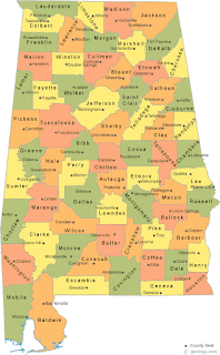
One very important thing that my great-grandma kept with her was a map of the state of Alabama. It is amazing how many people have no clue where they live on a map. And this is in the era of Google Maps, when it is much easier to find out, without anything on paper. 


Thank you to the fine folks at geology.com for providing maps that show not only counties, but the main city within each county. And like I say, if you want to learn more about your local geography, it is a lot easier to do than the days when you needed a printed map or an atlas. The technology is here, let's make good use of it. 

Especially if you need to bug out of a mobile home and get to a better shelter in advance of storms, it can be a good idea to do that while the severe storms are still a county or two away. Usually they will be coming from the West or Southwest. If you read the full text of a severe thunderstorm or tornado warning, it tells in what direction the storm is moving. 

Hope that helps. If you follow even half this advice, you'll probably be just fine if a tornado does ever cross your path. Try to make your plans while the weather is calm, not at the last minute. 

A thought about severe thunderstorm warnings: Most people I know just sit there and don't do anything. Opinions will vary on what you should do, but at the very least, I would get away from windows. And again, you might want to check the text of the warning. Sometimes it makes a note that there is weak rotation and that a tornado is possible, or that the winds are thought to be really strong, like 80 mph or greater, which can do damage similar to a tornado. Sometimes I've taken full shelter for a severe thunderstorm warning. It just depends on the situation. And a really good argument for taking those warnings seriously (especially if the environment favors tornadoes) is that the November 1989 Airport Road tornado in Huntsville came out of a Severe Thunderstorm Warning. The tornado dropped on Redstone Arsenal, and the Weather Service had to go live on weather radio and say, "TORNADO WARNING HUNTSVILLE!" before they even got the Tornado Warning written up. I heard Bob Baron give a talk describing that one time. 

And with all this talk of the worst the weather can do, I think it's worth mentioning that we need storms to keep the atmosphere balanced out. Most of them do not produce tornadoes, and the chances of being hit directly by a tornado are always on the low side, even on a high-risk severe weather day. Most tornadoes are easy to survive as long as you are in a sturdy house rather than a mobile home or a vehicle; by taking a few simple precautions. I'm sure you're heard the old saying that April showers bring May flowers. 

If you ever get down to a last resort situation where you are caught in a car or a mobile home, no decent shelter nearby, and a tornado is approaching, what I would do is lie flat in an unflooded culvert or ditch, or even on the flat ground, covering back of head and neck. Storm chasers especially like to argue whether they'd take their chances staying in the car or getting outside, down low. But nobody advises staying in a mobile home. And even in the F-5 tornado (or E/F-5 if you want to get technical) that hit Hackleburg and Phil Campbell in 2011, I remember a story of at least one couple who left a mobile home and survived by taking shelter in a ditch. If they can survive in a rare, worst-case scenario like that, then you know people have survived lesser tornadoes that way. I remember a story from 2008 where a trucker survived by leaving the vehicle at the last minute, although all he had time to think to do was hang on to the nearest tree. He was injured, but the injuries were minor, like just banged up and minor cuts. The vehicle was found thrown some distance away. 

Bottom line, the odds are in your favor, especially if you do the right things. So while the weather can get a little scary this time of the year, it's nothing to get overly worried about, but it is worth having a healthy respect for. And I'm just trying to do my part by sharing what I've learned over the years. 

Brief Cool Snap This Weekend, Then Warm/Unsettled Pattern Returns Next Week

(Forecast)

Friday (High 60, Low 50): Partly cloudy, breezy at times, cooler. Widely scattered lingering showers are possible. 

Saturday (High 67, Low 53): Partly cloudy. Isolated showers are possible.

Sunday (High 72, Low 56): Partly to mostly sunny. Warmer.

(Extended Outlook)

Monday (High 70, Low 60): Showers and thunderstorms likely. 

Tuesday (High 69, Low 48): Sunny. 

Wednesday (High 71, Low 45): Partly cloudy. 

Thursday (High 72, Low 59): Thunderstorms likely. 

Monday, February 20, 2023

Warm, Windy, and Unsettled

Tuesday (High 69, Low 58): Cloudy and breezy. Periods of scattered rain showers are possible. 

Wednesday (High 80, Low 61): Mostly cloudy, muggy, and windy. Periods of scattered showers and thunderstorms are possible, and an isolated stronger storm cannot be ruled out. 

Thursday (High 82, Low 63): Becoming mostly sunny. Staying unseasonably warm. 

Friday (High 62, Low 51): Partly cloudy. 

Saturday (High 73, Low 52): Partly to mostly cloudy with a 30% chance of showers. 

Sunday (High 72, Low 59): Mostly cloudy with a 40% chance of showers/thunderstorms.

Monday (High 74, Low 60): Partly to mostly cloudy with a 40% chance of thunderstorms. 

Sunday, February 19, 2023

Warm, Unsettled Pattern Sets Up This Week

President's Day (High 67, Low 48): Breezy with clouds gradually increasing throughout the day. Scattered rain showers are possible at night. 

Tuesday (High 70, Low 59): Cloudy and breezy. Periods of scattered rain showers are possible throughout the day and night. 

Wednesday (High 80, Low 62): Mostly cloudy, muggy, and windy. Periods of widely scattered showers and thunderstorms are possible, mainly in the afternoon and evening - and some could become strong, or even reach severe limits. 

Thursday (High 82, Low 63): Becoming partly to mostly sunny with a 20% chance of a lingering shower.

Friday (High 61, Low 52): Partly to mostly sunny.

Saturday (High 76, Low 54): Increasing clouds with a 30% chance of showers/thunderstorms.

Sunday (High 72, Low 60): Mostly cloudy with a 50% chance of showers/thunderstorms.

Winter Storm Expected To Impact Much of Country Next Few Days

 Short Range Forecast Discussion

NWS Weather Prediction Center College Park MD

307 PM EST Sun Feb 19 2023


Valid 00Z Mon Feb 20 2023 - 00Z Wed Feb 22 2023


...Clipper system to bring light to moderate snow to the Upper Midwest,

Great Lakes and interior Northeast...


...Winter storm will bring heavy snow and strong winds to much of the

West, the Northern/Central Plains and Upper Midwest through Midweek...


Shortwave energy riding along the southern periphery of a mean upper

trough will bring a quick hit of snow showers to parts of the Upper

Midwest/Great Lakes on Monday night before spreading into the Lower Great

Lakes and Northeast on Tuesday. Snowfall totals should remain relatively

negligible with accumulations of between 3-6 inches, and locally higher

amounts, likely across the aforementioned northern tier regions.


A deep upper-level trough will enter the Northwest early this week. Heavy

snow and strong winds are expected to across the Cascades and Northern

Rockies on Monday before spreading into the Northern Plains on Tuesday.

Snow accumulations of around 2-4 feet are possible in the Northwest

mountains while portions of the Northern Plains could receive between 3-6

inches with locally higher amounts through Tuesday. Increasing winds may

cause blowing snow over parts of the Northern Plains.


The wind threat shifts into the Southwest and Southern Plains late Tuesday

into Wednesday as the region gets sandwiched between a digging northern

stream trough in the West and a southern stream low gliding across the

Baja peninsula. Wind speeds of over 30mph and gusts over 40mph are

expected for the Four Corners region. An anomalous arctic airmass intrudes

into the Sest mid-to-late week on the backside of the storm system, while

much of the Southeast and Mid-Atlantic experience potentially record

breaking warm temperatures.


Kebede


Graphics available at

https://www.wpc.ncep.noaa.gov/basicwx/basicwx_ndfd.php

Tornadoes/Wind Damage Confirmed In Tennessee From February 16th

 Public Information Statement

National Weather Service Nashville TN

500 PM CST Sat Feb 18 2023


...NWS Damage Survey for February 16, 2023 Tornado Event...


.Wayne County Wind Damage...


Rating:                 TSTM/Wind

Estimated Peak Wind:    70 mph

Path Length /statute/:  1.1582 miles

Path Width /maximum/:   100.0 yards

Fatalities:             0

Injuries:               0


Start Date:             02/16/2023

Start Time:             03:05 PM CST

Start Location:         2 SW Waynesboro / Wayne County / TN

Start Lat/Lon:          35.3098 / -87.7817


End Date:               02/16/2023

End Time:               03:08 PM CST

End Location:           1 SSW Waynesboro / Wayne County / TN

End Lat/Lon:            35.3153 / -87.7624


Survey Summary:

A narrow swath of wind damage affected western and central

Waynesboro. A home on Hwy 64 West to the west of Longvue Drive

was heavily damaged from the roof of a nearby barn blowing into

it, with wood beams puncturing through the walls of the home and

breaking windows. Several trees were also blown down near the

home. Further to the east, more trees were blown down along Hwy

64 West and South High Street, and a detached carport was turned

upside down on Woodtown Street. More trees, power lines, and

fences were knocked down on South Main Street, with one large

tree falling onto a small business and shifting it off its

foundation. Special thanks to Wayne County Emergency Management

for their help with this damage survey.


..West Lawrence County EF0 Tornado...


Rating:                 EF0

Estimated Peak Wind:    85 mph

Path Length /statute/:  3.304 miles

Path Width /maximum/:   150.0 yards

Fatalities:             0

Injuries:               0


Start Date:             02/16/2023

Start Time:             03:38 PM CST

Start Location:         8 W Lawrenceburg / Lawrence County / TN

Start Lat/Lon:          35.2491 / -87.4872


End Date:               02/16/2023

End Time:               03:44 PM CST

End Location:           5 W Lawrenceburg / Lawrence County / TN

End Lat/Lon:            35.2686 / -87.4338


Survey Summary:

An EF0 tornado touched down on South Hood Road and moved

northeast blowing down numerous trees. More trees were blown down

with minor damage to outbuildings on N Bradley Rd and Mt Lebanon

Rd. The worst damage occurred along Granddaddy Road at Gore Rd,

where numerous large trees were snapped and uprooted and

outbuildings damaged. One large tree fell onto a home crushing

much of the structure. The tornado apparently lifted south of

Robertson Road. Special thanks to Lawrence County Emergency

Management for their help with this damage survey.


..Ethridge EF0 Tornado...


Rating:                 EF0

Estimated Peak Wind:    85 mph

Path Length /statute/:  3.6385 miles

Path Width /maximum/:   200.0 yards

Fatalities:             0

Injuries:               0


Start Date:             02/16/2023

Start Time:             03:57 PM CST

Start Location:         1 NNE Ethridge / Lawrence County / TN

Start Lat/Lon:          35.3351 / -87.2895


End Date:               02/16/2023

End Time:               04:03 PM CST

End Location:           5 NE Ethridge / Lawrence County / TN

End Lat/Lon:            35.3689 / -87.2402


Survey Summary:

An EF0 tornado touched down in Ethridge north of Brewer Road and

moved northeast, blowing the storefront off a building on Highway

43. Continuing northeast, the tornado snapped and uprooted

numerous trees along Rushing Road and caused minor damage to a

few homes and outbuildings. More barns and farm outbuildings were

damaged and trees blown down on East Edan Road, Morgan Drive, Tom

Lane, and Marcell Falls Road before the tornado lifted west of

Cross Road.


.Marshall County EF1 Tornado...


Rating:                 EF1

Estimated Peak Wind:    90 mph

Path Length /statute/:  1.4295 miles

Path Width /maximum/:   100.0 yards

Fatalities:             0

Injuries:               0


Start Date:             02/16/2023

Start Time:             04:39 PM CST

Start Location:         5 NNE Lewisburg / Marshall County / TN

Start Lat/Lon:          35.5158 / -86.7595


End Date:               02/16/2023

End Time:               04:43 PM CST

End Location:           6 NNE Lewisburg / Marshall County / TN

End Lat/Lon:            35.5249 / -86.7371


Survey Summary:

A low end EF-1 tornado touched down near Big Rock Creek northwest

of Farmington and moved northeast, damaging a barn and blowing

down dozens of trees west of Bethbirei Road. A home on Bethbirei

Road was damaged by a large uprooted tree falling on it, and

several nearby outbuildings were also damaged. Further northeast,

dozens more trees were snapped and uprooted south of Wade Brown

Road, and an RV was blown over with a horse trailed partially

blown on top of it. A home further east of Wade Brown Road

suffered minor exterior damage, while several nearby barns were

damaged or destroyed. Other trees and a nearby barn on Stegall

Road were heavily damage, with tree limbs and debris from the

barn blown up to 600 yards away across adjacent farm fields

before the tornado lifted. Special thanks to Marshall County

Emergency Management and NashSevereWx for their help with this

damage survey.


&&


EF Scale: The Enhanced Fujita Scale classifies tornadoes into the

following categories:


EF0...Weak......65 to 85 mph

EF1...Weak......86 to 110 mph

EF2...Strong....111 to 135 mph

EF3...Strong....136 to 165 mph

EF4...Violent...166 to 200 mph

EF5...Violent...>200 mph


NOTE:

The information in this statement is preliminary and subject to

change pending final review of the events and publication in NWS

Storm Data.


$$


Shamburger

Some Rain to Start the New Workweek, Then Another Cold Dry Spell

FORECAST: Sunday (High 55, Low 33): Partly to mostly cloudy during the day with an isolated shower or two possible. After dark, rain showers...